File:USGS geologic map Siguiri.png
Jump to navigation
Jump to search
Size of this preview: 800 × 444 pixels. Other resolutions: 320 × 177 pixels | 640 × 355 pixels | 1,024 × 568 pixels | 1,628 × 903 pixels.
Original file (1,628 × 903 pixels, file size: 1.04 MB, MIME type: image/png)
Captions
Captions
Add a one-line explanation of what this file represents
Summary[edit]
| Description |
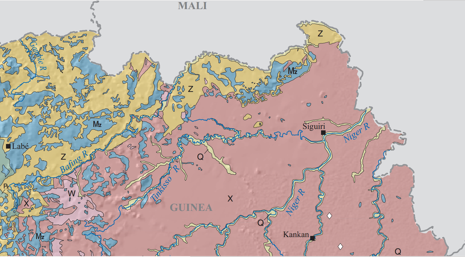
English: USGS geologic map Siguiri, where W is Neoarchean, X is Paleoproterozoic, Z is Neoproterozoic, Pz is Paleozoic, Mz is Mesozoic, and Q is Tertiary-Quaternary |
| Date | |
| Source | Alluvial Diamond Resource Potential and Production Capacity Assessment of Guinea, Scientific Investigations Report 2012–5256 Version 1.1, https://pubs.usgs.gov/sir/2012/5256/pdf/sir2012-5256.pdf |
| Author | Chirico, P.G., Malpeli, K.C., Van Bockstael, Mark, Diaby, Mamadou, Cissé, Kabinet, Diallo, T.A., and Sano, Mahmoud |
Licensing[edit]
This image is in the public domain in the United States because it only contains materials that originally came from the United States Geological Survey, an agency of the United States Department of the Interior. For more information, see the official USGS copyright policy.
|
File history
Click on a date/time to view the file as it appeared at that time.
| Date/Time | Thumbnail | Dimensions | User | Comment | |
|---|---|---|---|---|---|
| current | 12:55, 9 November 2018 | | 1,628 × 903 (1.04 MB) | Pi3.124 (talk | contribs) | User created page with UploadWizard |
You cannot overwrite this file.
File usage on Commons
There are no pages that use this file.
File usage on other wikis
The following other wikis use this file:
- Usage on en.wikipedia.org