File:USA West Virginia location map.svg
Jump to navigation
Jump to search

Size of this PNG preview of this SVG file: 644 × 599 pixels. Other resolutions: 258 × 240 pixels | 516 × 480 pixels | 825 × 768 pixels | 1,100 × 1,024 pixels | 2,200 × 2,048 pixels | 1,201 × 1,118 pixels.
Original file (SVG file, nominally 1,201 × 1,118 pixels, file size: 523 KB)
Captions
Captions
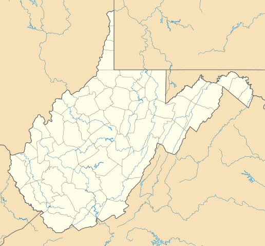
Location map of West Virginia in the United States of America
Summary[edit]
| Description |
Deutsch: Positionskarte von West Virginia, USA
Quadratische Plattkarte, N-S-Streckung 130.0 %. Geographische Begrenzung der Karte:
English: Location map of West Virginia, USA
Equirectangular projection, N/S stretching 130.0 %. Geographic limits of the map:
|
||
| Date | |||
| Source | Own work | ||
| Author | Alexrk2 | ||
| Other versions | Derivative works of this file: Wawa footprint 2012-07.png | ||
| SVG development |
|

Derivative works of this file:
Licensing[edit]
I, the copyright holder of this work, hereby publish it under the following licenses:

|
Permission is granted to copy, distribute and/or modify this document under the terms of the GNU Free Documentation License, Version 1.2 or any later version published by the Free Software Foundation; with no Invariant Sections, no Front-Cover Texts, and no Back-Cover Texts. A copy of the license is included in the section entitled GNU Free Documentation License. |
This file is licensed under the Creative Commons Attribution 3.0 Unported license.
- You are free:
- to share – to copy, distribute and transmit the work
- to remix – to adapt the work
- Under the following conditions:
- attribution – You must give appropriate credit, provide a link to the license, and indicate if changes were made. You may do so in any reasonable manner, but not in any way that suggests the licensor endorses you or your use.
You may select the license of your choice.
File history
Click on a date/time to view the file as it appeared at that time.
| Date/Time | Thumbnail | Dimensions | User | Comment | |
|---|---|---|---|---|---|
| current | 15:31, 3 July 2009 | | 1,201 × 1,118 (523 KB) | Alexrk2 (talk | contribs) | == Beschreibung == {{Information |Description= {{de|Positionskarte von West Virginia, USA}} Quadratische Plattkarte, N-S-Streckung 130.0 %. Geographische Begrenzung der Karte: * N: 40.8° N * S: 37.0° N * W: 82.8° W * O |
You cannot overwrite this file.
File usage on Commons
The following 38 pages use this file:
- File:BJ's Gas Station locations 2020 December.png
- File:BJ's store locations.png
- File:BJ's store locations 2020 December.png
- File:Checkers and Rally's footprint.png
- File:Citgo locations 2020 September.png
- File:Convenience stores of Mid-Atlantic.png
- File:Costco footprint map USA 2021-01.png
- File:CountryFair KwikFill 2020-01.png
- File:CountryFair footprint map.png
- File:Dollar Tree footprint map 2020-12.png
- File:Family Dollar footprint map 2020-12.png
- File:GetGo20-01.png
- File:Harris Teeter footprint 2020-12.png
- File:Harris Teeter footprint 2020-12 fuel.png
- File:Huntington National Bank footprint map.png
- File:M&T Bank footprint.png
- File:Moto Mart footprint map.png
- File:Publix footprint 2020 November.png
- File:QuikTrip Footprint 2020 October.png
- File:RaceTrac+RaceWay footprint 2020-01.png
- File:RaceTrac US footprint.png
- File:RaceWay US footprint.png
- File:Rooms To Go footprint map 2021-01.png
- File:Royal Farms stores footprint map.png
- File:Rutter's convenience store's footprint map.png
- File:Save-A-Lot footprint map.png
- File:Somerset Trust footprint 2020-12.png
- File:Speedway Footprint 2020 August.png
- File:Speedway Jun2018 to Aug2020 comparison.png
- File:Target stores footprint 2020-12.png
- File:Valero brands branded gas stations 2020-12.png
- File:Walmart branded fuel stations map 2020-12.png
- File:Walmart locations with on-site fuel stations map 2020-20.png
- File:Wawa footprint 2012-07.png
- File:Wawa footprint 2019-10.png
- File:Wawa footprint 2019-12.png
- File:Wawa footprint 2019-12 (fuel locations).png
- File:Wawa footprint 2019-12 (non-fuel locations).png
.png)
.png)
File usage on other wikis
The following other wikis use this file:
- Usage on an.wikipedia.org
- Usage on ar.wikipedia.org
- Usage on azb.wikipedia.org
- دانلو، باتی ویرجینیا
- پوینتس، باتی ویرجینیا
- تالمنزویل، باتی ویرجینیا
- جراردزتاون، باتی ویرجینیا
- لندقراف، باتی ویرجینیا
- کیربی، باتی ویرجینیا
- کوالوود، باتی ویرجینیا
- آقوستا، وست ویرجینیا
- های ویو، باتی ویرجینیا
- قلنقری، باتی ویرجینیا
- اسلینزویل، باتی ویرجینیا
- شنکس، باتی ویرجینیا
- دلری، باتی ویرجینیا
- پرجیتسویل، باتی ویرجینیا
- یلو اسپرینق، باتی ویرجینیا
- هوکس میلز، باتی ویرجینیا
- ریپان، باتی ویرجینیا
- نورت ریور میلز، باتی ویرجینیا
- اسلب فورک، وست ویرجینا
- راک کیو، باتی ویرجینیا
- فورکس آو کاکاپون، باتی ویرجینیا
- نایبرت، باتی ویرجینیا
- لیتل کاکیپون، باتی ویرجینیا
- لولز، باتی ویرجینیا
- ایوانز، باتی ویرجینیا
- بیکر، باتی ویرجینیا
- کپون اسپرینقز، باتی ویرجینیا
- ماونت استورم، باتی ویرجینیا
- سامیت پوینت، باتی ویرجینیا
- اتول، باتی ویرجینیا
- اجوود، باتی ویرجینیا
- ادنا، باتی ویرجینیا
- ارباکان، باتی ویرجینیا
- ارین، باتی ویرجینیا
- ازبری، باتی ویرجینیا
- اسرائیل، باتی ویرجینیا
- اسکو، باتی ویرجینیا
- اشتون، باتی ویرجینیا
- اشلند، باتی ویرجینیا
- اطلس، باتی ویرجینیا
- افتن، باتی ویرجینیا
- اکسچنج، باتی ویرجینیا
- اکمن، باتی ویرجینیا
View more global usage of this file.