File:USA California location map.svg
Jump to navigation
Jump to search

Size of this PNG preview of this SVG file: 523 × 599 pixels. Other resolutions: 209 × 240 pixels | 419 × 480 pixels | 670 × 768 pixels | 894 × 1,024 pixels | 1,787 × 2,048 pixels | 1,022 × 1,171 pixels.
Original file (SVG file, nominally 1,022 × 1,171 pixels, file size: 480 KB)
Captions
Captions
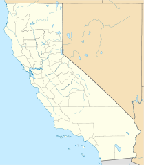
Map of California
Summary[edit]
| Description |
Quadratische Plattkarte, N-S-Streckung 125 %. Geographische Begrenzung der Karte:
Equirectangular projection, N/S stretching 125 %. Geographic limits of the map:
|
||
| Date | |||
| Source |
Own work
|
||
| Author | NordNordWest | ||
| Other versions |
Derivative works of this file: |
||
| SVG development |
|

Licensing[edit]
I, the copyright holder of this work, hereby publish it under the following licenses:

|
Permission is granted to copy, distribute and/or modify this document under the terms of the GNU Free Documentation License, Version 1.2 or any later version published by the Free Software Foundation; with no Invariant Sections, no Front-Cover Texts, and no Back-Cover Texts. A copy of the license is included in the section entitled GNU Free Documentation License. |
This file is licensed under the Creative Commons Attribution 3.0 Unported license.
- You are free:
- to share – to copy, distribute and transmit the work
- to remix – to adapt the work
- Under the following conditions:
- attribution – You must give appropriate credit, provide a link to the license, and indicate if changes were made. You may do so in any reasonable manner, but not in any way that suggests the licensor endorses you or your use.
You may select the license of your choice.
File history
Click on a date/time to view the file as it appeared at that time.
| Date/Time | Thumbnail | Dimensions | User | Comment | |
|---|---|---|---|---|---|
| current | 19:17, 5 June 2009 | | 1,022 × 1,171 (480 KB) | NordNordWest (talk | contribs) | more detailed |
| 21:50, 12 March 2009 |  | 1,020 × 1,169 (385 KB) | NordNordWest (talk | contribs) | {{Information |Description= {{de|Positionskarte von Kalifornien, USA}} Quadratische Plattkarte, N-S-Streckung 125 %. Geographische Begrenzung der Karte: * N: 42.2° N * S: 32.3° N * W: 124.7° W * O: 113.9° W {{en|Locatio |
You cannot overwrite this file.
File usage on Commons
More than 100 pages use this file. The following list shows the first 100 pages that use this file only. A full list is available.
- User:NordNordWest/Gallery/Location maps
- File:California Locator Map.PNG
- Category:1928 in California
- Category:1935 in California
- Category:1936 in California
- Category:1939 in California
- Category:1942 in California
- Category:1943 in California
- Category:1960 in California
- Category:1963 in California
- Category:1969 in California
- Category:1977 in California
- Category:1982 in California
- Category:1989 in California
- Category:1993 in California
- Category:2000 in California
- Category:2001 in California
- Category:2003 in California
- Category:2004 in California
- Category:2005 in California
- Category:2006 in California
- Category:2007 in California
- Category:2008 in California
- Category:2009 in California
- Category:Airports in California
- Category:Archaeological sites in California
- Category:Architecture of California
- Category:Association football venues in California
- Category:Baseball in California
- Category:Basketball players from California
- Category:Bays of California
- Category:Beaches of California
- Category:Bodies of water in California
- Category:Botanical gardens in California
- Category:Bridges in California
- Category:California
- Category:California by decade
- Category:California in the 1790s
- Category:California in the 1810s
- Category:California in the 1820s
- Category:California in the 1830s
- Category:California in the 1840s
- Category:California in the 1850s
- Category:California in the 1860s
- Category:California in the 1870s
- Category:California in the 1880s
- Category:California in the 1890s
- Category:California in the 1900s
- Category:California in the 1910s
- Category:California in the 1920s
- Category:California in the 1930s
- Category:California in the 1940s
- Category:California in the 1950s
- Category:California in the 1960s
- Category:California in the 1970s
- Category:California in the 1980s
- Category:California in the 1990s
- Category:California in the 2000s
- Category:Canals in California
- Category:Caves of California
- Category:Cemeteries in California
- Category:Dams in California
- Category:Events in California
- Category:Festivals in California
- Category:Flora of California
- Category:Footbridges in California
- Category:Fountains in California
- Category:Glaciers of California
- Category:Hospitals in California
- Category:Hotels in California
- Category:Ice hockey venues in California
- Category:Islands of California
- Category:Lakes of California
- Category:Libraries in California
- Category:Lighthouses in California
- Category:Maps of California
- Category:Mountain passes of California
- Category:National Register of Historic Places in California
- Category:National Wildlife Refuges in California
- Category:Nature reserves in California
- Category:Nuclear power plants in California
- Category:Parks in California
- Category:Piers in California
- Category:Power plants in California
- Category:Protected areas of California
- Category:Racing circuits in California
- Category:Rail transport in California
- Category:Religion in California
- Category:Reservoirs in California
- Category:Rivers of California
- Category:Roads in California
- Category:Schools in California
- Category:Sports venues in California
- Category:Streets in California
- Category:Towers in California
- Category:Towns in California
- Category:Unincorporated communities in California
- Category:Valleys of California
- Category:Volcanoes in California
- Category:Waterfalls in California
View more links to this file.
File usage on other wikis
The following other wikis use this file:
- Usage on af.wikipedia.org
- Usage on als.wikipedia.org
- Usage on an.wikipedia.org
- Usage on ar.wikipedia.org
- يونيفرسال سيتي
- قالب:ص.م/موقع جغرافي متعدد
- قالب:خريطة مواقع الولايات المتحدة/كاليفورنيا
- قالب:ص.م/موقع جغرافي متعدد/شرح
- مطار رينو تاهو الدولي
- خطوط الاسكا الجوية الرحلة 261
- برج ليليان كويت
- حادثة إطلاق النار بمطار لوس أنجلوس الدولي 2002
- قصر وينشستر الغامض
- زلزال نورثريدج 1994
- زامبيريني فيلد
- قالب:ص.م/موقع جغرافي متعدد/ملعب
- Usage on ast.wikipedia.org
- Aeropuertu Internacional de Los Angeles
- Aeropuertu de Long Beach
- Aeropuertu Internacional d'Oakland
- Aeropuertu Internacional LA/Ontario
- Aeropuertu Internacional de Sacramento
- Aeropuertu Públicu de Santa María
- Módulu:Mapa de llocalización/datos/California
- Módulu:Mapa de llocalización/datos/California/usu
- Usage on azb.wikipedia.org
View more global usage of this file.