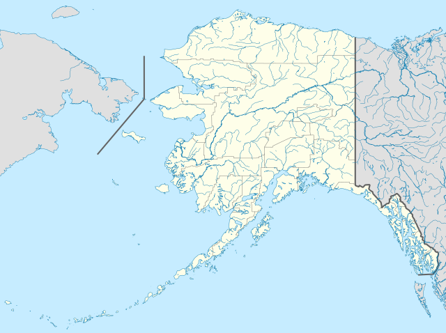
File:USA Alaska location map.svg
Jump to navigation
Jump to search

Size of this PNG preview of this SVG file: 800 × 598 pixels. Other resolutions: 320 × 239 pixels | 640 × 478 pixels | 1,024 × 765 pixels | 1,280 × 956 pixels | 2,560 × 1,912 pixels | 1,553 × 1,160 pixels.
Original file (SVG file, nominally 1,553 × 1,160 pixels, file size: 1.24 MB)
Captions
Captions
Add a one-line explanation of what this file represents
Summary[edit]
| Description | |
| Date | |
| Source | Own work |
| Author | Alexrk2 |
| Other versions |
Derivative works of this file: Starbucks footprint.png
|


| Open this image as an overlay in Google Earth (Google Maps, Bing) | (Help|Source) |
Licensing[edit]
I, the copyright holder of this work, hereby publish it under the following licenses:

|
Permission is granted to copy, distribute and/or modify this document under the terms of the GNU Free Documentation License, Version 1.2 or any later version published by the Free Software Foundation; with no Invariant Sections, no Front-Cover Texts, and no Back-Cover Texts. A copy of the license is included in the section entitled GNU Free Documentation License. |
This file is licensed under the Creative Commons Attribution 3.0 Unported license.
- You are free:
- to share – to copy, distribute and transmit the work
- to remix – to adapt the work
- Under the following conditions:
- attribution – You must give appropriate credit, provide a link to the license, and indicate if changes were made. You may do so in any reasonable manner, but not in any way that suggests the licensor endorses you or your use.
You may select the license of your choice.
| Annotations | This image is annotated: View the annotations at Commons |
File history
Click on a date/time to view the file as it appeared at that time.
| Date/Time | Thumbnail | Dimensions | User | Comment | |
|---|---|---|---|---|---|
| current | 19:13, 3 October 2009 | | 1,553 × 1,160 (1.24 MB) | Alexrk2 (talk | contribs) | Linien gesäubert |
| 19:03, 3 October 2009 |  | 1,553 × 1,160 (1.25 MB) | Alexrk2 (talk | contribs) | Westlicher Teil korrigiert | |
| 18:35, 3 October 2009 |  | 1,553 × 1,160 (1.24 MB) | Alexrk2 (talk | contribs) | == Beschreibung == {{Information |Description= {{de|Positionskarte von Alaska, USA}} Quadratische Plattkarte, N-S-Streckung 210.0 %. Geographische Begrenzung der Karte: * N: 72.0° N * S: 51.0° N * W: 188.0° W * O: 129.0° W { |
You cannot overwrite this file.
File usage on Commons
More than 100 pages use this file. The following list shows the first 100 pages that use this file only. A full list is available.
- Alaska
- File:800x598-Carte-Alaska-R.jpg
- File:USA Alaska location map.svg
- Category:1915 in Alaska
- Category:1963 in Alaska
- Category:1964 in Alaska
- Category:1965 in Alaska
- Category:1969 in Alaska
- Category:1970 in Alaska
- Category:1971 in Alaska
- Category:1972 in Alaska
- Category:1973 in Alaska
- Category:1977 in Alaska
- Category:1978 in Alaska
- Category:1979 in Alaska
- Category:1981 in Alaska
- Category:1982 in Alaska
- Category:1984 in Alaska
- Category:1985 in Alaska
- Category:1987 in Alaska
- Category:1989 in Alaska
- Category:1990 in Alaska
- Category:1991 in Alaska
- Category:1992 in Alaska
- Category:1993 in Alaska
- Category:1994 in Alaska
- Category:1995 in Alaska
- Category:1996 in Alaska
- Category:1997 in Alaska
- Category:1998 in Alaska
- Category:1999 in Alaska
- Category:2000 in Alaska
- Category:2001 in Alaska
- Category:2002 in Alaska
- Category:2003 in Alaska
- Category:2004 in Alaska
- Category:2005 in Alaska
- Category:2006 in Alaska
- Category:2007 in Alaska
- Category:2008 in Alaska
- Category:2009 in Alaska
- Category:2010 in Alaska
- Category:2011 in Alaska
- Category:Airports in Alaska
- Category:Alaska
- Category:Alaska by decade
- Category:Alaska in the 1860s
- Category:Alaska in the 1880s
- Category:Alaska in the 1890s
- Category:Alaska in the 1900s
- Category:Alaska in the 1910s
- Category:Alaska in the 1920s
- Category:Alaska in the 1930s
- Category:Alaska in the 1940s
- Category:Alaska in the 1950s
- Category:Alaska in the 1960s
- Category:Alaska in the 1970s
- Category:Alaska in the 1980s
- Category:Alaska in the 1990s
- Category:Alaska in the 19th century
- Category:Alaska in the 2000s
- Category:Alaska in the 2010s
- Category:Alaska in the 20th century
- Category:Alaska in the 21st century
- Category:Animals of Alaska
- Category:Archaeological sites in Alaska
- Category:Architecture of Alaska
- Category:Bays of Alaska
- Category:Bodies of water in Alaska
- Category:Botanical gardens in Alaska
- Category:Bridges in Alaska
- Category:Cemeteries in Alaska
- Category:Cities in Alaska
- Category:Dams in Alaska
- Category:Education in Alaska
- Category:Energy in Alaska
- Category:Flora of Alaska
- Category:Geology of Alaska
- Category:Glaciers of Alaska
- Category:Hotels in Alaska
- Category:Ice hockey players from Alaska
- Category:Islands of Alaska
- Category:Lakes of Alaska
- Category:Lighthouses in Alaska
- Category:Maps of Alaska
- Category:Mines in Alaska
- Category:Mountain passes of Alaska
- Category:National Forests of Alaska
- Category:National Historic Landmarks in Alaska
- Category:National Register of Historic Places in Alaska
- Category:National Wildlife Refuges in Alaska
- Category:Parks in Alaska
- Category:Protected areas of Alaska
- Category:Regions of Alaska
- Category:Religion in Alaska
- Category:Roads in Alaska
- Category:Straits of Alaska
- Category:Valleys of Alaska
- Category:Water transport in Alaska
- Category:Waterfalls in Alaska
View more links to this file.
File usage on other wikis
The following other wikis use this file:
- Usage on af.wikipedia.org
- Usage on als.wikipedia.org
- Usage on an.wikipedia.org
- Usage on ar.wikipedia.org
- Usage on ast.wikipedia.org
- Alaska
- Baranof
- Juneau (Alaska)
- Anchorage (Alaska)
- Fairbanks (Alaska)
- Ninilchik (Alaska)
- Islles Aleutianes
- Kodiak (Alaska)
- Golfu d'Alaska
- Monte Denali
- Parque y Reserva Nacionales de les Puertes del Árticu
- Cordal d'Alaska
- Módulu:Mapa de llocalización/datos/Alaska
- Módulu:Mapa de llocalización/datos/Alaska/usu
- Aeropuertu Internacional Ted Stevens Anchorage
- Base de la Fuercia Aérea Eielson
- Islla Semisopochnoi
- St. George (Alaska)
- Islles Pribilof
- St. Paul (Alaska)
- Islla Sitkinak
- Usage on azb.wikipedia.org
View more global usage of this file.