File:USACE New Orleans skyline.jpg
Jump to navigation
Jump to search

Size of this preview: 800 × 534 pixels. Other resolutions: 320 × 214 pixels | 640 × 428 pixels | 1,024 × 684 pixels | 1,500 × 1,002 pixels.
Original file (1,500 × 1,002 pixels, file size: 314 KB, MIME type: image/jpeg)
Captions
Captions
Add a one-line explanation of what this file represents
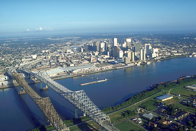
| Description | Skyline of New Orleans, Louisiana, USA. The twin spans of the Crescent City Connection bridges are in the foreground. | |||
| Date | ||||
| Source |
U.S. Army Corp of Engineers Digital Visual Library Digital Visual Library home page Image page Image description page |
|||
| Author | Michael Maples, U.S. Army Corps of Engineers | |||
| Permission (Reusing this file) |
|
|||
| Other versions |
|

| Camera location | | View this and other nearby images on: OpenStreetMap |
|---|
File history
Click on a date/time to view the file as it appeared at that time.
| Date/Time | Thumbnail | Dimensions | User | Comment | |
|---|---|---|---|---|---|
| current | 03:55, 14 March 2007 | | 1,500 × 1,002 (314 KB) | DanMS (talk | contribs) | {{Information | Description = Skyline of New Orleans, Louisiana, USA. | Source = U.S. Army Corp of Engineers Digital Visual Library<br />[http://images.usace.army.mil/Main.html Digital Visual Library home page]<br />[http://images.usace.army.mil/imag |
You cannot overwrite this file.
File usage on Commons
The following 3 pages use this file:
File usage on other wikis
The following other wikis use this file:
- Usage on bg.wikipedia.org
- Usage on bn.wikipedia.org
- Usage on de.wikipedia.org
- Usage on en.wikipedia.org
- Usage on es.wikipedia.org
- Usage on es.wikinews.org
- Usage on ext.wikipedia.org
- Usage on fa.wikipedia.org
- Usage on fr.wikipedia.org
- Usage on it.wikiquote.org
- Usage on it.wikivoyage.org
- Usage on nl.wikipedia.org
- Usage on zh.wikipedia.org