File:USACE Lavon Lake and Dam.jpg
Jump to navigation
Jump to search
Size of this preview: 752 × 600 pixels. Other resolutions: 301 × 240 pixels | 602 × 480 pixels | 987 × 787 pixels.
Original file (987 × 787 pixels, file size: 200 KB, MIME type: image/jpeg)
Captions
Captions
Add a one-line explanation of what this file represents
| Description |
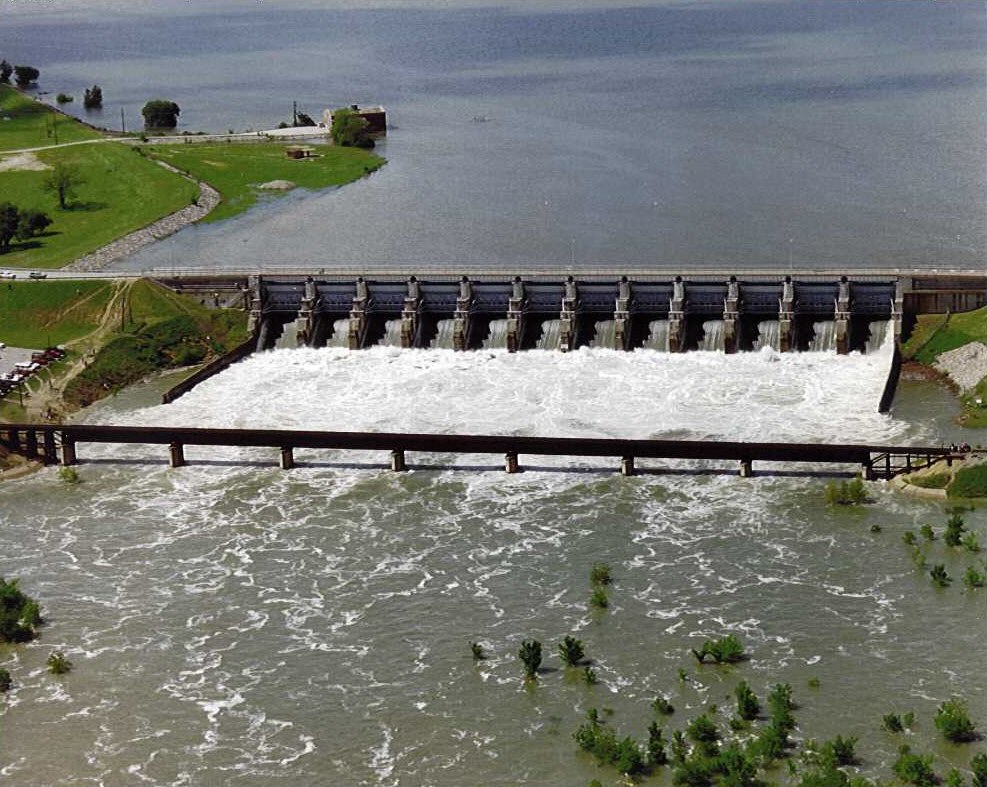
English: Aerial view of Lavon Dam and Lake on the East Fork of the Trinity River in Collin County, Texas, USA. The dam was constructed in 1953 by the U.S. Army Corps of Engineers for flood control and water supply. View is to the north
Coordinates: 33°02′40″N 96°27′56″W / 33.0444°N 96.46556°W |
|||
| Location | Collin County, Texas, USA | |||
| Date | not specified or unknown | |||
| Source |
U.S. Army Corps of Engineers Lavon Lake website Image page Image description page |
|||
| Author | U.S. Army Corps of Engineers, photographer not specified or unknown | |||
| Permission (Reusing this file) |
|
File history
Click on a date/time to view the file as it appeared at that time.
| Date/Time | Thumbnail | Dimensions | User | Comment | |
|---|---|---|---|---|---|
| current | 04:33, 9 May 2007 | | 987 × 787 (200 KB) | DanMS (talk | contribs) | Trimmed excess white space around image and uploaded same again. |
| 04:31, 9 May 2007 |  | 1,002 × 800 (100 KB) | DanMS (talk | contribs) | {{Information | Description = {{en|Aerial view of Lavon Dam and Lake on the East Fork of the Trinity River in Collin County, Texas, USA. The dam was constructed in 1953 by the U.S. Army Corps of Engineers for flood control and water supply. View is to |
You cannot overwrite this file.
File usage on Commons
The following page uses this file:
File usage on other wikis
The following other wikis use this file:
- Usage on arz.wikipedia.org
- Usage on ceb.wikipedia.org
- Usage on de.wikipedia.org
- Usage on en.wikipedia.org
- Usage on la.wikipedia.org
- Usage on www.wikidata.org