File:USACE G V Montgomery Lock and Dam.jpg
Jump to navigation
Jump to search

Size of this preview: 800 × 560 pixels. Other resolutions: 320 × 224 pixels | 640 × 448 pixels | 1,024 × 717 pixels | 1,280 × 896 pixels | 1,500 × 1,050 pixels.
Original file (1,500 × 1,050 pixels, file size: 438 KB, MIME type: image/jpeg)
Captions
Captions
Add a one-line explanation of what this file represents
| Description |
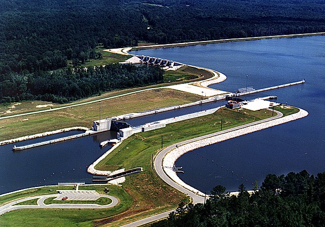
English: Aerial view of the G. V. Montgomery Lock and Dam on the Tennessee-Tombigbee Waterway. The lock is located in Itawamba County, Mississippi, USA. At this point the border between Itawamba County and Prentiss County crosses the waterway, and the dam (visible at top) is actually located in Prentiss County. The lock and dam are part of the Tennessee-Tombigbee project, constructed by the U.S. Army Corps of Engineers for barge navigation between the Tennessee River and the Gulf of Mexico. View is to the north.
Coordinates: 34°27′47.06″N 88°21′53.5″W / 34.4630722°N 88.364861°W |
|||
| Location | Itawamba County, Mississippi, USA | |||
| Date | (Caveat: Dates provided by U.S. Army Corps of Engineers Digital Visual Library are not reliable and may be wrong.) | |||
| Source |
U.S. Army Corps of Engineers Digital Visual Library Image page Image description page Digital Visual Library home page |
|||
| Author | Adrien Lamarre, U.S. Army Corps of Engineers | |||
| Permission (Reusing this file) |
|
File history
Click on a date/time to view the file as it appeared at that time.
| Date/Time | Thumbnail | Dimensions | User | Comment | |
|---|---|---|---|---|---|
| current | 17:44, 29 April 2007 | | 1,500 × 1,050 (438 KB) | DanMS (talk | contribs) | {{Information | Description = {{en|Aerial view of the G. V. Montgomery Lock and Dam on the Tennessee-Tombigbee Waterway. The lock is located in Itawamba County, Mississippi, USA. At this point the border between Itawamba County and Prentiss County cros |
You cannot overwrite this file.
File usage on Commons
There are no pages that use this file.
File usage on other wikis
The following other wikis use this file:
- Usage on en.wikipedia.org
- Usage on es.wikipedia.org
- Usage on fa.wikipedia.org
- Usage on www.wikidata.org