File:USACE Fulton Lock and Dam.jpg
Jump to navigation
Jump to search

Size of this preview: 800 × 566 pixels. Other resolutions: 320 × 226 pixels | 640 × 453 pixels | 1,024 × 724 pixels | 1,280 × 905 pixels | 1,500 × 1,061 pixels.
Original file (1,500 × 1,061 pixels, file size: 330 KB, MIME type: image/jpeg)
Captions
Captions
Add a one-line explanation of what this file represents
| Description |
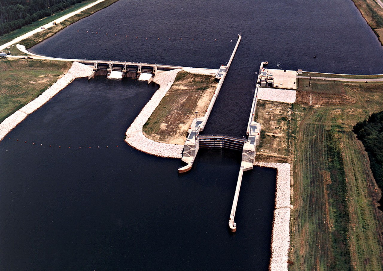
English: Aerial view of Fulton Lock and Dam on the Tennessee-Tombigbee Waterway at Fulton, Itawamba County, Mississippi, USA. Fulton Lock was formerly known as Lock C. The lock and dam are one of a series of ten locks and dams on the Tennessee-Tombigbee Waterway. The lock and waterway are maintained by the U.S. Army Corps of Engineers for navigation between the Tennessee River and the Gulf of Mexico. View is upriver to the northwest.
Coordinates: 34°15′28.09″N 88°25′29.33″W / 34.2578028°N 88.4248139°W |
|||
| Date | ||||
| Source |
U.S. Army Corps of Engineers Digital Visual Library Image page Image description page Digital Visual Library home page |
|||
| Author | Adrien Lamarre, U.S. Army Corps of Engineers | |||
| Permission (Reusing this file) |
|
|||
| Location | Fulton, Itawamba County, Mississippi, USA |
File history
Click on a date/time to view the file as it appeared at that time.
| Date/Time | Thumbnail | Dimensions | User | Comment | |
|---|---|---|---|---|---|
| current | 23:04, 28 April 2007 | | 1,500 × 1,061 (330 KB) | DanMS (talk | contribs) | {{Information | Description = {{en|Aerial view of Fulton Lock and Dam on the Tennessee-Tombigbee Waterway at Fulton, Itawamba County, Mississippi, USA. Fulton Lock was formerly known as Lock C. The lock and dam are one of a series of ten locks and dams |
You cannot overwrite this file.
File usage on Commons
There are no pages that use this file.
File usage on other wikis
The following other wikis use this file:
- Usage on arz.wikipedia.org
- Usage on en.wikipedia.org
- Usage on ru.wikipedia.org
- Usage on www.wikidata.org