File:USACE Amory Lock.jpg
Jump to navigation
Jump to search

Size of this preview: 800 × 559 pixels. Other resolutions: 320 × 224 pixels | 640 × 448 pixels | 1,024 × 716 pixels | 1,280 × 895 pixels | 1,500 × 1,049 pixels.
Original file (1,500 × 1,049 pixels, file size: 425 KB, MIME type: image/jpeg)
Captions
Captions
Add a one-line explanation of what this file represents
| Description |
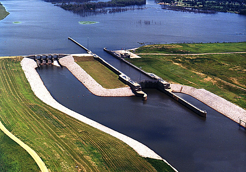
English: Amory Lock, formerly called Lock A, on the Tennessee-Tombigbee Waterway, Amory, Mississippi, USA. View is upriver to the northeast. |
|||
| Date | not specified | |||
| Source |
U.S. Army Corp of Engineers Digital Visual Library Digital Visual Library home page Image page Image description page |
|||
| Author | Adrien Lamarre, U.S. Army Corps of Engineers | |||
| Permission (Reusing this file) |
|
| Camera location | | View this and other nearby images on: OpenStreetMap |
|---|
File history
Click on a date/time to view the file as it appeared at that time.
| Date/Time | Thumbnail | Dimensions | User | Comment | |
|---|---|---|---|---|---|
| current | 04:11, 14 March 2007 | | 1,500 × 1,049 (425 KB) | DanMS (talk | contribs) | {{Information | Description = Amory Lock, formerly called Lock A, on the Tennessee-Tombigbee Waterway, Amory, Mississippi, USA. | Source = U.S. Army Corp of Engineers Digital Visual Library<br />[http://images.usace.army.mil/Main.html Digital Visual |
You cannot overwrite this file.
File usage on Commons
There are no pages that use this file.
File usage on other wikis
The following other wikis use this file:
- Usage on arz.wikipedia.org
- Usage on en.wikipedia.org