File:U.S. Census Bureau Regions.svg
Jump to navigation
Jump to search

Size of this PNG preview of this SVG file: 548 × 380 pixels. Other resolutions: 320 × 222 pixels | 640 × 444 pixels | 1,024 × 710 pixels | 1,280 × 888 pixels | 2,560 × 1,775 pixels.
Original file (SVG file, nominally 548 × 380 pixels, file size: 320 KB)
Captions
Captions
Add a one-line explanation of what this file represents
| Description |
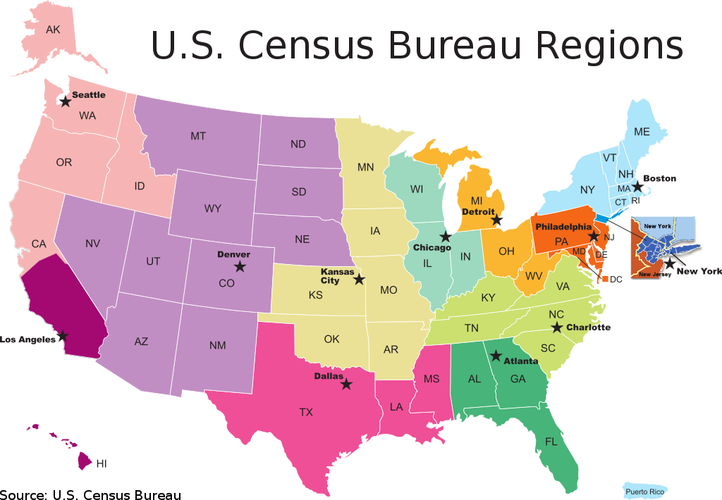
English: U.S. Census Bureau Regions, Partnership and Data Services Program. A map of the US Census Bureau Regions.
This W3C-unspecified vector image was created with Inkscape . |
|||
| Date | ||||
| Source | Comes from 2009 - December - PDS Map #2, FLDPDS/09-2 | |||
| Author |
U.S. Department of Commerce Economics and Statistics Administration U.S. CENSUS BUREAU |
|||
| Permission (Reusing this file) |
|

File history
Click on a date/time to view the file as it appeared at that time.
| Date/Time | Thumbnail | Dimensions | User | Comment | |
|---|---|---|---|---|---|
| current | 17:51, 20 June 2010 | | 548 × 380 (320 KB) | Smallman12q (talk | contribs) | Corrected Angeles to Los Angeles, added source |
| 17:03, 19 June 2010 |  | 542 × 380 (315 KB) | Smallman12q (talk | contribs) | {{Information |Description={{en|1=U.S. Census Bureau Regions, Partnership and Data Services Program. A map of the US Census Bureau Regions.}} |Source=Comes from [http://2010.census.gov/partners/pdf/censusRegionMap.pdf 2009 - December - PDS Map #2], FLDP |
You cannot overwrite this file.
File usage on Commons
The following page uses this file:
File usage on other wikis
The following other wikis use this file:
- Usage on en.wikipedia.org
- Usage on ja.wikipedia.org