File:Tyne and Wear County.png
Jump to navigation
Jump to search
Size of this preview: 800 × 585 pixels. Other resolutions: 320 × 234 pixels | 640 × 468 pixels | 1,024 × 749 pixels | 1,280 × 936 pixels | 2,560 × 1,873 pixels | 2,879 × 2,106 pixels.
Original file (2,879 × 2,106 pixels, file size: 495 KB, MIME type: image/png)
Captions
Captions
Add a one-line explanation of what this file represents
Summary[edit]
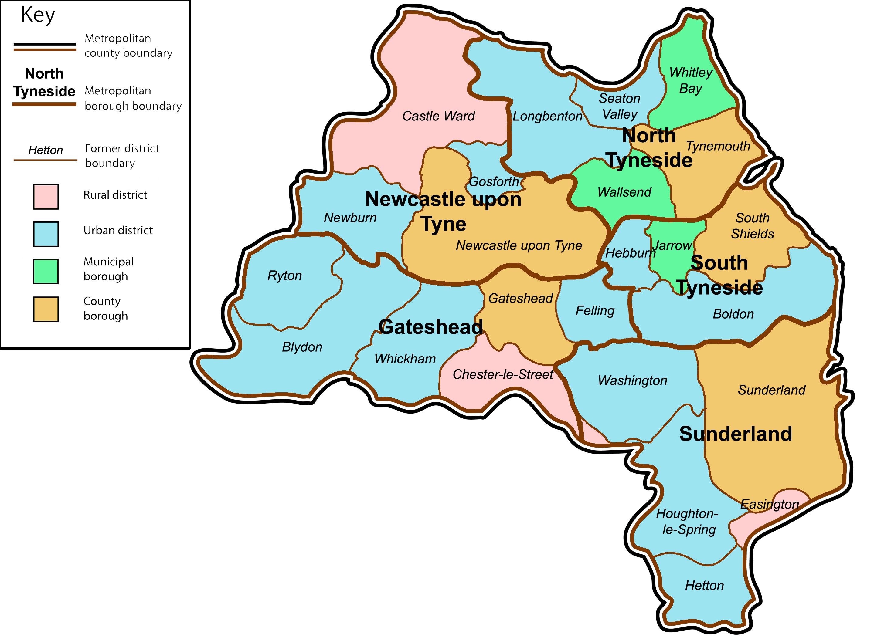
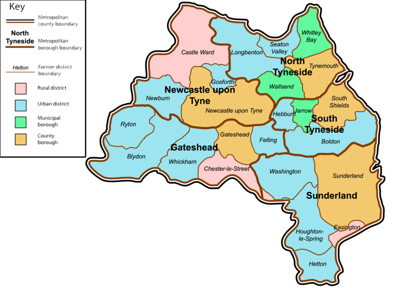
| Description | A map of the metropolitan county of Tyne and Wear, North East England. This map shows former and modern district boundaries. See key for explanation of colours. |
| Date | |
| Source | self-made. Content is verified at Her Majesty's Stationery Office (1974) Local Government in England and Wales: A Guide to the New System, London: HMSO ISBN: 0117508470. |
| Author | Jza84 |
Licensing[edit]
| I, the copyright holder of this work, release this work into the public domain. This applies worldwide. In some countries this may not be legally possible; if so: I grant anyone the right to use this work for any purpose, without any conditions, unless such conditions are required by law. |
File history
Click on a date/time to view the file as it appeared at that time.
| Date/Time | Thumbnail | Dimensions | User | Comment | |
|---|---|---|---|---|---|
| current | 18:02, 13 January 2009 | | 2,879 × 2,106 (495 KB) | Jza84 (talk | contribs) | {{Information |Description=A map of the metropolitan county of Tyne and Wear, North East England. This map shows former and modern district boundaries. See key for explanation of colours. |Source=self-made |Date=January 2009 |Author= Jza84 |
You cannot overwrite this file.
File usage on Commons
The following page uses this file:
File usage on other wikis
The following other wikis use this file:
- Usage on bg.wikipedia.org
- Usage on en.wikipedia.org
- Usage on et.wikipedia.org
- Usage on it.wikipedia.org
- Usage on ko.wikipedia.org
- Usage on nl.wikipedia.org
- Usage on sco.wikipedia.org