File:Txu-oclc-224571173-se19-11.jpg
Jump to navigation
Jump to search

Size of this preview: 800 × 599 pixels. Other resolutions: 320 × 240 pixels | 640 × 479 pixels | 1,024 × 767 pixels | 1,280 × 959 pixels | 2,560 × 1,918 pixels | 5,358 × 4,014 pixels.
Original file (5,358 × 4,014 pixels, file size: 8.72 MB, MIME type: image/jpeg)
Captions
Captions
Add a one-line explanation of what this file represents
Summary[edit]
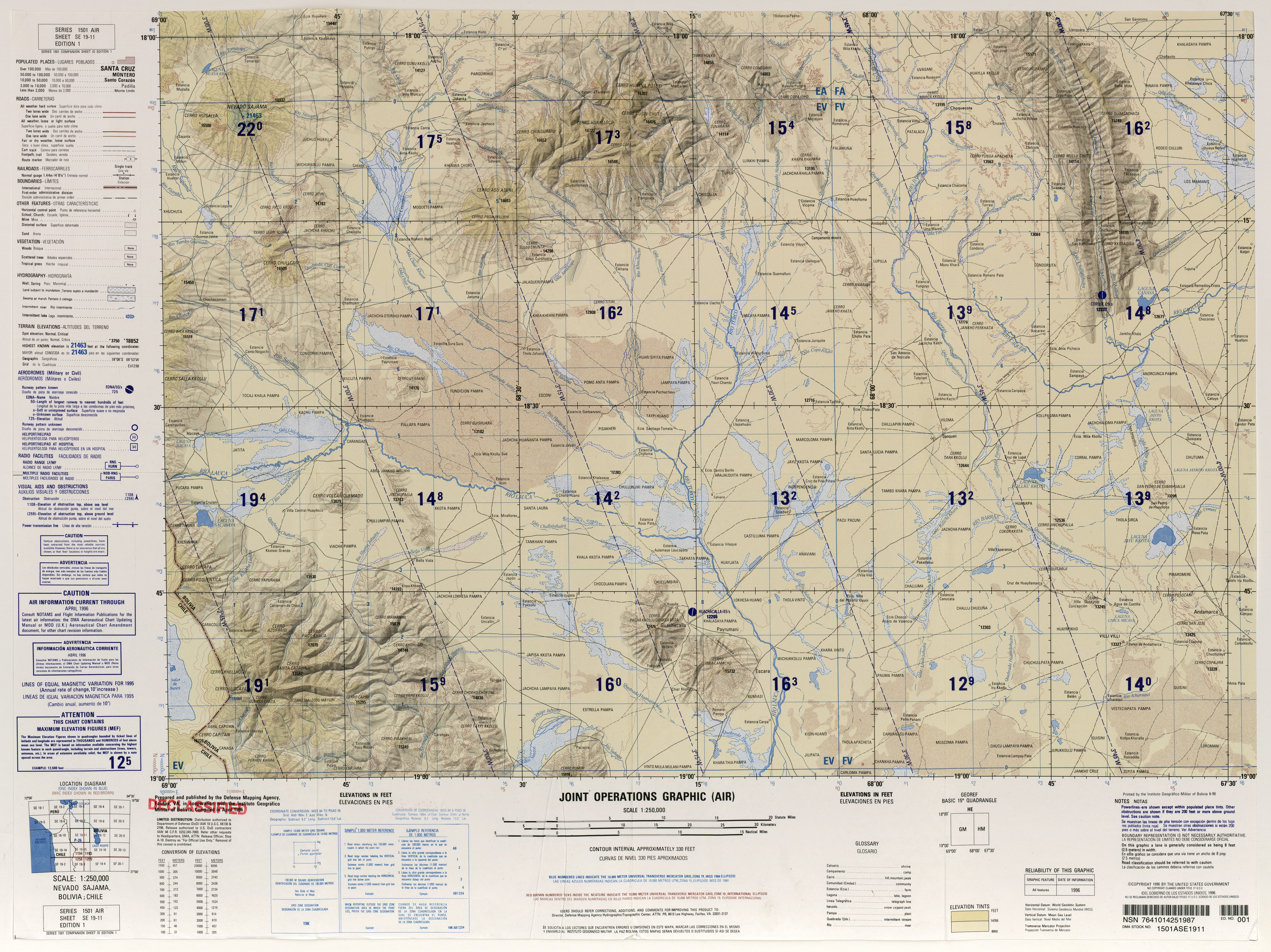
| Description |
Español: Nevado Sajama, Río Lauca, Salar de Suriri, Río Cosapa, Río Barras, laguna Sacabaya. |
| Date | |
| Source | https://legacy.lib.utexas.edu/maps/jog/latin_america/txu-oclc-224571173-se19-11.jpg |
| Author | Latin America, Joint Operations Graphic 1:250,000, U.S. National Imagery and Mapping Agency |
Licensing[edit]
This image is a work of the United States National Geospatial-Intelligence Agency or one of its predecessor agencies. As a work of the U.S. federal government, the image is in the public domain.
|
 |
File history
Click on a date/time to view the file as it appeared at that time.
| Date/Time | Thumbnail | Dimensions | User | Comment | |
|---|---|---|---|---|---|
| current | 14:31, 24 November 2019 | | 5,358 × 4,014 (8.72 MB) | Juan Villalobos (talk | contribs) | User created page with UploadWizard |
You cannot overwrite this file.
File usage on Commons
The following page uses this file: