File:Turkey Western. Lesbos, Dardanelles 1.JPG
Jump to navigation
Jump to search
Size of this preview: 397 × 599 pixels. Other resolutions: 159 × 240 pixels | 318 × 480 pixels | 508 × 768 pixels | 678 × 1,024 pixels | 2,008 × 3,032 pixels.
Original file (2,008 × 3,032 pixels, file size: 1.72 MB, MIME type: image/jpeg)
Captions
Captions
Add a one-line explanation of what this file represents
Summary[edit]
| Description |
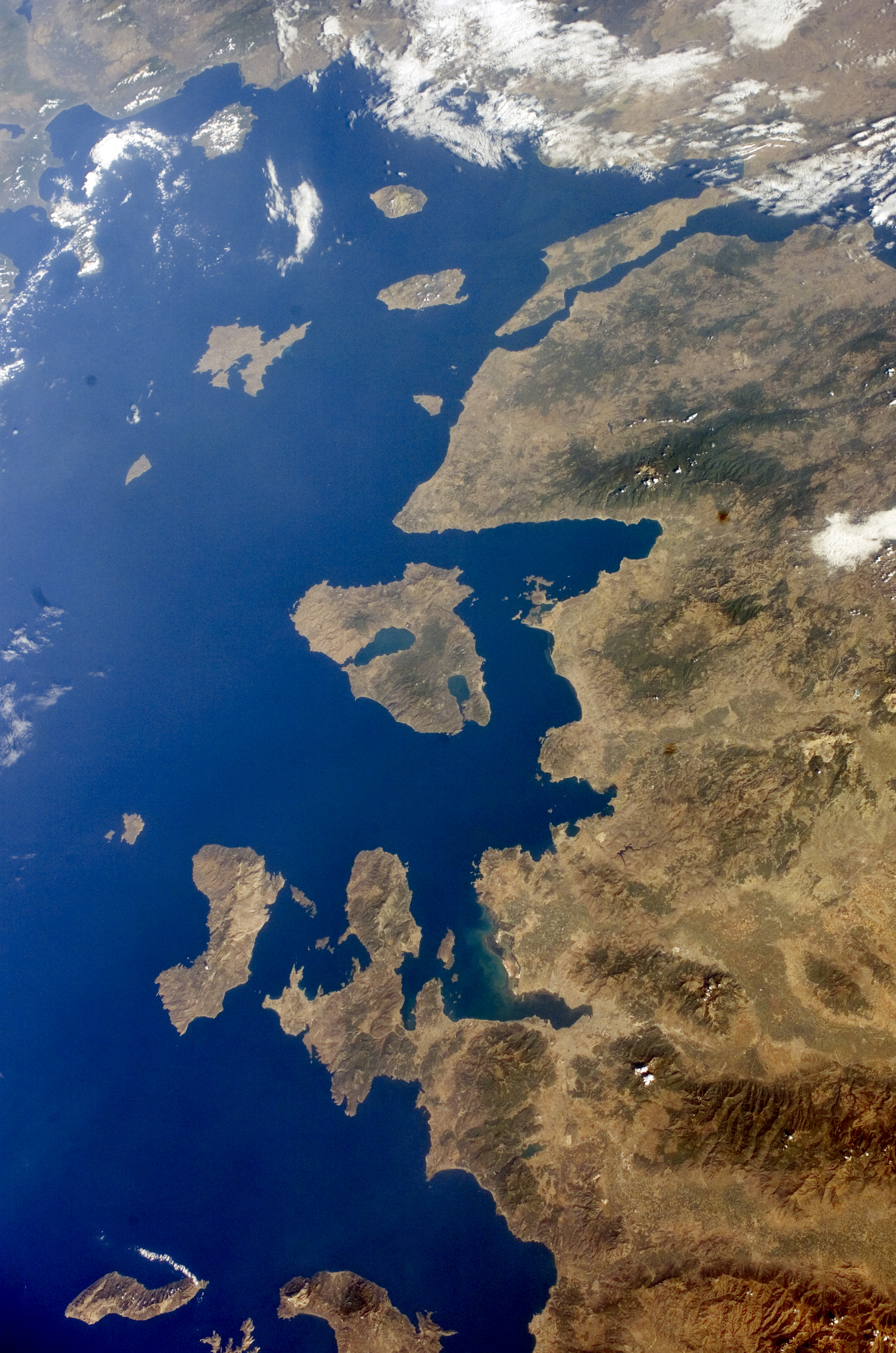
English: Turkey Western, Lesbos and Dardanelles.
Español: Noroeste de Turquía, Lesbos y Dardanelos. Mapa satelital de la Nasa (2005). |
| Date | |
| Source | http://eol.jsc.nasa.gov/scripts/sseop/QuickView.pl?directory=ESC&ID=ISS011-E-13602 |
| Author | NASA |
| Other versions |


.JPG)
.JPG)
Licensing[edit]
This file is in the public domain in the United States because it was created by the Image Science & Analysis Laboratory, of the NASA Johnson Space Center. NASA copyright policy states that "NASA material is not protected by copyright unless noted". (NASA media use guidelines or Conditions of Use of Astronaut Photographs).
Photo source: ISS011-E-13602.
|
File history
Click on a date/time to view the file as it appeared at that time.
| Date/Time | Thumbnail | Dimensions | User | Comment | |
|---|---|---|---|---|---|
| current | 22:52, 3 August 2014 | | 2,008 × 3,032 (1.72 MB) | Ras67 (talk | contribs) | new rendered from NASA's raw image data |
| 01:31, 18 April 2010 |  | 423 × 639 (99 KB) | Dorieo (talk | contribs) | {{Information |Description={{en|1=Turkey Western, Lesbos and_Dardanelles.}} {{es|1=Noroeste de Turquía, Lesbos y Dardanelos. Mapa satelital de la Nasa (2005).}} |Source=http://eol.jsc.nasa.gov/scripts/sseop/QuickView.pl?directory=ESC&ID=ISS011-E-13602 |A |
You cannot overwrite this file.
File usage on Commons
The following 6 pages use this file:
File usage on other wikis
The following other wikis use this file:
- Usage on az.wikipedia.org
- Usage on ceb.wikipedia.org
- Usage on en.wikipedia.org
- Usage on es.wikipedia.org
- Usage on eu.wikipedia.org
- Usage on he.wikipedia.org
- Usage on hy.wikipedia.org
- Usage on it.wikipedia.org
- Usage on ku.wikipedia.org
- Usage on nn.wikipedia.org
- Usage on ru.wikipedia.org
- Usage on tr.wikipedia.org
- Usage on www.wikidata.org