File:Tunisian Republic location map.svg
Jump to navigation
Jump to search

Size of this PNG preview of this SVG file: 318 × 598 pixels. Other resolutions: 127 × 240 pixels | 255 × 480 pixels | 408 × 768 pixels | 544 × 1,024 pixels | 1,088 × 2,048 pixels | 379 × 713 pixels.
Original file (SVG file, nominally 379 × 713 pixels, file size: 176 KB)
Captions
Captions
Add a one-line explanation of what this file represents
Summary[edit]
| Description |
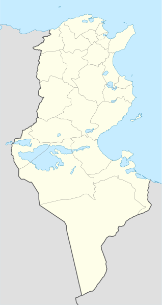
Deutsch: Positionskarte von Tunesien
Quadratische Plattkarte, N-S-Streckung 115 %. Geographische Begrenzung der Karte:
English: Location map of Tunisia
Equirectangular projection, N/S stretching 115 %. Geographic limits of the map:
|
| Date | |
| Source |
own work, using
|
| Author | NordNordWest |
| Other versions |
Derivative works of this file: |

|
This map has been made or improved in the German Kartenwerkstatt (Map Lab). You can propose maps to improve as well.
|
Licensing[edit]
I, the copyright holder of this work, hereby publish it under the following licenses:

|
Permission is granted to copy, distribute and/or modify this document under the terms of the GNU Free Documentation License, Version 1.2 or any later version published by the Free Software Foundation; with no Invariant Sections, no Front-Cover Texts, and no Back-Cover Texts. A copy of the license is included in the section entitled GNU Free Documentation License. |
This file is licensed under the Creative Commons Attribution-Share Alike 3.0 Unported license.
- You are free:
- to share – to copy, distribute and transmit the work
- to remix – to adapt the work
- Under the following conditions:
- attribution – You must give appropriate credit, provide a link to the license, and indicate if changes were made. You may do so in any reasonable manner, but not in any way that suggests the licensor endorses you or your use.
- share alike – If you remix, transform, or build upon the material, you must distribute your contributions under the same or compatible license as the original.
You may select the license of your choice.
File history
Click on a date/time to view the file as it appeared at that time.
| Date/Time | Thumbnail | Dimensions | User | Comment | |
|---|---|---|---|---|---|
| current | 11:54, 29 October 2010 | | 379 × 713 (176 KB) | NordNordWest (talk | contribs) | an equirectangular projection cannot have just one scale |
| 11:38, 29 October 2010 |  | 379 × 714 (180 KB) | Dyolf77 (talk | contribs) | adding a filometer scale | |
| 18:07, 17 July 2008 |  | 379 × 713 (176 KB) | NordNordWest (talk | contribs) | {{Information |Description= {{de|Positionskarte von Tunesien}} Quadratische Plattkarte, N-S-Streckung 115 %. Geographische Begrenzung der Karte: * N: 37.7° N * S: 30.0° N * W: 7.2° O * O: 11.9° O {{en|Location map of [[:en:Tunisia|Tun |
You cannot overwrite this file.
File usage on Commons
The following 25 pages use this file:
- User:NordNordWest/Gallery/Location maps
- File:Ariana in Tunisia.svg
- File:Beja in Tunisia.svg
- File:Ben Arous in Tunisia.svg
- File:Bizerte in Tunisia.svg
- File:Gabes in Tunisia.svg
- File:Gafsa in Tunisia.svg
- File:Jendouba in Tunisia.svg
- File:Kairouan in Tunisia.svg
- File:Kasserine in Tunisia.svg
- File:Kebili in Tunisia.svg
- File:Kef in Tunisia.svg
- File:Mahdia in Tunisia.svg
- File:Manouba in Tunisia.svg
- File:Medenine in Tunisia.svg
- File:Monastir in Tunisia.svg
- File:Nabeul in Tunisia.svg
- File:Sfax in Tunisia.svg
- File:Sidi Bouzid in Tunisia.svg
- File:Siliana in Tunisia.svg
- File:Sousse in Tunisia.svg
- File:Tataouine in Tunisia.svg
- File:Tozeur in Tunisia.svg
- File:Tunis in Tunisia.svg
- File:Zaghouan in Tunisia.svg
File usage on other wikis
The following other wikis use this file:
- Usage on ce.wikipedia.org
- Usage on ckb.wikipedia.org
- Usage on de.wikipedia.org
- Usage on de.wikivoyage.org
- Usage on el.wikipedia.org
- Usage on en.wikipedia.org
- Usage on eo.wikipedia.org
- Usage on es.wikipedia.org
- Usage on eu.wikipedia.org
- Usage on fa.wikipedia.org
- Usage on fr.wikipedia.org
- Usage on fr.wikinews.org
- Usage on gl.wikipedia.org
- Usage on he.wikivoyage.org
- Usage on hr.wiktionary.org
- Usage on hy.wikipedia.org
View more global usage of this file.