File:Tulum map.jpg
Jump to navigation
Jump to search

Size of this preview: 800 × 396 pixels. Other resolutions: 320 × 159 pixels | 640 × 317 pixels | 1,024 × 507 pixels | 1,280 × 634 pixels | 2,560 × 1,268 pixels | 4,493 × 2,226 pixels.
Original file (4,493 × 2,226 pixels, file size: 1.29 MB, MIME type: image/jpeg)
Captions
Captions
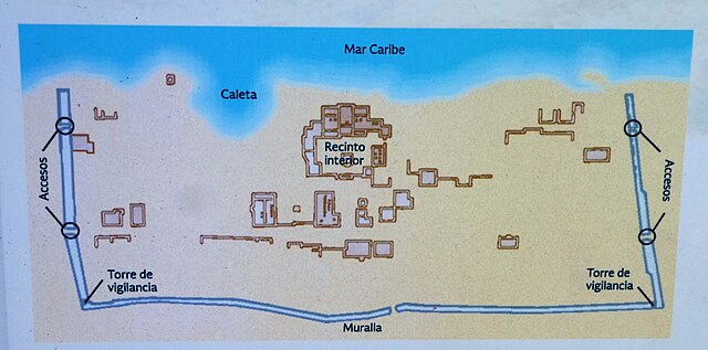
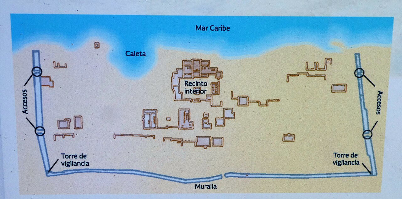
Map of Tulum.
Summary[edit]
| Description |
English: In the 1200's, Tulum was an important Mayan seaport along the Yucatan coast. It was the only Mayan city built on a coast. It remained inhabited well after the arrival of the Spanish.
A map of the ruins. |
| Date | |
| Source | https://www.flickr.com/photos/124651729@N04/52549044351/ |
| Author | Larry Syverson |
| Camera location | | View this and other nearby images on: OpenStreetMap |
|---|
Licensing[edit]
This file is licensed under the Creative Commons Attribution-Share Alike 2.0 Generic license.
- You are free:
- to share – to copy, distribute and transmit the work
- to remix – to adapt the work
- Under the following conditions:
- attribution – You must give appropriate credit, provide a link to the license, and indicate if changes were made. You may do so in any reasonable manner, but not in any way that suggests the licensor endorses you or your use.
- share alike – If you remix, transform, or build upon the material, you must distribute your contributions under the same or compatible license as the original.
| This image was originally posted to Flickr by Stabbur's Master at https://flickr.com/photos/124651729@N04/52549044351. It was reviewed on 25 July 2023 by FlickreviewR 2 and was confirmed to be licensed under the terms of the cc-by-sa-2.0. |
File history
Click on a date/time to view the file as it appeared at that time.
| Date/Time | Thumbnail | Dimensions | User | Comment | |
|---|---|---|---|---|---|
| current | 00:53, 25 July 2023 | | 4,493 × 2,226 (1.29 MB) | El Nuevo Doge (talk | contribs) | Uploaded a work by Larry Syverson from https://www.flickr.com/photos/124651729@N04/52549044351/ with UploadWizard |
You cannot overwrite this file.
File usage on Commons
There are no pages that use this file.