File:TruroFalmouthAerial.jpg
Jump to navigation
Jump to search
Size of this preview: 450 × 600 pixels. Other resolutions: 180 × 240 pixels | 360 × 480 pixels | 576 × 768 pixels | 768 × 1,024 pixels | 1,500 × 2,000 pixels.
Original file (1,500 × 2,000 pixels, file size: 1.6 MB, MIME type: image/jpeg)
Captions
Captions
Add a one-line explanation of what this file represents
Summary[edit]
| Description |
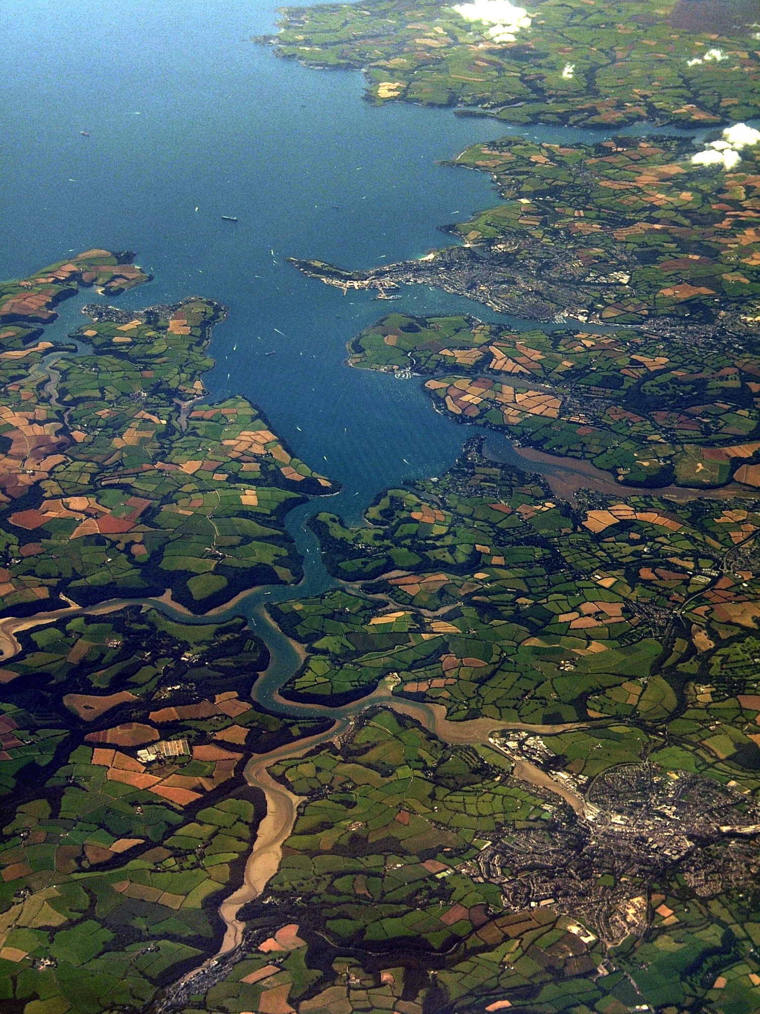
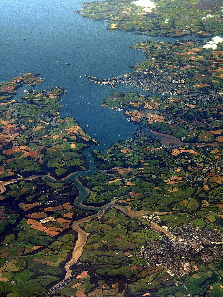
An aerial photo of Carrick Roads. Falmouth is at the mouth of the estuary, and Truro is in the bottom-right of the image. See map. [?] |
| Date | |
| Source | South Cornish coast |
| Author | Jessica from Hove, United Kingdom |
Licensing[edit]
This file is licensed under the Creative Commons Attribution 2.0 Generic license.
- You are free:
- to share – to copy, distribute and transmit the work
- to remix – to adapt the work
- Under the following conditions:
- attribution – You must give appropriate credit, provide a link to the license, and indicate if changes were made. You may do so in any reasonable manner, but not in any way that suggests the licensor endorses you or your use.
| This image, originally posted to Flickr, was reviewed on 13:23, 4 November 2007 (UTC) by the administrator or reviewer Boricuaeddie, who confirmed that it was available on Flickr under the stated license on that date. |
File history
Click on a date/time to view the file as it appeared at that time.
| Date/Time | Thumbnail | Dimensions | User | Comment | |
|---|---|---|---|---|---|
| current | 23:11, 26 July 2010 | | 1,500 × 2,000 (1.6 MB) | Smalljim (talk | contribs) | Reduce haze and other unwanted colour casts. |
| 23:39, 2 November 2007 |  | 1,500 × 2,000 (1.81 MB) | Joowwww (talk | contribs) | {{Information |Description= An aerial photo of Carrick Roads. Falmouth is at the mouth of the estuary, and Truro is in the bottom-right of the image. [http://loc.alize.us/#/flickr:1250339847 See map.] [http://www.flickr.com/groups/geotagging/discuss/7215 |
You cannot overwrite this file.
File usage on Commons
The following 2 pages use this file:
File usage on other wikis
The following other wikis use this file:
- Usage on de.wikipedia.org
- Usage on en.wikipedia.org
- Usage on es.wikipedia.org
- Usage on eu.wikipedia.org
- Usage on fr.wikipedia.org
- Usage on kw.wikipedia.org
- Usage on ro.wikipedia.org
- Usage on ru.wikipedia.org
- Usage on uk.wikipedia.org
- Usage on www.wikidata.org