File:Tropical Storm Jerry off Leeward Islands (MODIS 2019-09-21).jpg

Original file (5,606 × 4,530 pixels, file size: 5.96 MB, MIME type: image/jpeg)
Captions
Captions
Summary[edit]
.jpg&action=edit§ion=1)
| Description |
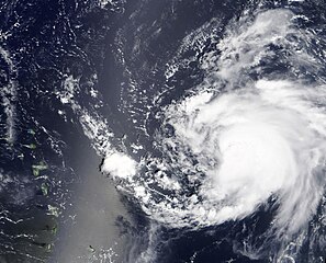
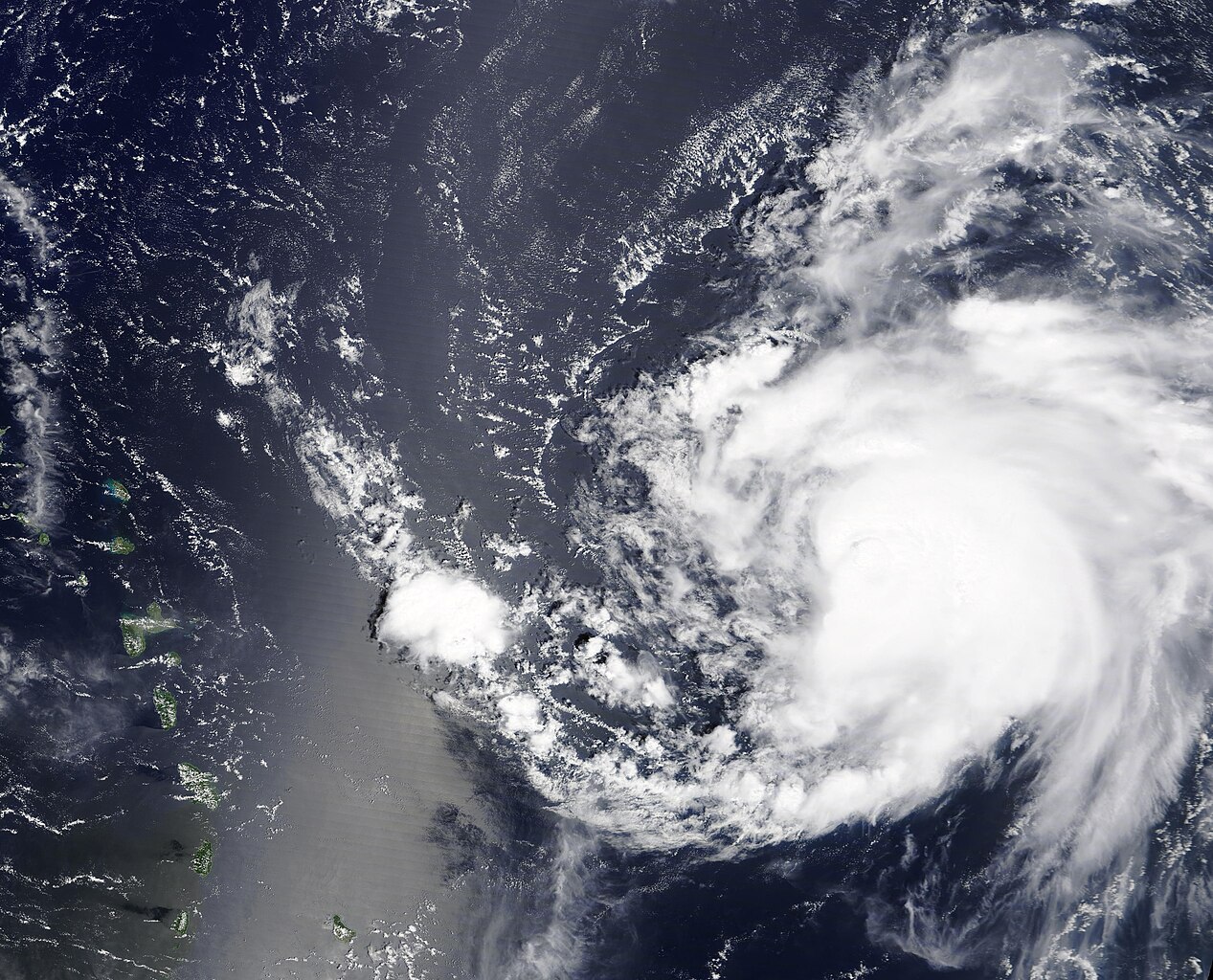
English: Tropical Depression Ten formed in the formed over the Central Tropical Atlantic Ocean on September 17, 2019 and by the next day had strengthened to become Tropical Storm Jerry. The tenth named storm of the Atlantic hurricane seasons, Jerry reached hurricane strength on the morning of September 19 as it spun over open water about 490 mi (785 km) east of the Leeward Islands. At the end of the day, Hurricane Jerry sported maximum sustained winds of 105 mph (165 km/h).
At 1500 UTC (11:00 am EDT) on September 20, the National Hurricane Center (NHC) reported that Hurricane Jerry was located about 130 mi (205 km) northeast of Barbuda and 190 mi (300 km) east-northeast of Anguilla and was moving west-northwest at 17 mph (28 km/h). Maximum sustained winds had decreased to 85 mph (140 km/h). The forecast predicts that Jerry will be interacting with a weakening subtropical ridge and a mid-latitude trough, which should gradually steer the hurricane northward and northeastward. Although Jerry’s core is expected to move north of the northern Leeward Islands, the storm is expected to bring heavy rainfall and flash floods there through September 20. The Moderate Resolution Imaging Spectroradiometer (MODIS) on board NASA’s Terra satellite acquired a true-color image of Hurricane Jerry spinning on the open ocean off of the Leeward Islands. The cloud-covered center of the storm remains ragged as the circulation begins to take on the apostrophe-shape of a strengthening system. |
||
| Date | Taken on 19 September 2019 | ||
| Source |
Tropical Storm Jerry off Leeward Islands (direct link)
|
||
| Author | MODIS Land Rapid Response Team, NASA GSFC |
| This media is a product of the Terra mission Credit and attribution belongs to the mission team, if not already specified in the "author" row |
Licensing[edit]
.jpg&action=edit§ion=2)
| This file is in the public domain in the United States because it was solely created by NASA. NASA copyright policy states that "NASA material is not protected by copyright unless noted". (See Template:PD-USGov, NASA copyright policy page or JPL Image Use Policy.) | ||
 |
Warnings:
|
File history
Click on a date/time to view the file as it appeared at that time.
| Date/Time | Thumbnail | Dimensions | User | Comment | |
|---|---|---|---|---|---|
| current | 03:02, 17 February 2024 | | 5,606 × 4,530 (5.96 MB) | OptimusPrimeBot (talk | contribs) | #Spacemedia - Upload of http://modis.gsfc.nasa.gov/gallery/images/image09212019_250m.jpg via Commons:Spacemedia |
You cannot overwrite this file.
File usage on Commons
There are no pages that use this file.
.jpg&oldid=875550688)