File:TransjakartaBuswayMapOctober2006.png
Original file (1,693 × 1,159 pixels, file size: 311 KB, MIME type: image/png)
Captions
Captions
Need Assistance!
I don't live in Indonesia and the map basically was drawn after a journey of the TranJakarta network in October 2006. I would like to update the plan in the future, but the informations given in the media and the Web about system extensions are often incorrect or very inaccurate. So if you want the network map as accurate as possible too, please announce your error hints and corrections about the correct network configuration on my German discussion page.
Thank you in advance!
| Description |
|
| Date | |
| Source |
Self made with Adobe Illustrator 12.0, using
|
| Author | Maximilian Dörrbecker (Chumwa) |
| Permission (Reusing this file) |
I, the copyright holder of this work, hereby publish it under the following license: This file is licensed under the Creative Commons Attribution-Share Alike 2.5 Generic license.
Sie dürfen das Bild zu den folgenden Bedingungen nutzen:
|
| Other versions |
|


File history
Click on a date/time to view the file as it appeared at that time.
| Date/Time | Thumbnail | Dimensions | User | Comment | |
|---|---|---|---|---|---|
| current | 20:41, 20 November 2006 | | 1,693 × 1,159 (311 KB) | Chumwa (talk | contribs) | Stasiun Kota -> Stasiun Kota Jakarta |
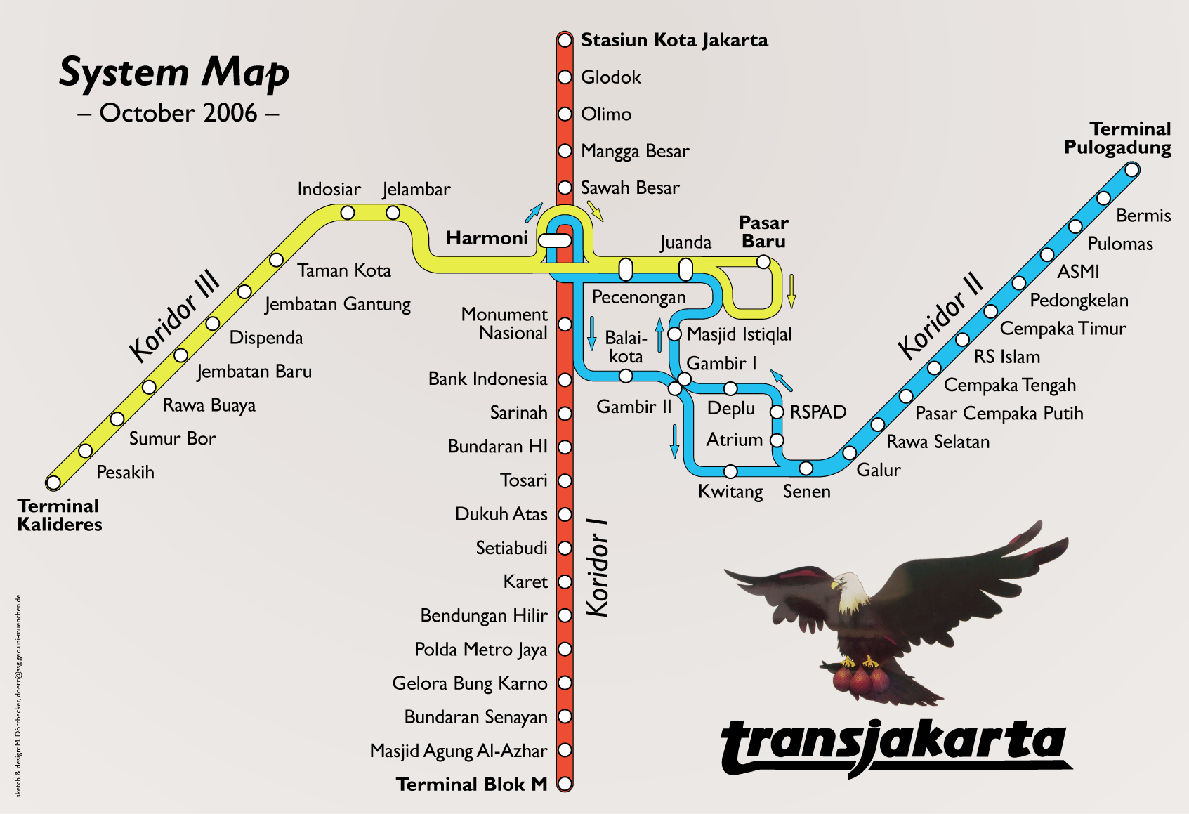
| 17:46, 19 November 2006 |  | 1,711 × 1,154 (356 KB) | Chumwa (talk | contribs) | TransJakarta Busway Network, October 2006 Category:Maximilian Dörrbecker Category:Public transport Category:busway Category:Rapid transit Category:Jakarta Category:Indonesia Category:Map Category:Transport map |
You cannot overwrite this file.
File usage on Commons
The following 6 pages use this file:
File usage on other wikis
The following other wikis use this file:
- Usage on de.wikipedia.org
- Usage on en.wikibooks.org