File:Trans-European Suture Zone.jpg
Jump to navigation
Jump to search
Size of this preview: 663 × 600 pixels. Other resolutions: 265 × 240 pixels | 531 × 480 pixels | 849 × 768 pixels | 1,270 × 1,149 pixels.
Original file (1,270 × 1,149 pixels, file size: 543 KB, MIME type: image/jpeg)
Captions
Captions
Add a one-line explanation of what this file represents
Summary[edit]
| Description |
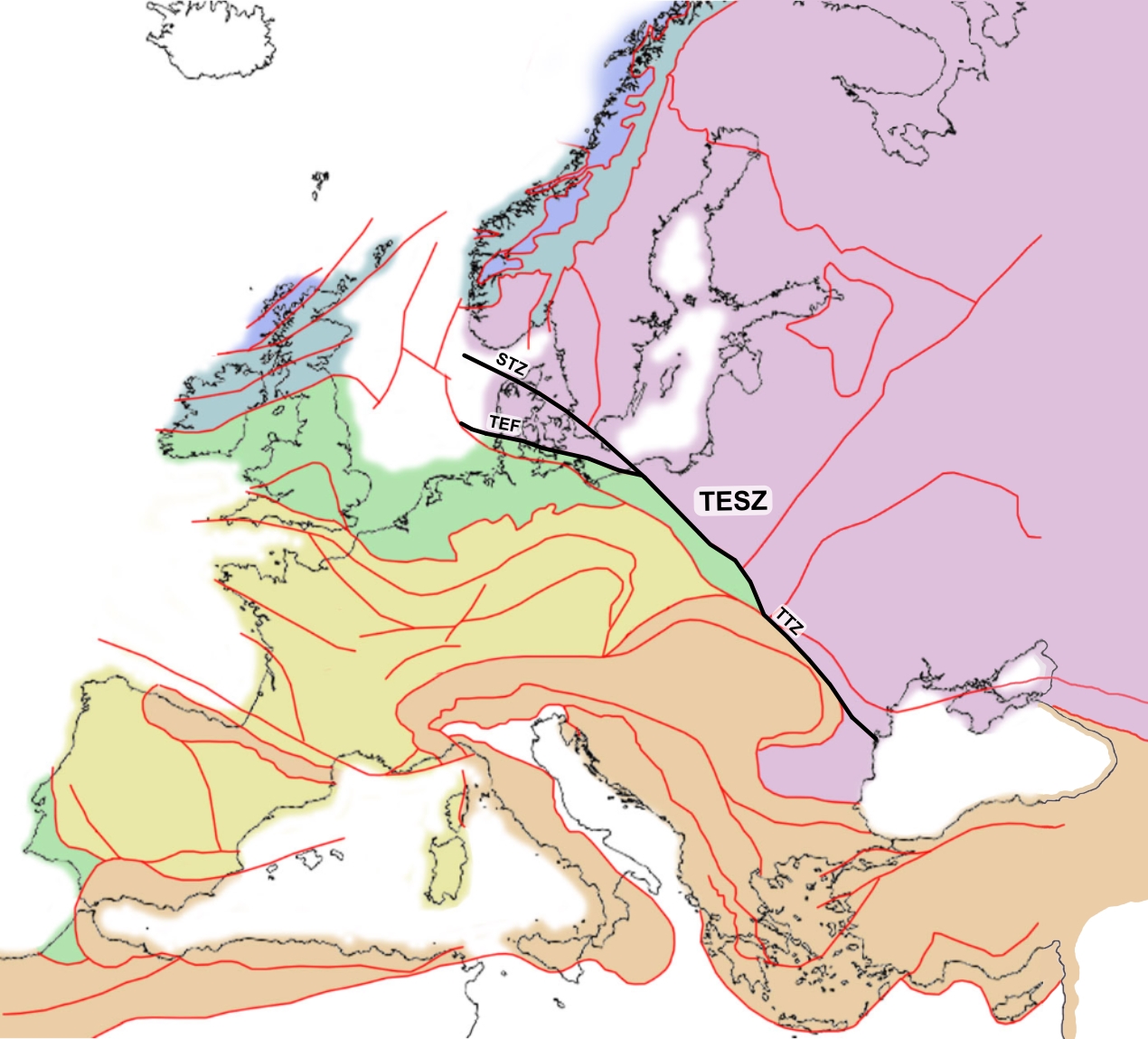
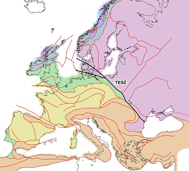
English: Geologic map of Europe. Parts of the Trans-European Suture Zone (STZ, TEF and TTZ) are shown as bands of black colour between the North Sea and the Black Sea. |
| Date | |
| Source | Basemap: Tectonic_map_Europe.jpg, TESZ after DOI:10.1144/GSL.MEM.2006.032.01.02 |
| Author | Woudloper, Polyethylen, LukeTriton |
Licensing[edit]
| This work has been released into the public domain by its author, Woudloper. This applies worldwide. In some countries this may not be legally possible; if so: |
File history
Click on a date/time to view the file as it appeared at that time.
| Date/Time | Thumbnail | Dimensions | User | Comment | |
|---|---|---|---|---|---|
| current | 07:54, 22 September 2023 | | 1,270 × 1,149 (543 KB) | LukeTriton (talk | contribs) | Uploaded a work by Woudloper, Polyethylen, LukeTriton from https://commons.wikimedia.org/wiki/File:Tectonic_Map_of_Europe_noleg.jpg with UploadWizard |
You cannot overwrite this file.
File usage on Commons
There are no pages that use this file.
File usage on other wikis
The following other wikis use this file:
- Usage on be.wikipedia.org
- Usage on de.wikipedia.org
- Usage on en.wikipedia.org
- Usage on pl.wikipedia.org