File:Trans-Alaska Pipeline System Luca Galuzzi 2005.jpg

Original file (2,000 × 1,333 pixels, file size: 1.71 MB, MIME type: image/jpeg)
Captions
Captions
| Description |
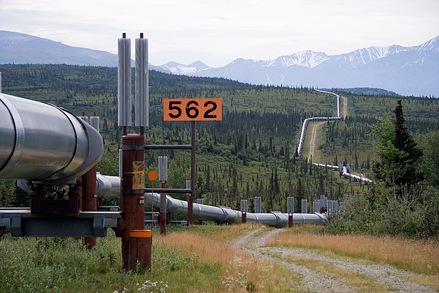
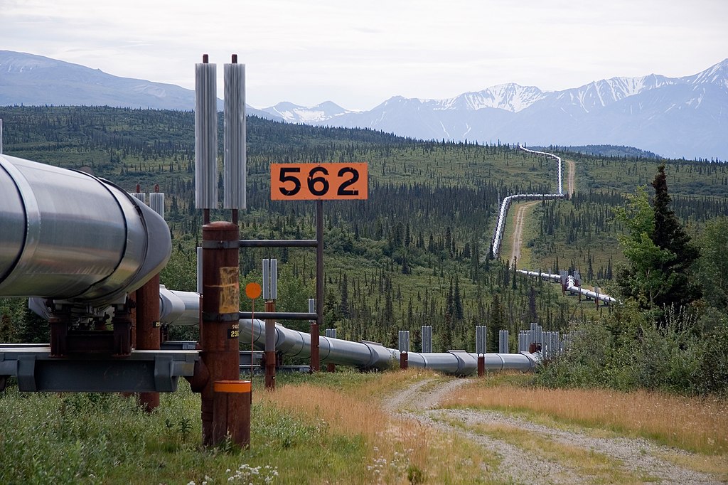
English: Trans-Alaska Pipeline System. It runs from the Arctic Ocean to the Gulf of Alaska at Valdez 800 miles (1,300 km)
Italiano: Oleodotto Trans-Alaska. Lunga 1,300 km va dall'Oceano Artico fino al Golfo dell'Alaska a Valdez
Nederlands: De Trans-Alaska pijplijn loopt 1300 km dwars door Alaska, van de Poolzee tot aan de Golf van Alaska bij Valdez. |
||
| Date | |||
| Source | Photo taken by (Luca Galuzzi) * http://www.galuzzi.it | ||
| Author | Luca Galuzzi (Lucag) | ||
| Permission (Reusing this file) |
I, Luca Galuzzi, the copyright holder of this work, hereby publishes it under the following license: This file is licensed under the Creative Commons Attribution-Share Alike 2.5 Generic license. Attribution: I, Luca Galuzzi
|

| Camera location | | View this and other nearby images on: OpenStreetMap |
|---|
File history
Click on a date/time to view the file as it appeared at that time.
| Date/Time | Thumbnail | Dimensions | User | Comment | |
|---|---|---|---|---|---|
| current | 23:40, 26 May 2007 | | 2,000 × 1,333 (1.71 MB) | Lucag (talk | contribs) | {{Information |Description={{en|Trans-Alaska Pipeline System. It runs from the Arctic Ocean to the Gulf of Alaska at Valdez 800 miles (1,300 km)}} {{it|Oleodotto Trans-Alaska. Lunga 1,300 km va dall'Oceano Artico fino al Golfo dell'Alaska a Valdez}} |Sour |
You cannot overwrite this file.
File usage on Commons
The following 3 pages use this file:
File usage on other wikis
The following other wikis use this file:
- Usage on ar.wikipedia.org
- Usage on as.wikipedia.org
- Usage on bn.wikipedia.org
- Usage on bs.wikipedia.org
- Usage on cs.wikipedia.org
- Usage on en.wikipedia.org
- Usage on en.wikibooks.org
- Usage on eo.wikipedia.org
- Usage on es.wikipedia.org
- Usage on et.wikipedia.org
- Usage on eu.wikipedia.org
- Usage on fa.wikipedia.org
- Usage on fi.wikipedia.org
- Usage on fr.wikipedia.org
- Usage on fr.wikiversity.org
- Usage on fy.wikipedia.org
- Usage on he.wikipedia.org
- Usage on hi.wikipedia.org
- Usage on hu.wikipedia.org
- Usage on hy.wikipedia.org
- Usage on id.wikipedia.org
View more global usage of this file.