File:Traffic down King St. during heavy rains. (29491225215).jpg
Jump to navigation
Jump to search

Size of this preview: 400 × 600 pixels. Other resolutions: 160 × 240 pixels | 320 × 480 pixels | 512 × 768 pixels | 683 × 1,024 pixels | 2,443 × 3,664 pixels.
Original file (2,443 × 3,664 pixels, file size: 3.35 MB, MIME type: image/jpeg)
Captions
Captions
Add a one-line explanation of what this file represents
Summary[edit]
.jpg&action=edit§ion=1)
| Description |
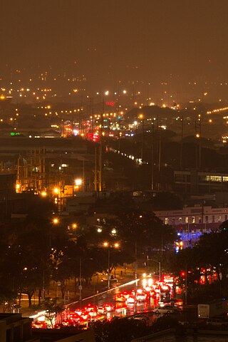
There was some flooding farther down Dillingham Boulevard. I could see a few areas without power from my window as well. This is a previous photo to more clearly identify the areas without power: www.flickr.com/photos/danramarch/23990855896/in/album-721... |
| Date | |
| Source | Traffic down King St. during heavy rains. |
| Author | Daniel Ramirez from Honolulu, USA |
| Camera location | | View this and other nearby images on: OpenStreetMap |
|---|
.jpg¶ms=021.312136_N_-157.858375_E_globe:Earth_type:camera_source:Flickr_&language=en)
Licensing[edit]
.jpg&action=edit§ion=2)
This file is licensed under the Creative Commons Attribution 2.0 Generic license.
- You are free:
- to share – to copy, distribute and transmit the work
- to remix – to adapt the work
- Under the following conditions:
- attribution – You must give appropriate credit, provide a link to the license, and indicate if changes were made. You may do so in any reasonable manner, but not in any way that suggests the licensor endorses you or your use.
| This image was originally posted to Flickr by jdnx at https://flickr.com/photos/21442511@N08/29491225215. It was reviewed on 4 March 2017 by FlickreviewR and was confirmed to be licensed under the terms of the cc-by-2.0. |
File history
Click on a date/time to view the file as it appeared at that time.
| Date/Time | Thumbnail | Dimensions | User | Comment | |
|---|---|---|---|---|---|
| current | 23:32, 4 March 2017 | | 2,443 × 3,664 (3.35 MB) | KAVEBEAR (talk | contribs) | Transferred from Flickr via Flickr2Commons |
You cannot overwrite this file.
File usage on Commons
The following page uses this file:
.jpg&oldid=718146734)