File:Tracking a Superstorm (8971451260).png
Original file (3,840 × 2,160 pixels, file size: 9.38 MB, MIME type: image/png)
Captions
Captions
Summary[edit]
.png&action=edit§ion=1)
| Description |
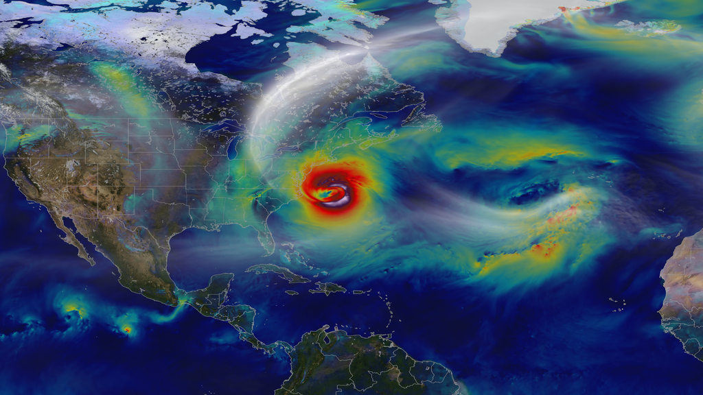
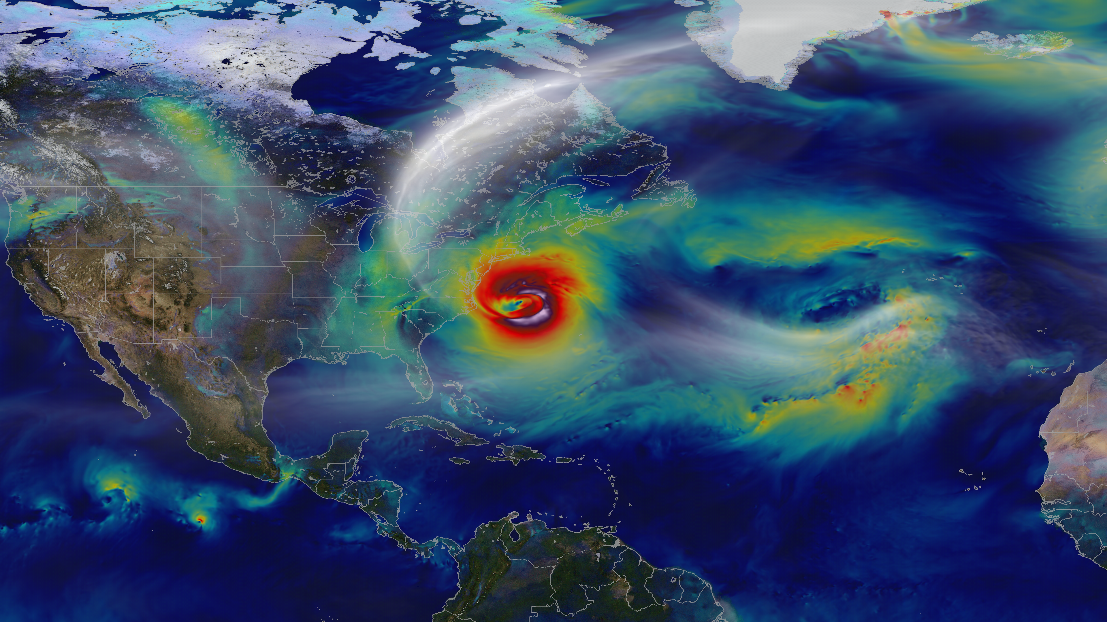
Oct. 29, 2012 – A day before landfall, Sandy intensified into a Category 2 superstorm nearly 1,000 miles wide. Credit: NASA's Goddard Space Flight Center and NASA Center for Climate Simulation Video and images courtesy of NASA/GSFC/William Putman -- A NASA computer model simulates the astonishing track and forceful winds of Hurricane Sandy. Hurricane Sandy pummeled the East Coast late in 2012’s Atlantic hurricane season, causing 159 deaths and $70 billion in damages. Days before landfall, forecasts of its trajectory were still being made. Some computer models showed that a trough in the jet stream would kick the monster storm away from land and out to sea. Among the earliest to predict its true course was NASA’s GEOS-5 global atmosphere model. The model works by dividing Earth’s atmosphere into a virtual grid of stacked boxes. A supercomputer then solves mathematical equations inside each box to create a weather forecast predicting Sandy’s structure, path and other traits. The NASA model not only produced an accurate track of Sandy, but also captured fine-scale details of the storm’s changing intensity and winds. Watch the video to see it for yourself. For more information, please visit: gmao.gsfc.nasa.gov/research/atmosphericassim/tracking_hur... NASA Goddard Space Flight Center enables NASA’s mission through four scientific endeavors: Earth Science, Heliophysics, Solar System Exploration, and Astrophysics. Goddard plays a leading role in NASA’s accomplishments by contributing compelling scientific knowledge to advance the Agency’s mission. Follow us on Twitter Like us on Facebook Find us on Instagram |
| Date | |
| Source | Tracking a Superstorm |
| Author | NASA Goddard Space Flight Center from Greenbelt, MD, USA |
Licensing[edit]
.png&action=edit§ion=2)
- You are free:
- to share – to copy, distribute and transmit the work
- to remix – to adapt the work
- Under the following conditions:
- attribution – You must give appropriate credit, provide a link to the license, and indicate if changes were made. You may do so in any reasonable manner, but not in any way that suggests the licensor endorses you or your use.
| This image was originally posted to Flickr by NASA Goddard Photo and Video at https://flickr.com/photos/24662369@N07/8971451260. It was reviewed on 6 October 2017 by FlickreviewR and was confirmed to be licensed under the terms of the cc-by-2.0. |
| This file is in the public domain in the United States because it was solely created by NASA. NASA copyright policy states that "NASA material is not protected by copyright unless noted". (See Template:PD-USGov, NASA copyright policy page or JPL Image Use Policy.) | ||
 |
Warnings:
|
File history
Click on a date/time to view the file as it appeared at that time.
| Date/Time | Thumbnail | Dimensions | User | Comment | |
|---|---|---|---|---|---|
| current | 12:34, 5 October 2017 | 3,840 × 2,160 (9.38 MB) | A1Cafel (talk | contribs) | Transferred from Flickr via Flickr2Commons |
You cannot overwrite this file.
File usage on Commons
There are no pages that use this file.
.png&oldid=542799087)