File:Tournette.jpg
Jump to navigation
Jump to search

Size of this preview: 800 × 562 pixels. Other resolutions: 320 × 225 pixels | 640 × 450 pixels | 1,000 × 703 pixels.
Original file (1,000 × 703 pixels, file size: 95 KB, MIME type: image/jpeg)
Captions
Captions
Add a one-line explanation of what this file represents
Summary[edit]
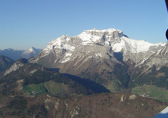
| Description | La fr:Tournette (2 351 m), sommet le plus élevé du fr:massif des Bornes. fr:Photographie aérienne, vue depuis l'ouest, au-dessus du fr:lac d'Annecy. On devine au premier-plan (à gauche du centre de la photo) le Col de la Forclaz. |
| Date | |
| Source | photo by Didier Halatre |
| Author | Didier at French Wikipedia |
Licensing[edit]

|
Permission is granted to copy, distribute and/or modify this document under the terms of the GNU Free Documentation License, Version 1.2 or any later version published by the Free Software Foundation; with no Invariant Sections, no Front-Cover Texts, and no Back-Cover Texts. A copy of the license is included in the section entitled GNU Free Documentation License. |
| This file is licensed under the Creative Commons Attribution-Share Alike 3.0 Unported license. | ||
| ||
| This licensing tag was added to this file as part of the GFDL licensing update. |
Original upload log[edit]
(All user names refer to fr.wikipedia)
- 2004-10-29 14:04 Didier 1000×703×8 (97564 bytes) La [[Tournette]] (2351 m), sommet le plus élevé du [[massif des Bornes]]. Photo perso sous GFDL.
| Annotations | This image is annotated: View the annotations at Commons |
File history
Click on a date/time to view the file as it appeared at that time.
| Date/Time | Thumbnail | Dimensions | User | Comment | |
|---|---|---|---|---|---|
| current | 23:03, 30 January 2007 | | 1,000 × 703 (95 KB) | Bilou~commonswiki (talk | contribs) | {{Information |Description=La fr:Tournette (2 351 m), sommet le plus élevé du fr:massif des Bornes. fr:Photographie aérienne, vue depuis l'ouest, au-dessus du fr:lac d'Annecy. On devine au premier-plan (à gauche du centre de la pho |
You cannot overwrite this file.
File usage on Commons
There are no pages that use this file.
File usage on other wikis
The following other wikis use this file:
- Usage on cs.wikipedia.org
- Usage on fr.wikipedia.org
- Usage on it.wikipedia.org
- Usage on nl.wikipedia.org
- Usage on pl.wikipedia.org
- Usage on pt.wikipedia.org
- Usage on zh.wikipedia.org