File:Thurber, Texas (24243305535).jpg
Jump to navigation
Jump to search
Size of this preview: 800 × 581 pixels. Other resolutions: 320 × 232 pixels | 640 × 465 pixels | 1,024 × 744 pixels | 1,280 × 930 pixels | 2,560 × 1,859 pixels | 5,507 × 4,000 pixels.
Original file (5,507 × 4,000 pixels, file size: 1.62 MB, MIME type: image/jpeg)
Captions
Captions
Add a one-line explanation of what this file represents
Summary[edit]
.jpg&action=edit§ion=1)
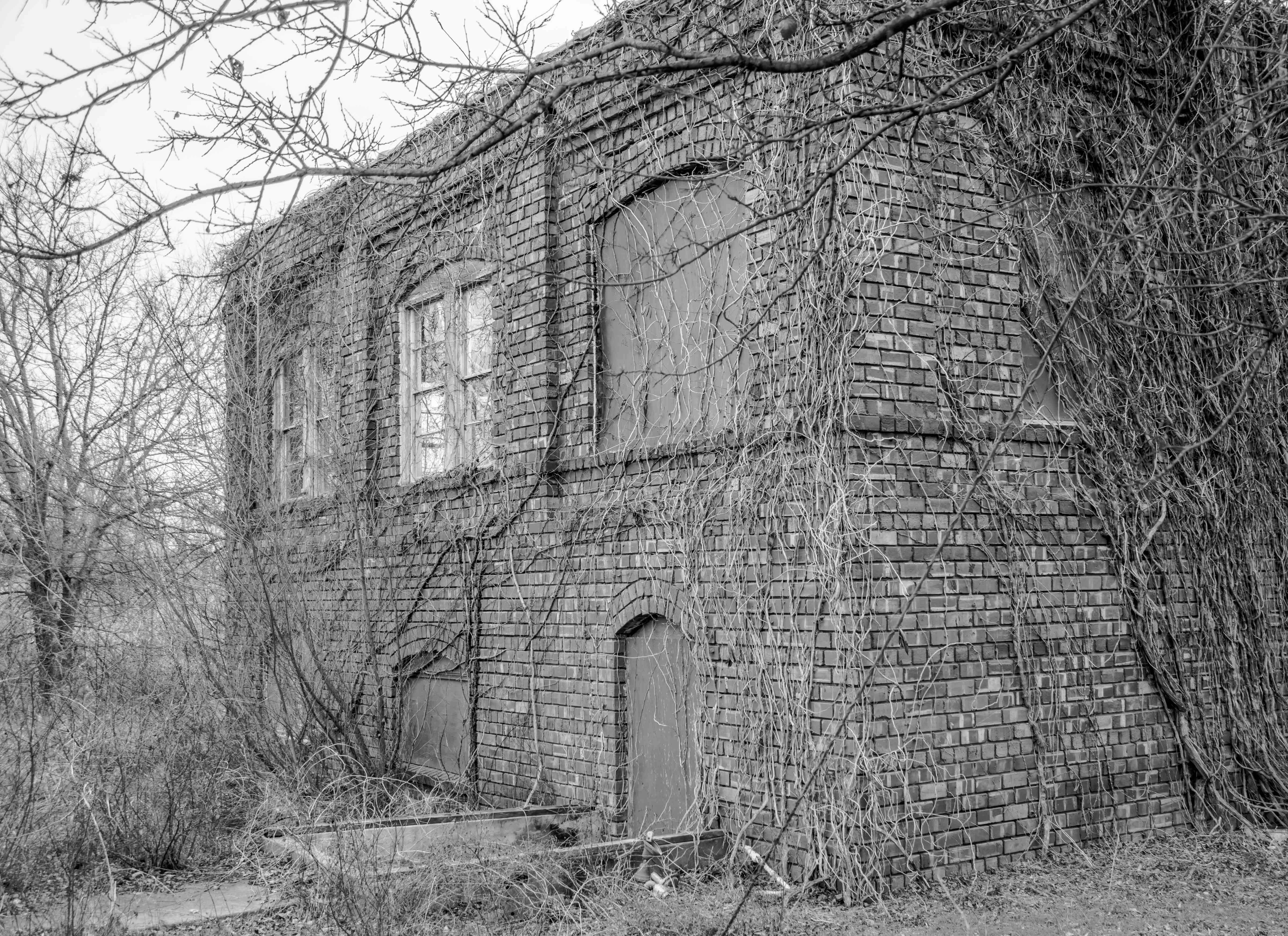
| Description | Between 1888 and 1921 Thurber was the largest coal producing mine in the state of Texas. Once home to 10,000 residents, the current population is 48. Its smokestack is visible for miles to drivers on I-20 between Fort Worth and Abilene. |
| Date | |
| Source | Thurber, Texas |
| Author | David Layne from Texas |
| Camera location | | View this and other nearby images on: OpenStreetMap |
|---|
.jpg¶ms=032.507647_N_-098.416073_E_globe:Earth_type:camera_source:Flickr_&language=en)
Licensing[edit]
.jpg&action=edit§ion=2)
This file is licensed under the Creative Commons Attribution 2.0 Generic license.
- You are free:
- to share – to copy, distribute and transmit the work
- to remix – to adapt the work
- Under the following conditions:
- attribution – You must give appropriate credit, provide a link to the license, and indicate if changes were made. You may do so in any reasonable manner, but not in any way that suggests the licensor endorses you or your use.
| This image was originally posted to Flickr by davidlayne1284 at https://flickr.com/photos/130546768@N02/24243305535 (archive). It was reviewed on 30 June 2018 by FlickreviewR 2 and was confirmed to be licensed under the terms of the cc-by-2.0. |
File history
Click on a date/time to view the file as it appeared at that time.
| Date/Time | Thumbnail | Dimensions | User | Comment | |
|---|---|---|---|---|---|
| current | 05:55, 30 June 2018 | | 5,507 × 4,000 (1.62 MB) | Ser Amantio di Nicolao (talk | contribs) | Transferred from Flickr via #flickr2commons |
You cannot overwrite this file.
File usage on Commons
There are no pages that use this file.
.jpg&oldid=513098303)