File:The choice is yours - geograph.org.uk - 785816.jpg
Jump to navigation
Jump to search
Size of this preview: 450 × 600 pixels. Other resolutions: 180 × 240 pixels | 480 × 640 pixels.
Original file (480 × 640 pixels, file size: 113 KB, MIME type: image/jpeg)
Captions
Captions
Add a one-line explanation of what this file represents
Summary[edit]
| Description |
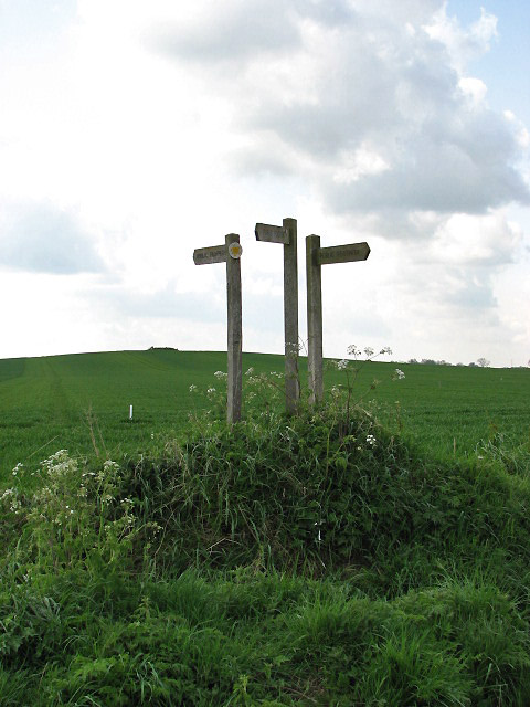
English: The choice is yours Two paths lead across the field seen in the background: one leads south to High Hill, the other one southwest to Silcock's Farm. Across the road and in the opposite direction, one path traverses a field and connects with Pound Road in the north; another path leads towards East Ruston in northeasterly direction. The location of the mound seen on top of the hill is marked with a small circle on OS maps; there is no explanation as to what it represents, though. |
| Date | |
| Source | From geograph.org.uk |
| Author | Evelyn Simak |
| Attribution (required by the license) | Evelyn Simak / The choice is yours / |
| Camera location | | View this and other nearby images on: OpenStreetMap |
|---|
_heading:180.00&language=en)
| Object location | | View this and other nearby images on: OpenStreetMap |
|---|
_heading:180.00&language=en)
Licensing[edit]

|
This image was taken from the Geograph project collection. See this photograph's page on the Geograph website for the photographer's contact details. The copyright on this image is owned by Evelyn Simak and is licensed for reuse under the Creative Commons Attribution-ShareAlike 2.0 license.
|
This file is licensed under the Creative Commons Attribution-Share Alike 2.0 Generic license.
Attribution: Evelyn Simak
- You are free:
- to share – to copy, distribute and transmit the work
- to remix – to adapt the work
- Under the following conditions:
- attribution – You must give appropriate credit, provide a link to the license, and indicate if changes were made. You may do so in any reasonable manner, but not in any way that suggests the licensor endorses you or your use.
- share alike – If you remix, transform, or build upon the material, you must distribute your contributions under the same or compatible license as the original.
File history
Click on a date/time to view the file as it appeared at that time.
| Date/Time | Thumbnail | Dimensions | User | Comment | |
|---|---|---|---|---|---|
| current | 02:46, 20 February 2011 | | 480 × 640 (113 KB) | GeographBot (talk | contribs) | == {{int:filedesc}} == {{Information |description={{en|1=The choice is yours Two paths lead across the field seen in the background: one leads south to High Hill, the other one southwest to Silcock's Farm. Across the road and in the opposite direction, on |
You cannot overwrite this file.
File usage on Commons
There are no pages that use this file.