File:The Slurry Lagoon - geograph.org.uk - 1389734.jpg
Jump to navigation
Jump to search
No higher resolution available.
The_Slurry_Lagoon_-_geograph.org.uk_-_1389734.jpg (640 × 479 pixels, file size: 106 KB, MIME type: image/jpeg)
Captions
Captions
Add a one-line explanation of what this file represents
Summary[edit]
| Description |
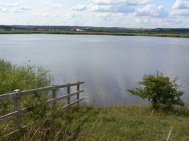
English: The Slurry Lagoon This was significantly the larger of the two pits created to deal with the slurry from Gedling Colliery. This was the pit into which the slurry was discharged, allowing it to settle with the overflow running into Deep Pit. About half the area is still under water, with substantial reedbed growth in the shallows. Much of the pit is basically dry, although it clearly gets wet in certain conditions. At this point the fencing has been arranged to allow visitors to get down to the water's edge. |
| Date | |
| Source | From geograph.org.uk |
| Author | Alan Murray-Rust |
| Attribution (required by the license) | Alan Murray-Rust / The Slurry Lagoon / |
| Camera location | | View this and other nearby images on: OpenStreetMap |
|---|
| Object location | | View this and other nearby images on: OpenStreetMap |
|---|
Licensing[edit]

|
This image was taken from the Geograph project collection. See this photograph's page on the Geograph website for the photographer's contact details. The copyright on this image is owned by Alan Murray-Rust and is licensed for reuse under the Creative Commons Attribution-ShareAlike 2.0 license.
|
This file is licensed under the Creative Commons Attribution-Share Alike 2.0 Generic license.
Attribution: Alan Murray-Rust
- You are free:
- to share – to copy, distribute and transmit the work
- to remix – to adapt the work
- Under the following conditions:
- attribution – You must give appropriate credit, provide a link to the license, and indicate if changes were made. You may do so in any reasonable manner, but not in any way that suggests the licensor endorses you or your use.
- share alike – If you remix, transform, or build upon the material, you must distribute your contributions under the same or compatible license as the original.

_heading:315.00&language=en)
_heading:315.00&language=en)
File history
Click on a date/time to view the file as it appeared at that time.
| Date/Time | Thumbnail | Dimensions | User | Comment | |
|---|---|---|---|---|---|
| current | 19:55, 28 February 2011 | | 640 × 479 (106 KB) | GeographBot (talk | contribs) | == {{int:filedesc}} == {{Information |description={{en|1=The Slurry Lagoon This was significantly the larger of the two pits created to deal with the slurry from Gedling Colliery. This was the pit into which the slurry was discharged, allowing it to settl |
You cannot overwrite this file.
File usage on Commons
There are no pages that use this file.