File:The Russian Empire-es.svg
Jump to navigation
Jump to search

Size of this PNG preview of this SVG file: 800 × 407 pixels. Other resolutions: 320 × 163 pixels | 640 × 325 pixels | 1,024 × 520 pixels | 1,280 × 650 pixels | 2,560 × 1,301 pixels | 3,121 × 1,586 pixels.
Original file (SVG file, nominally 3,121 × 1,586 pixels, file size: 1.18 MB)
Captions
Captions
Add a one-line explanation of what this file represents
Summary[edit]
| Description |
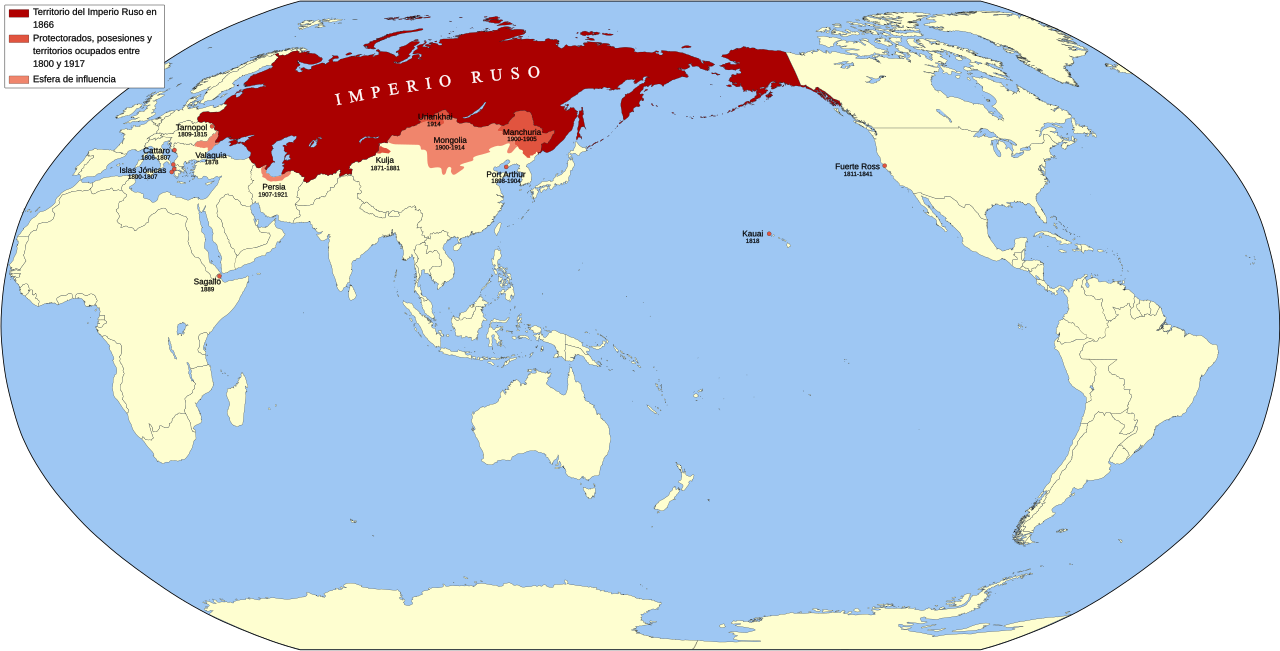
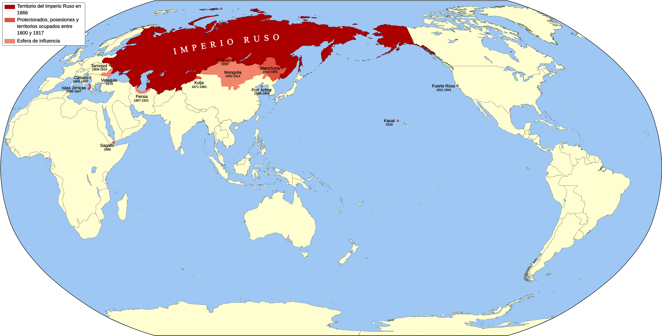
Español: Imperio Ruso (1800-1866). Territorio (1866). Protectorados, territorios de ultramar, posesiones y territorios ocupados (con fecha) entre 1800 y 1917. Esfera de influencia. |
| Date | |
| Source |
Own work
|
| Author | Milenioscuro |
| Other versions |
|


Licensing[edit]
I, the copyright holder of this work, hereby publish it under the following license:
This file is licensed under the Creative Commons Attribution-Share Alike 3.0 Unported license.
- You are free:
- to share – to copy, distribute and transmit the work
- to remix – to adapt the work
- Under the following conditions:
- attribution – You must give appropriate credit, provide a link to the license, and indicate if changes were made. You may do so in any reasonable manner, but not in any way that suggests the licensor endorses you or your use.
- share alike – If you remix, transform, or build upon the material, you must distribute your contributions under the same or compatible license as the original.
File history
Click on a date/time to view the file as it appeared at that time.
| Date/Time | Thumbnail | Dimensions | User | Comment | |
|---|---|---|---|---|---|
| current | 12:16, 11 February 2023 | | 3,121 × 1,586 (1.18 MB) | Максим Иванов Васильевич (talk | contribs) | Reverted to version as of 07:24, 6 March 2015 (UTC) |
| 07:54, 9 March 2015 |  | 3,121 × 1,586 (1.18 MB) | Milenioscuro (talk | contribs) | minor errors | |
| 07:24, 6 March 2015 |  | 3,121 × 1,586 (1.18 MB) | Milenioscuro (talk | contribs) | cambio de colores y agrupamiento de elementos | |
| 05:25, 16 May 2011 |  | 3,121 × 1,586 (1.92 MB) | Milenioscuro (talk | contribs) | Manchuria y Tuva Uriankhai | |
| 20:36, 9 May 2011 |  | 3,121 × 1,586 (1.91 MB) | Milenioscuro (talk | contribs) | Uriankhai protectorate (Tuva) | |
| 18:58, 9 May 2011 |  | 3,121 × 1,586 (1.91 MB) | Milenioscuro (talk | contribs) | cambio de colores, arreglos en las fronteras y mejorada la leyenda | |
| 23:08, 7 May 2011 |  | 3,121 × 1,586 (1.85 MB) | Milenioscuro (talk | contribs) | {{Information |Description ={{en|1=Russiam Empire (1800-1866)}} |Source ={{own}} |Author =Shadowxfox |Date =07-05-2011 |Permission = |other_versions = }} Category:Maps of the Russian Empire |
You cannot overwrite this file.
File usage on Commons
The following 3 pages use this file:
File usage on other wikis
The following other wikis use this file:
- Usage on es.wikipedia.org
- Usage on pt.wikipedia.org