File:The Balkans - The Graphic war map (5003846) (cropped).jpg
Jump to navigation
Jump to search

Size of this preview: 800 × 523 pixels. Other resolutions: 320 × 209 pixels | 640 × 418 pixels | 1,024 × 670 pixels | 1,280 × 837 pixels | 2,421 × 1,583 pixels.
Original file (2,421 × 1,583 pixels, file size: 943 KB, MIME type: image/jpeg)
Captions
Captions
Add a one-line explanation of what this file represents
Summary[edit]
| G F Morrell: The Graphic war map
|
||||||||||||||||||||||||
|---|---|---|---|---|---|---|---|---|---|---|---|---|---|---|---|---|---|---|---|---|---|---|---|---|
| Author |
The Graphic staff |
.jpg) | ||||||||||||||||||||||
| Editor |
The Graphic staff |
|||||||||||||||||||||||
| Illustrator |
G. F. Morrell |
|||||||||||||||||||||||
| Title |
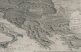
The Graphic war map: price threepence (detail showing the Balkans) |
|||||||||||||||||||||||
| Publisher | ||||||||||||||||||||||||
| Object type |
map / publication |
|||||||||||||||||||||||
| Description |
English: Cropped detail from a WWI map from the collections of the National Library of Wales.another reference |
|||||||||||||||||||||||
| Publication date |
1914 |
|||||||||||||||||||||||
| Dimensions |
height: 33 cm (12.9 in) |
|||||||||||||||||||||||
| Collection |
|
|||||||||||||||||||||||
| Source |
|
|||||||||||||||||||||||
| Other versions | ||||||||||||||||||||||||


_(cropped).jpg&action=edit§ion=1)
Licensing[edit]
_(cropped).jpg&action=edit§ion=2)
|
This work is in the public domain in its country of origin and other countries and areas where the copyright term is the author's life plus 100 years or fewer. This work is in the public domain in the United States because it was published (or registered with the U.S. Copyright Office) before January 1, 1929. | |
| This file has been identified as being free of known restrictions under copyright law, including all related and neighboring rights. | |
File history
Click on a date/time to view the file as it appeared at that time.
| Date/Time | Thumbnail | Dimensions | User | Comment | |
|---|---|---|---|---|---|
| current | 19:54, 26 June 2020 | | 2,421 × 1,583 (943 KB) | Balkanique (talk | contribs) | File:The Graphic war map (5003846).jpg cropped 52 % horizontally, 57 % vertically using CropTool with lossless mode. |
You cannot overwrite this file.
File usage on Commons
The following 3 pages use this file:
_(cropped).jpg)
_(cropped).jpg&oldid=829491215)