File:Thailand Surat Thani locator map.svg
Jump to navigation
Jump to search

Size of this PNG preview of this SVG file: 341 × 599 pixels. Other resolutions: 136 × 240 pixels | 273 × 480 pixels | 437 × 768 pixels | 582 × 1,024 pixels | 1,165 × 2,048 pixels | 1,052 × 1,849 pixels.
Original file (SVG file, nominally 1,052 × 1,849 pixels, file size: 1.25 MB)
Captions
Captions
Add a one-line explanation of what this file represents
Summary[edit]
| Description |
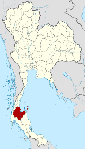
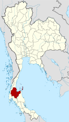
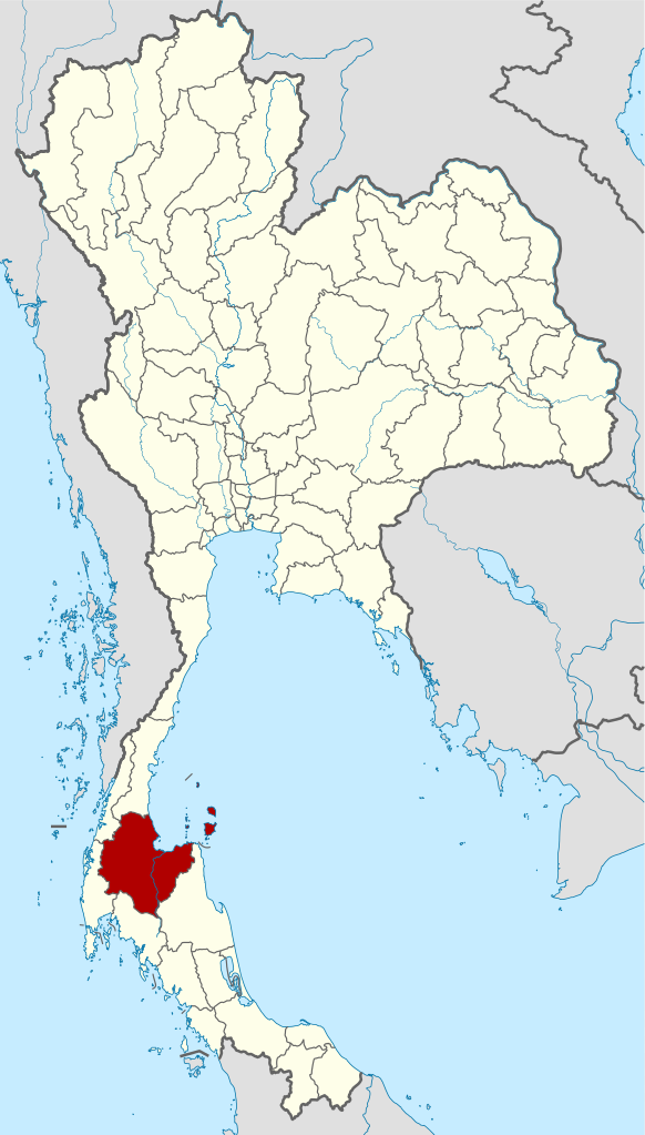
Deutsch: Lagekarte der Provinz Surat Thani, Thailand
English: Locator map of Surat Thani Province, Thailand |
| Date | |
| Source |
self-made, using |
| Author | NordNordWest |

|
This map has been made or improved in the German Kartenwerkstatt (Map Lab). You can propose maps to improve as well.
|
Licensing[edit]
I, the copyright holder of this work, hereby publish it under the following licenses:

|
Permission is granted to copy, distribute and/or modify this document under the terms of the GNU Free Documentation License, Version 1.2 or any later version published by the Free Software Foundation; with no Invariant Sections, no Front-Cover Texts, and no Back-Cover Texts. A copy of the license is included in the section entitled GNU Free Documentation License. |
This file is licensed under the Creative Commons Attribution 3.0 Unported license.
- You are free:
- to share – to copy, distribute and transmit the work
- to remix – to adapt the work
- Under the following conditions:
- attribution – You must give appropriate credit, provide a link to the license, and indicate if changes were made. You may do so in any reasonable manner, but not in any way that suggests the licensor endorses you or your use.
You may select the license of your choice.
File history
Click on a date/time to view the file as it appeared at that time.
| Date/Time | Thumbnail | Dimensions | User | Comment | |
|---|---|---|---|---|---|
| current | 16:09, 25 March 2011 | | 1,052 × 1,849 (1.25 MB) | Hdamm (talk | contribs) | Update: new province Bueng Kan |
| 08:29, 23 April 2009 |  | 1,052 × 1,849 (1.46 MB) | NordNordWest (talk | contribs) | corr | |
| 18:32, 22 April 2009 |  | 1,052 × 1,849 (1.45 MB) | NordNordWest (talk | contribs) | {{Information |Description= {{de|Lagekarte der Provinz Surat Thani, Thailand}} {{en|Locator map of Surat Thani Province, Thailand}} |Source=self-made, using * Thailand location map.svg |Date=22-02-2009 |Author=[[User:N |
You cannot overwrite this file.
File usage on Commons
The following 5 pages use this file:
File usage on other wikis
The following other wikis use this file:
- Usage on ar.wikipedia.org
- Usage on be.wikipedia.org
- Usage on bg.wikipedia.org
- Usage on bo.wikipedia.org
- Usage on bpy.wikipedia.org
- Usage on cdo.wikipedia.org
- Usage on ceb.wikipedia.org
- Usage on ckb.wikipedia.org
- Usage on de.wikipedia.org
- Usage on de.wikivoyage.org
- Usage on en.wikipedia.org
- Usage on es.wikipedia.org
- Usage on fa.wikipedia.org
- Usage on fr.wikipedia.org
- Usage on gl.wikipedia.org
- Usage on hi.wikipedia.org
- Usage on hu.wikipedia.org
- Usage on id.wikipedia.org
- Usage on it.wikipedia.org
- Usage on ja.wikipedia.org
- Usage on ka.wikipedia.org
- Usage on ko.wikipedia.org
- Usage on lv.wikipedia.org
- Usage on mg.wikipedia.org
- Usage on ml.wikipedia.org
- Usage on nl.wikipedia.org
- Usage on pa.wikipedia.org
- Usage on ro.wikipedia.org
- Usage on ru.wikipedia.org
- Usage on sco.wikipedia.org
- Usage on sv.wikipedia.org
- Usage on th.wikipedia.org
- Usage on tl.wikipedia.org
- Usage on tr.wikipedia.org
- Usage on uk.wikipedia.org
- Usage on ur.wikipedia.org
- Usage on vi.wikipedia.org
- Usage on www.wikidata.org
- Usage on zh-yue.wikipedia.org
- Usage on zh.wikipedia.org