File:Thailand Bueng Kan locator map.svg
Jump to navigation
Jump to search

Size of this PNG preview of this SVG file: 341 × 599 pixels. Other resolutions: 136 × 240 pixels | 273 × 480 pixels | 437 × 768 pixels | 582 × 1,024 pixels | 1,165 × 2,048 pixels | 1,052 × 1,849 pixels.
Original file (SVG file, nominally 1,052 × 1,849 pixels, file size: 1.84 MB)
Captions
Captions
Add a one-line explanation of what this file represents
| Description |
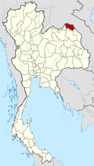
Deutsch: Lagekarte der Provinz Bueng Kan, Thailand English: Locator map of Bueng Kan Province, Thailand |
| Date | (UTC) |
| Source | |
| Author |
|
| This is a retouched picture, which means that it has been digitally altered from its original version. Modifications: Merged together to show Bueng Kan province. The original can be viewed here: Amphoe Nong Khai.svg:
|
This file is licensed under the Creative Commons Attribution-Share Alike 3.0 Unported license.
- You are free:
- to share – to copy, distribute and transmit the work
- to remix – to adapt the work
- Under the following conditions:
- attribution – You must give appropriate credit, provide a link to the license, and indicate if changes were made. You may do so in any reasonable manner, but not in any way that suggests the licensor endorses you or your use.
- share alike – If you remix, transform, or build upon the material, you must distribute your contributions under the same or compatible license as the original.
Original upload log[edit]
This image is a derivative work of the following images:
- File:Thailand_Nong_Khai_locator_map.svg licensed with Cc-by-3.0, GFDL
- 2009-04-21T17:01:48Z NordNordWest 1052x1849 (1525269 Bytes) {{Information |Description= {{de|Lagekarte der Provinz Nong Khai, Thailand}} {{en|Locator map of Nong Khai Province, Thailand}} |Source=self-made, using * [[:file:Thailand location map.svg|Thailand location map.svg]] |Date=2
- File:Amphoe_Nong_Khai.svg licensed with Cc-by-sa-3.0
Uploaded with derivativeFX
File history
Click on a date/time to view the file as it appeared at that time.
| Date/Time | Thumbnail | Dimensions | User | Comment | |
|---|---|---|---|---|---|
| current | 21:27, 6 August 2010 | | 1,052 × 1,849 (1.84 MB) | Ahoerstemeier (talk | contribs) | {{Information |Description={{de|Lagekarte der Provinz Nong Khai, Thailand}} {{en|Locator map of Nong Khai Province, Thailand}} {{en|1=Map of Nong Khai province, Thailand, with the districts (Amphoe) numbered. #Mueang Nong Khai (อำเภอเมื� |
You cannot overwrite this file.
File usage on Commons
The following 4 pages use this file:
File usage on other wikis
The following other wikis use this file:
- Usage on ar.wikipedia.org
- Usage on be.wikipedia.org
- Usage on cdo.wikipedia.org
- Usage on ckb.wikipedia.org
- Usage on de.wikipedia.org
- Usage on de.wikivoyage.org
- Usage on en.wikipedia.org
- Bueng Khong Long district
- Bung Khla district
- Pak Khat district
- Si Wilai district
- Seka district
- So Phisai district
- Bueng Kan province
- Seals of the provinces of Thailand
- Template:BuengKan-geo-stub
- Si Wilai subdistrict
- Chumphu Phon
- Phon Charoen
- Tha Kok Daeng
- Seka subdistrict
- Bueng Khong Long subdistrict
- Dong Bang, Bueng Kan
- Pho Mak Khaeng
- Tha Dok Kham
- Bung Khla subdistrict
- Khok Kwang
- Nong Doen
- Pak Khat subdistrict
- Nong Yong
- Na Kang
- Na Dong
- Non Sila, Bueng Kan
- Som Sanuk
- Don Ya Nang
- Nong Hua Chang
- Pa Faek, Bueng Kan
- Si Chomphu, Phon Charoen
- Si Samran
- Wang Chomphu
- Ban Tong
- Nam Chan
- Nong Thum
- Pong Hai
- Sang, Bueng Kan
- Sok Kam
- Tha Sa-at
- Na Sabaeng
- Na Saeng, Bueng Kan
- Na Sing
View more global usage of this file.