File:Target Tokyo (1943).jpg
Jump to navigation
Jump to search
Size of this preview: 451 × 600 pixels. Other resolutions: 180 × 240 pixels | 361 × 480 pixels | 577 × 768 pixels | 770 × 1,024 pixels | 1,540 × 2,048 pixels | 4,015 × 5,339 pixels.
Original file (4,015 × 5,339 pixels, file size: 4.04 MB, MIME type: image/jpeg)
Captions
Captions
Add a one-line explanation of what this file represents
Summary[edit]
.jpg&action=edit§ion=1)
| Description |
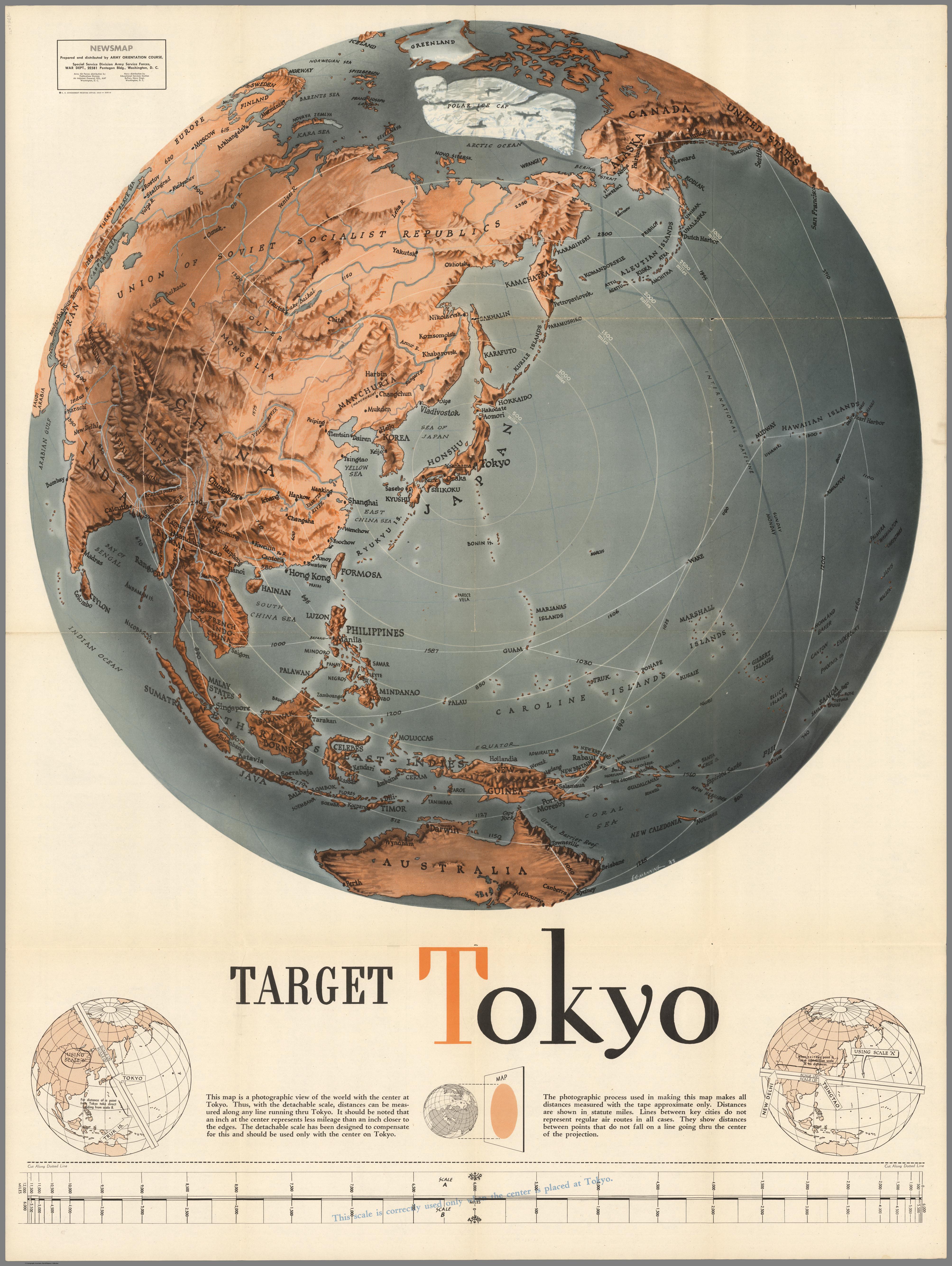
English: Shaded relief map centered on Tokyo, Japan. Has a cut-away scale for measuring distances from Tokyo or, alternatively one can use the concentric rings. Some flight routes and mileages shown. Hemispherical view. |
| Date | |
| Source | David Rumsey Map Collection, list no 6769.001 |
| Author | Army Orientation Course |
Licensing[edit]
.jpg&action=edit§ion=2)
This image is a work of a U.S. military or Department of Defense employee, taken or made as part of that person's official duties. As a work of the U.S. federal government, the image is in the public domain in the United States.
|
 |
File history
Click on a date/time to view the file as it appeared at that time.
| Date/Time | Thumbnail | Dimensions | User | Comment | |
|---|---|---|---|---|---|
| current | 19:49, 28 August 2022 | | 4,015 × 5,339 (4.04 MB) | Universalis (talk | contribs) | Uploaded a work by Army Orientation Course from David Rumsey Map Collection, list no [https://www.davidrumsey.com/luna/servlet/detail/RUMSEY~8~1~260209~5522904:Target-Tokyo-?sort=Pub_List_No_InitialSort%2CPub_Date%2CPub_List_No%2CSeries_No&qvq=q:author%3D%22Army%20Orientation%20Course%2C%20Special%20Service%20Division%20Army%20Service%20Forces%22;sort:Pub_List_No_InitialSort%2CPub_Date%2CPub_List_No%2CSeries_No;lc:RUMSEY~8~1&mi=5&trs=12 6769.001] with UploadWizard |
You cannot overwrite this file.
File usage on Commons
The following page uses this file:
.jpg&oldid=711754513)