File:Tainan Airport (1944).jpg
Jump to navigation
Jump to search
Size of this preview: 521 × 599 pixels. Other resolutions: 209 × 240 pixels | 417 × 480 pixels | 668 × 768 pixels | 890 × 1,024 pixels | 1,891 × 2,175 pixels.
Original file (1,891 × 2,175 pixels, file size: 1.01 MB, MIME type: image/jpeg)
Captions
Captions
Add a one-line explanation of what this file represents
| Description |
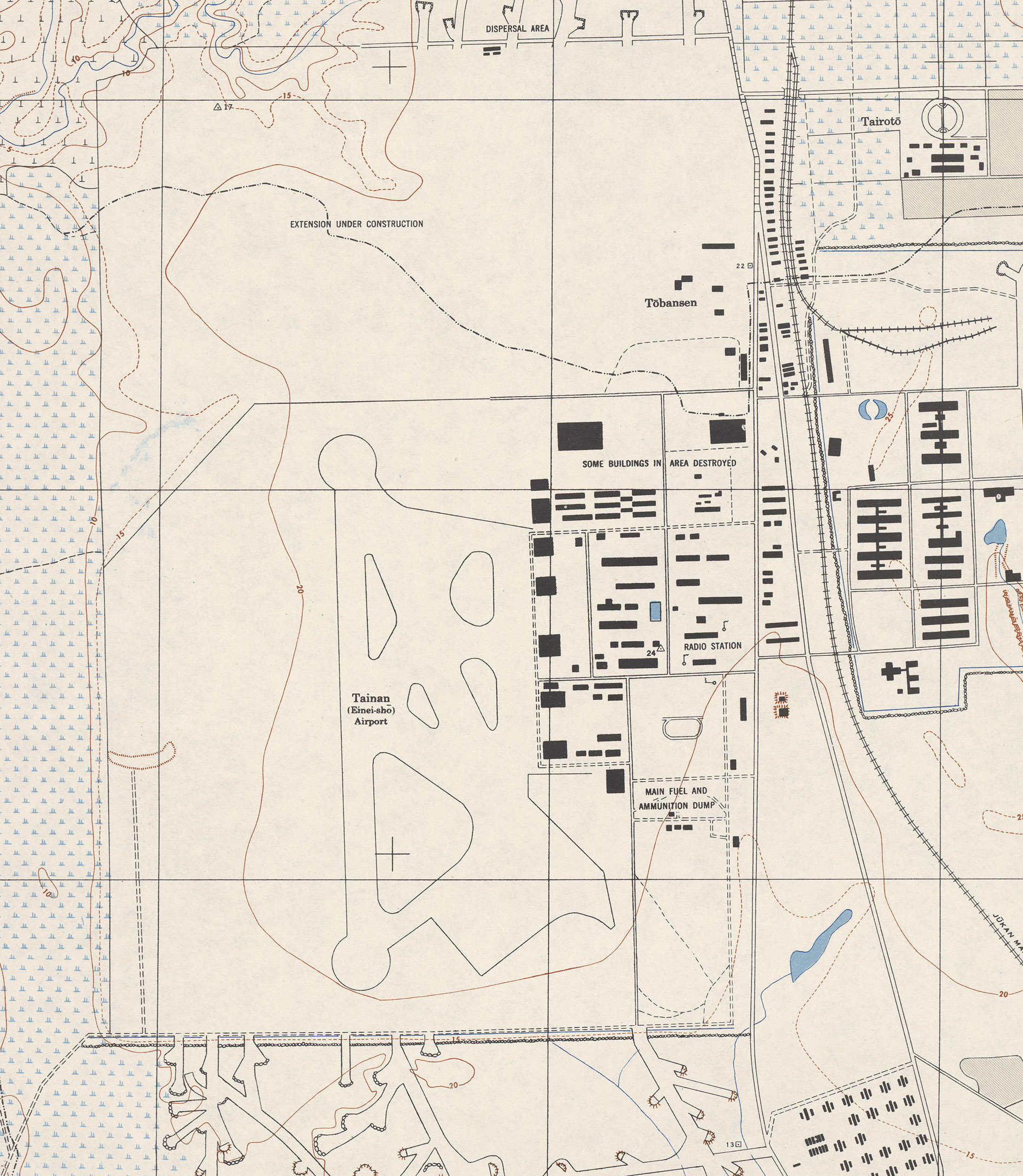
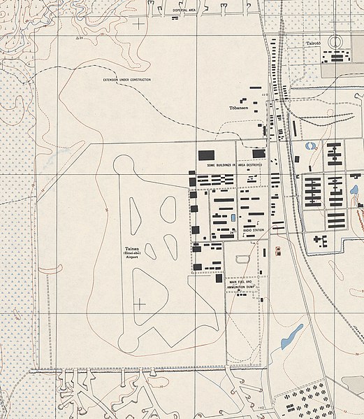
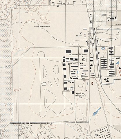
中文(臺灣):美軍地圖上的臺南機場 |
||||||
| Date | between 1944 and 1945 | ||||||
| Source | http://www.lib.utexas.edu/maps/ams/formosa_city_plans/ | ||||||
| Author | U.S. Army Map Service | ||||||
| Permission (Reusing this file) |
|
||||||
| Other versions |
 |
||||||

File history
Click on a date/time to view the file as it appeared at that time.
| Date/Time | Thumbnail | Dimensions | User | Comment | |
|---|---|---|---|---|---|
| current | 03:35, 23 November 2013 | | 1,891 × 2,175 (1.01 MB) | Pbdragonwang (talk | contribs) | {{Information |Description ={{zh-tw|1=美軍地圖上的臺南機場}} |Source =[http://www.lib.utexas.edu/maps/ams/formosa_city_plans/ http://www.lib.utexas.edu/maps/ams/formosa_city_plans/] |Author =U.S. Army Map Service |Date ... |
You cannot overwrite this file.
File usage on Commons
The following page uses this file:
File usage on other wikis
The following other wikis use this file:
- Usage on zh.wikipedia.org
.jpg&oldid=715429712)