File:Tai Lake NASA.jpg
Jump to navigation
Jump to search

Size of this preview: 734 × 599 pixels. Other resolutions: 294 × 240 pixels | 588 × 480 pixels | 862 × 704 pixels.
Original file (862 × 704 pixels, file size: 164 KB, MIME type: image/jpeg)
Captions
Captions
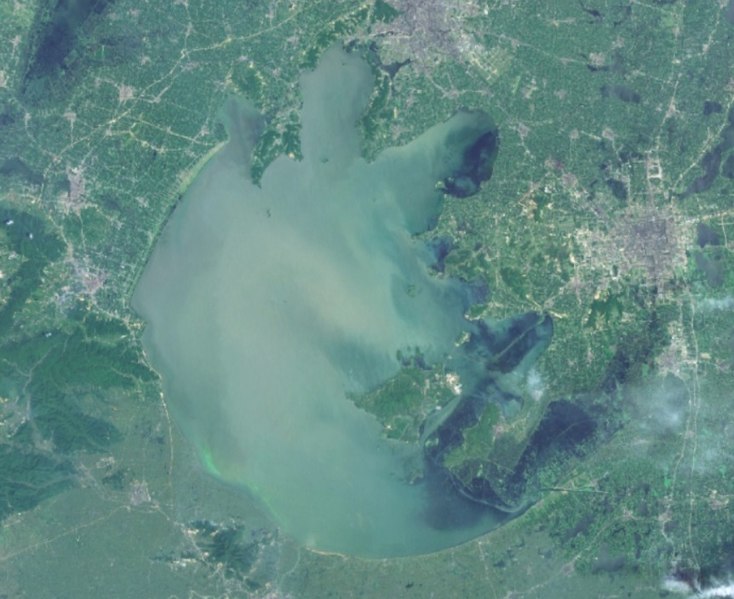
Lake Tai in the east of China, basin of the Yangtze River
Summary
[edit]
| Description |
Русский: Также Тай или Тай-ху. На снимке выглядит синим полумесяцем: от темно-синего до сероватого и голубоватого оттенка. Крупное озеро в бассейне реки Янцзы, одно из крупнейших в стране, причисляется к "пяти озёрам". Находится внутри очень сложной системы рек и каналов, связывающих Тайху, Янцзы и Жёлтое море.
English: Lake Taihu, one of the largest lakes of China. |
| Date | Unknown date |
| Source | Screenshot from NASA World Wind software, Blue Marble & Landsat layer |
| Author | NASA |
| Object location | | View this and other nearby images on: OpenStreetMap |
|---|
Licensing
[edit]
| This image is in the public domain because it is a screenshot from NASA’s globe software World Wind using a public domain layer, such as Blue Marble, MODIS, Landsat, SRTM, USGS or GLOBE.
|
 |
File history
Click on a date/time to view the file as it appeared at that time.
| Date/Time | Thumbnail | Dimensions | User | Comment | |
|---|---|---|---|---|---|
| current | 15:30, 15 February 2022 | | 862 × 704 (164 KB) | Proeksad (talk | contribs) | Uploaded a work by NASA from Screenshot from NASA World Wind software, Blue Marble & Landsat layer with UploadWizard |
You cannot overwrite this file.
File usage on Commons
There are no pages that use this file.
File usage on other wikis
The following other wikis use this file:
- Usage on ru.wikipedia.org