File:Taakeheim ill 117.png
Jump to navigation
Jump to search
No higher resolution available.
Taakeheim_ill_117.png (575 × 321 pixels, file size: 275 KB, MIME type: image/png)
Captions
Captions
Add a one-line explanation of what this file represents
Summary[edit]
| Description |
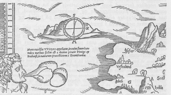
Norsk bokmål: Del av Gourmont's kart fra 1548, med nordvestkysten av Island og klippeøen Hvitserk. |
| Date | |
| Source |
Fridtjof Nansen: Nord i tåkeheimen. Utforskningen av jordens nordlige strøk i tidlige tider. Jacob Dybwads Forlag. Kristiania, 1911. In the Public Domain by the National Library of Norway. |
| Author | Artist unknown. In the Public Domain by the National Library of Norway. |
Licensing[edit]
This file is licensed under the Creative Commons Attribution-Share Alike 4.0 International license.
- You are free:
- to share – to copy, distribute and transmit the work
- to remix – to adapt the work
- Under the following conditions:
- attribution – You must give appropriate credit, provide a link to the license, and indicate if changes were made. You may do so in any reasonable manner, but not in any way that suggests the licensor endorses you or your use.
- share alike – If you remix, transform, or build upon the material, you must distribute your contributions under the same or compatible license as the original.
File history
Click on a date/time to view the file as it appeared at that time.
| Date/Time | Thumbnail | Dimensions | User | Comment | |
|---|---|---|---|---|---|
| current | 08:37, 2 March 2023 | | 575 × 321 (275 KB) | Krage52 (talk | contribs) | Uploaded a work by Artist unknown. In the Public Domain by the National Library of Norway. from Fridtjof Nansen: Nord i tåkeheimen. Utforskningen av jordens nordlige strøk i tidlige tider. Jacob Dybwads Forlag. Kristiania, 1911. In the Public Domain by the National Library of Norway. with UploadWizard |
You cannot overwrite this file.
File usage on Commons
There are no pages that use this file.