File:TK 25000 Langeoog 1955 1951.jpg
Jump to navigation
Jump to search

Size of this preview: 800 × 361 pixels. Other resolutions: 320 × 144 pixels | 640 × 289 pixels | 1,024 × 462 pixels | 1,280 × 578 pixels | 2,560 × 1,156 pixels | 7,999 × 3,611 pixels.
Original file (7,999 × 3,611 pixels, file size: 11.91 MB, MIME type: image/jpeg)
Captions
Captions
Add a one-line explanation of what this file represents
Summary[edit]
| Description |
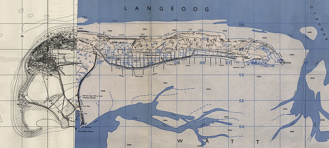
Deutsch: Topographische Karte von Langeoog. 1:25.000 Zusammengesetzt aus den Blättern 2211 - Ostende Langeoog aus dem Jahr 1951 und 2210 - Baltrum aus dem Jahr 1955 |
| Date | and 1955 |
| Source | File:TK_25000_1951_Ostende_Langeoog_2211.jpg und https://commons.wikimedia.org/wiki/File:TK_25000_1955_Baltrum_2210.jpg |
| Author | Germany. Reichsamt für Landesaufnahme |
| This image is in the public domain according to German copyright law because it is part of a statute, ordinance, official decree or judgment (official work) issued by a German authority or court (§ 5 Abs.1 UrhG).
|
 |
File history
Click on a date/time to view the file as it appeared at that time.
| Date/Time | Thumbnail | Dimensions | User | Comment | |
|---|---|---|---|---|---|
| current | 17:51, 8 October 2013 | | 7,999 × 3,611 (11.91 MB) | Heinz-Josef Lücking (talk | contribs) | {{Information |Description ={{de|1=Topographische Karte von Langeoog. 1:25.000 Zusammengesetzt aus den Blättern [https://commons.wikimedia.org/wiki/File:TK_25000_1951_Ostende_Langeoog_2211.jpg 2211 - OstendeLangeoog] aus dem Jahr 1951 und [https://... |
You cannot overwrite this file.
File usage on Commons
The following page uses this file:
File usage on other wikis
The following other wikis use this file:
- Usage on de.wikipedia.org