File:TER Auvergne, carte du réseau.svg
Jump to navigation
Jump to search

Size of this PNG preview of this SVG file: 552 × 600 pixels. Other resolutions: 221 × 240 pixels | 442 × 480 pixels | 707 × 768 pixels | 942 × 1,024 pixels | 1,885 × 2,048 pixels | 1,234 × 1,341 pixels.
Original file (SVG file, nominally 1,234 × 1,341 pixels, file size: 4.49 MB)
Captions
Captions
Add a one-line explanation of what this file represents
| Description |
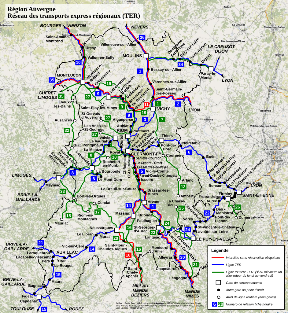
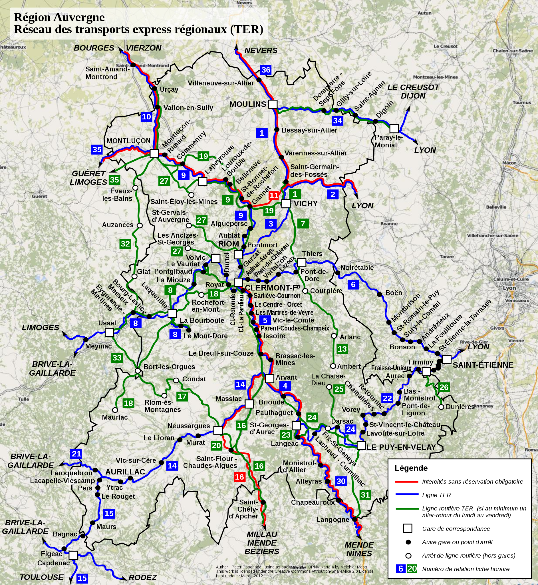
English: Region Auvergne, regional transport network (TER)
Français : Région Auvergne, réseau des transports express régionaux (TER) |
|||
| Date | ||||
| Source | Own work | |||
| Author | P.poschadel, sur fond de carte « ÖPNV-Karte » par Melchior Moos sous licence cc-by-sa-2.0 | |||
| Permission (Reusing this file) |
This file is licensed under the Creative Commons Attribution-Share Alike 2.0 France license.
 |
|||
| Other versions |
|


This W3C-unspecified vector image was created with Inkscape .
File history
Click on a date/time to view the file as it appeared at that time.
| Date/Time | Thumbnail | Dimensions | User | Comment | |
|---|---|---|---|---|---|
| current | 16:31, 6 March 2012 | | 1,234 × 1,341 (4.49 MB) | P.poschadel (talk | contribs) | {{Information |Description ={{en|1=Region Auvergne, regional transport network (TER) }} {{fr|1=Région Auvergne, réseau des transports express régionaux (TER)}} |Source ={{own}} |Author =P.poschadel, sur fond d... |
You cannot overwrite this file.
File usage on Commons
The following page uses this file:
File usage on other wikis
The following other wikis use this file:
- Usage on la.wikipedia.org