File:Sverigekarta-Norrland borders2.svg
Jump to navigation
Jump to search

Size of this PNG preview of this SVG file: 263 × 599 pixels. Other resolutions: 105 × 240 pixels | 211 × 480 pixels | 337 × 768 pixels | 450 × 1,024 pixels | 900 × 2,048 pixels | 290 × 660 pixels.
Original file (SVG file, nominally 290 × 660 pixels, file size: 89 KB)
Captions
Captions
Add a one-line explanation of what this file represents
Summary[edit]
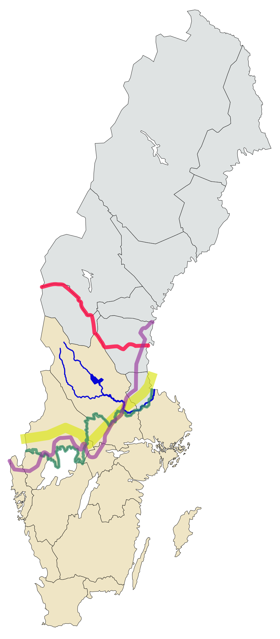
| Description |
English:
Region of Norrland
Limes Norrlandicus
South border of the forest counties
The border of dialects in Northern Sweden
The Dal River (including Österdalälven and Västerdalälven)
The Norrland terrain border Svenska: Landsdelen Norrland
Biologiska norrlandsgränsen
Södra gränsen för skogslänen
Gräns för norrländska mål
Dalälven (inklusive Österdalälven och Västerdalälven)
Norrlandsterrängens gräns |
| Date | |
| Source |
|
| Author | MikaelLindmark |
| Other versions |
|

This W3C-unspecified vector image was created with Inkscape .
Licensing[edit]
I, the copyright holder of this work, hereby publish it under the following license:
This file is licensed under the Creative Commons Attribution-Share Alike 3.0 Unported license.
- You are free:
- to share – to copy, distribute and transmit the work
- to remix – to adapt the work
- Under the following conditions:
- attribution – You must give appropriate credit, provide a link to the license, and indicate if changes were made. You may do so in any reasonable manner, but not in any way that suggests the licensor endorses you or your use.
- share alike – If you remix, transform, or build upon the material, you must distribute your contributions under the same or compatible license as the original.
File history
Click on a date/time to view the file as it appeared at that time.
| Date/Time | Thumbnail | Dimensions | User | Comment | |
|---|---|---|---|---|---|
| current | 19:38, 19 August 2012 | | 290 × 660 (89 KB) | MikaelLindmark (talk | contribs) |
You cannot overwrite this file.
File usage on Commons
The following page uses this file:
File usage on other wikis
The following other wikis use this file:
- Usage on da.wikipedia.org
- Usage on en.wikipedia.org
- Usage on es.wikipedia.org
- Usage on fi.wikipedia.org
- Usage on fr.wikipedia.org
- Usage on mk.wikipedia.org
- Usage on sv.wikipedia.org