File:Super Typhoon Goni (MODIS 2020-10-31).jpg

Original file (5,675 × 4,873 pixels, file size: 3.06 MB, MIME type: image/jpeg)
Captions
Captions
Summary[edit]
.jpg&action=edit§ion=1)
| Description |
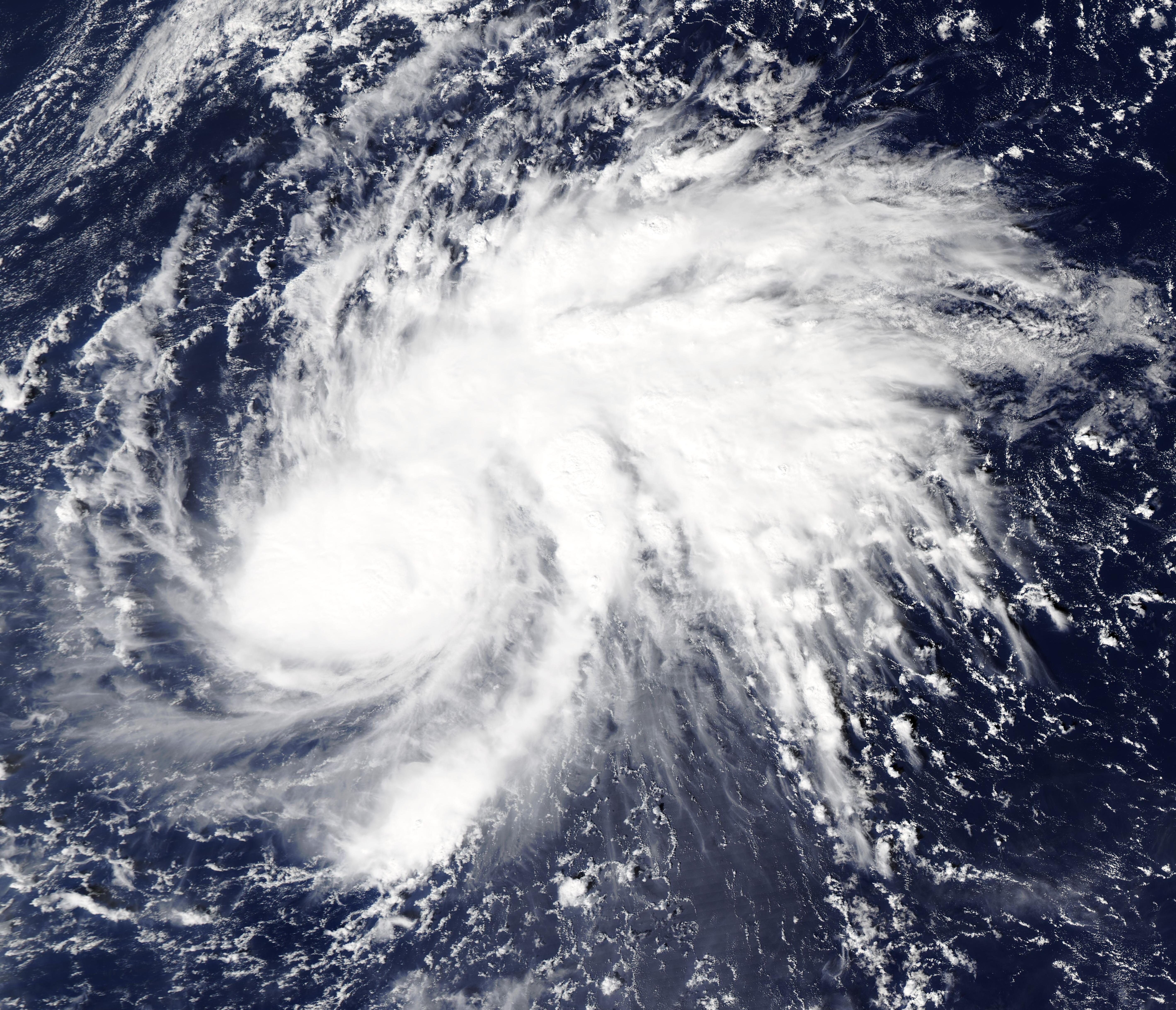
English: On October 30, 2020, Super Typhoon Goni was moving westward over the Philippine Sea as it intensified to become the strongest storm of 2020. At 11:00 a.m. EDT (1500 UTC) on that day, Goni’s one-minute sustained winds registered 180 mph (290 km/h), making it a Category 5 storm on the Saffir-Simpson Hurricane Wind Scale. The Moderate Resolution Imaging Spectroradiometer (MODIS) on board NASA’s Aqua satellite acquired a true-color image of Super Typhoon Goni that same day.
According to the Joint Typhoon Warning Center (JTWC), Goni is expected to continue to track generally southwestward to south-southwestward over the next 24 hours. While the environment remains favorable for development, the JTWC forecasts a general weaking of the storm thanks to a steering ridge that will interact with the storm, and increasing wind shear should also contribute to weakening prior to landfall along the coast of Luzon, Philippines, on November 1. Wind speeds at landfall are estimated as high as 138 mph (222 km/h), a Category 4 storm. The track of Super Typhoon Goni follows close in the wake of Typhoon Molave, which struck the Philippines on October 25. Molave caused widespread damage, with at least a million people impacted, 300,000 evacuations, and 16 people dead in the Philippines. |
||
| Date | Taken on 30 October 2020 | ||
| Source |
Super Typhoon Goni (direct link)
|
||
| Author | MODIS Land Rapid Response Team, NASA GSFC |
| This media is a product of the Aqua mission Credit and attribution belongs to the mission team, if not already specified in the "author" row |
Licensing[edit]
.jpg&action=edit§ion=2)
| This file is in the public domain in the United States because it was solely created by NASA. NASA copyright policy states that "NASA material is not protected by copyright unless noted". (See Template:PD-USGov, NASA copyright policy page or JPL Image Use Policy.) | ||
 |
Warnings:
|
File history
Click on a date/time to view the file as it appeared at that time.
| Date/Time | Thumbnail | Dimensions | User | Comment | |
|---|---|---|---|---|---|
| current | 22:06, 5 February 2024 | | 5,675 × 4,873 (3.06 MB) | OptimusPrimeBot (talk | contribs) | #Spacemedia - Upload of http://modis.gsfc.nasa.gov/gallery/images/image10312020_250m.jpg via Commons:Spacemedia |
You cannot overwrite this file.
File usage on Commons
There are no pages that use this file.
.jpg&oldid=849338479)