File:Station 6 - Apollo 17 (LROC759 - A17 eva).png
Jump to navigation
Jump to search

Size of this preview: 765 × 600 pixels. Other resolutions: 306 × 240 pixels | 613 × 480 pixels | 980 × 768 pixels | 1,280 × 1,003 pixels | 1,336 × 1,047 pixels.
Original file (1,336 × 1,047 pixels, file size: 1.11 MB, MIME type: image/png)
Captions
Captions
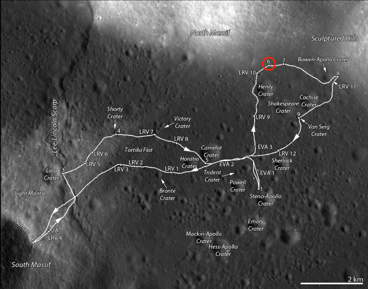
Traverse map of the Apollo 17 site. Station 6 is along the base of the North Massif on the north side of the valley and is circled in red.
Summary[edit]
| Description |
English: Traverse map of the Apollo 17 site. Station 6 is along the base of the North Massif on the north side of the valley and is circled in red. |
| Date | 13 December 2013 (upload date) |
| Source | Station 6 - Apollo 17 |
| Author | NASA/GSFC/Arizona State University |
| Other versions |
|
| Keywords | Apollo; Robotic Spacecraft; Scarp |
.jpg)
.png)

.jpg)
.jpg)
.png&action=edit§ion=1)
| This media is a product of the Lunar Reconnaissance Orbiter Camera Credit and attribution belongs to the Lunar Reconnaissance Orbiter Camera (LROC) team, NASA/GSFC/Arizona State University |
This image or video was catalogued by Goddard Space Flight Center of the United States National Aeronautics and Space Administration (NASA) under Photo ID: lroc:759. This tag does not indicate the copyright status of the attached work. A normal copyright tag is still required. See Commons:Licensing. Other languages:
|
Licensing[edit]
.png&action=edit§ion=2)
| This file is in the public domain in the United States because it was solely created by NASA. NASA copyright policy states that "NASA material is not protected by copyright unless noted". (See Template:PD-USGov, NASA copyright policy page or JPL Image Use Policy.) | ||
 |
Warnings:
|
File history
Click on a date/time to view the file as it appeared at that time.
| Date/Time | Thumbnail | Dimensions | User | Comment | |
|---|---|---|---|---|---|
| current | 22:03, 8 March 2024 | | 1,336 × 1,047 (1.11 MB) | OptimusPrimeBot (talk | contribs) | #Spacemedia - Upload of https://www.lroc.asu.edu/news/uploads/LROCiotw/A17_eva.png via Commons:Spacemedia |
You cannot overwrite this file.
File usage on Commons
The following 5 pages use this file:
.png&oldid=859010462)