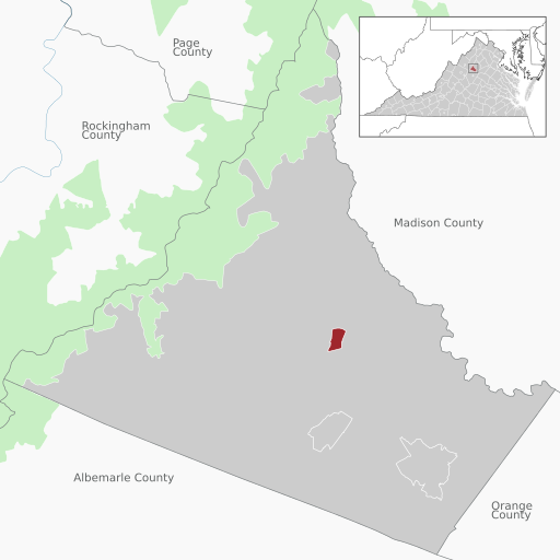
File:Stanardsville in Greene County, VA.svg
Jump to navigation
Jump to search

Size of this PNG preview of this SVG file: 512 × 512 pixels. Other resolutions: 240 × 240 pixels | 480 × 480 pixels | 768 × 768 pixels | 1,024 × 1,024 pixels | 2,048 × 2,048 pixels.
Original file (SVG file, nominally 512 × 512 pixels, file size: 890 KB)
Captions
Captions
Add a one-line explanation of what this file represents
Summary[edit]
| Description | |
| Date | |
| Source |
Own work, Top map of Virginia based on File:USA Virginia location map.svg, Alexrk2 |
| Author | Lgnhes97, with top map based on Alexrk2 |
| Other versions |
|
| SVG development | This W3C-invalid map was created with Adobe Illustrator. |

Licensing[edit]
I, the copyright holder of this work, hereby publish it under the following licenses:

|
Permission is granted to copy, distribute and/or modify this document under the terms of the GNU Free Documentation License, Version 1.2 or any later version published by the Free Software Foundation; with no Invariant Sections, no Front-Cover Texts, and no Back-Cover Texts. A copy of the license is included in the section entitled GNU Free Documentation License. |
This file is licensed under the Creative Commons Attribution 3.0 Unported license.
- You are free:
- to share – to copy, distribute and transmit the work
- to remix – to adapt the work
- Under the following conditions:
- attribution – You must give appropriate credit, provide a link to the license, and indicate if changes were made. You may do so in any reasonable manner, but not in any way that suggests the licensor endorses you or your use.
You may select the license of your choice.
File history
Click on a date/time to view the file as it appeared at that time.
| Date/Time | Thumbnail | Dimensions | User | Comment | |
|---|---|---|---|---|---|
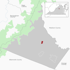
| current | 03:21, 29 May 2022 | | 512 × 512 (890 KB) | Lgnhes97 (talk | contribs) | Wrong description for Page County |
| 00:19, 22 May 2022 |  | 512 × 512 (893 KB) | Lgnhes97 (talk | contribs) | {{Information |Description= {{de|Lage von Stanardsville inmitten des Greene County, Virginia, USA}} {{en|Location of Stanardsville within Greene County, Virginia, USA.}} |Source={{own}}, Top map of Virginia based on File:USA Virginia location map.svg, Alexrk2 |Date= 2022-05-22 |Author= [[User:Lgn... |
You cannot overwrite this file.
File usage on Commons
There are no pages that use this file.
File usage on other wikis
The following other wikis use this file:
- Usage on de.wikipedia.org
- Usage on en.wikipedia.org