File:Spreading ridges volcanoes map-fr.svg
Jump to navigation
Jump to search

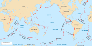
Size of this PNG preview of this SVG file: 800 × 402 pixels. Other resolutions: 320 × 161 pixels | 640 × 322 pixels | 1,024 × 515 pixels | 1,280 × 643 pixels | 2,560 × 1,286 pixels | 4,995 × 2,510 pixels.
Original file (SVG file, nominally 4,995 × 2,510 pixels, file size: 1.36 MB)
Captions
Captions
Add a one-line explanation of what this file represents
Summary[edit]
| Description |
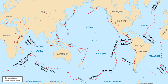
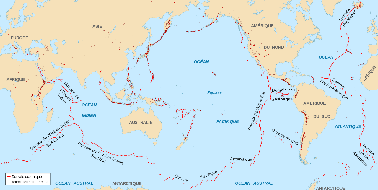
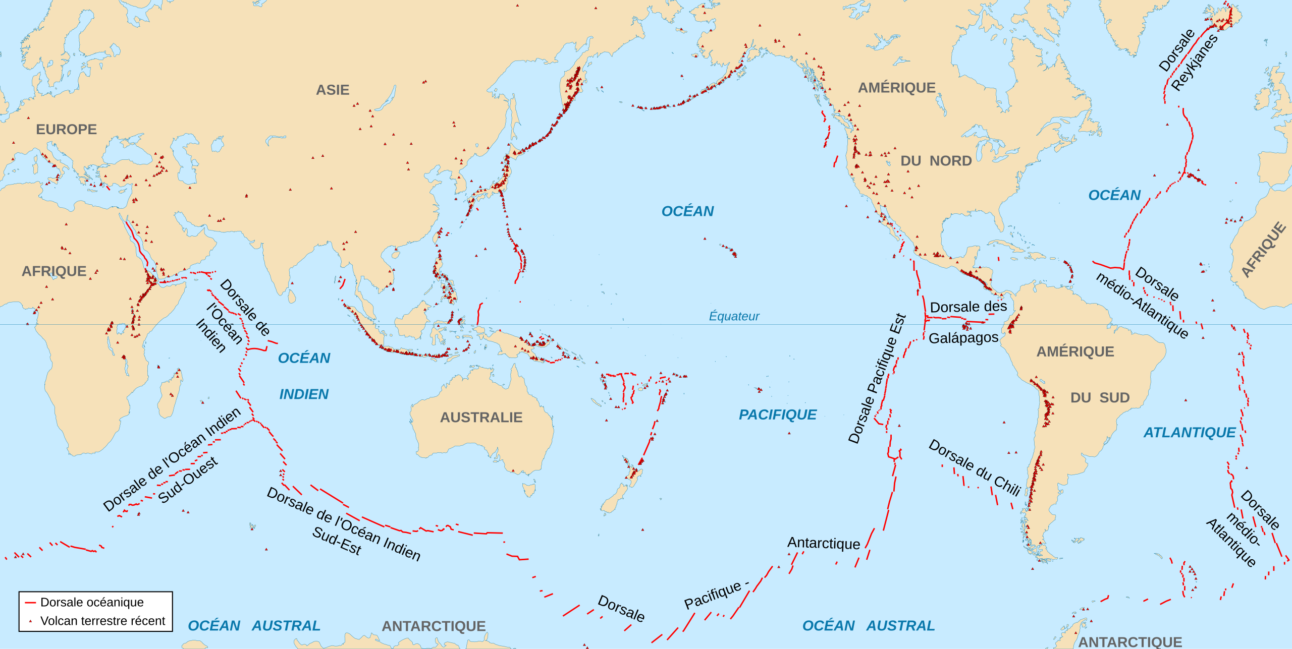
English: World map in French showing the divergent plate boundaries (OSR – Oceanic Spreading Ridges) and recent sub aerial volcanoes.
Français : Carte en français des dorsales océaniques et volcans terrestres récents. |
||
| Date | 2006-10, upgraded 2015-09 | ||
| Source |
|
||
| Author | Eric Gaba (Sting - fr:Sting) | ||
| Permission (Reusing this file) |
|
||
| Other versions |
|

Licensing[edit]
I, the copyright holder of this work, hereby publish it under the following license:
This file is licensed under the Creative Commons Attribution-Share Alike 2.5 Generic license.
- You are free:
- to share – to copy, distribute and transmit the work
- to remix – to adapt the work
- Under the following conditions:
- attribution – You must give appropriate credit, provide a link to the license, and indicate if changes were made. You may do so in any reasonable manner, but not in any way that suggests the licensor endorses you or your use.
- share alike – If you remix, transform, or build upon the material, you must distribute your contributions under the same or compatible license as the original.
File history
Click on a date/time to view the file as it appeared at that time.
| Date/Time | Thumbnail | Dimensions | User | Comment | |
|---|---|---|---|---|---|
| current | 19:09, 6 September 2015 | | 4,995 × 2,510 (1.36 MB) | Sting (talk | contribs) | New background map using NGDC WCL data |
| 22:07, 23 October 2006 |  | 5,000 × 2,525 (914 KB) | Sting (talk | contribs) | OCR names corretion; + Red Sea OCR; + continent names | |
| 15:28, 23 October 2006 |  | 5,000 × 2,525 (899 KB) | Sting (talk | contribs) | {{Information| |Description=World map in French showing the divergent plate boundaries (OSR – Oceanic Spreading Ridges) and recent sub aerial volcanoes |Source= '''Background map (modified) :''' Image:Tectonic plates (empty).svg created by [[User:� |
.svg)
You cannot overwrite this file.
File usage on Commons
The following page uses this file:
File usage on other wikis
The following other wikis use this file:
- Usage on ar.wikipedia.org
- Usage on bg.wikipedia.org
- Usage on ca.wikipedia.org
- Usage on eo.wikipedia.org
- Usage on fr.wikipedia.org
- Usage on ko.wikipedia.org