File:Spinnerei Juchen, Dornbirn.jpg
Jump to navigation
Jump to search
Size of this preview: 800 × 409 pixels. Other resolutions: 320 × 164 pixels | 640 × 327 pixels | 1,024 × 524 pixels | 1,280 × 655 pixels | 2,560 × 1,309 pixels | 4,967 × 2,540 pixels.
Original file (4,967 × 2,540 pixels, file size: 10.32 MB, MIME type: image/jpeg)
Captions
Captions
Add a one-line explanation of what this file represents
| Description |
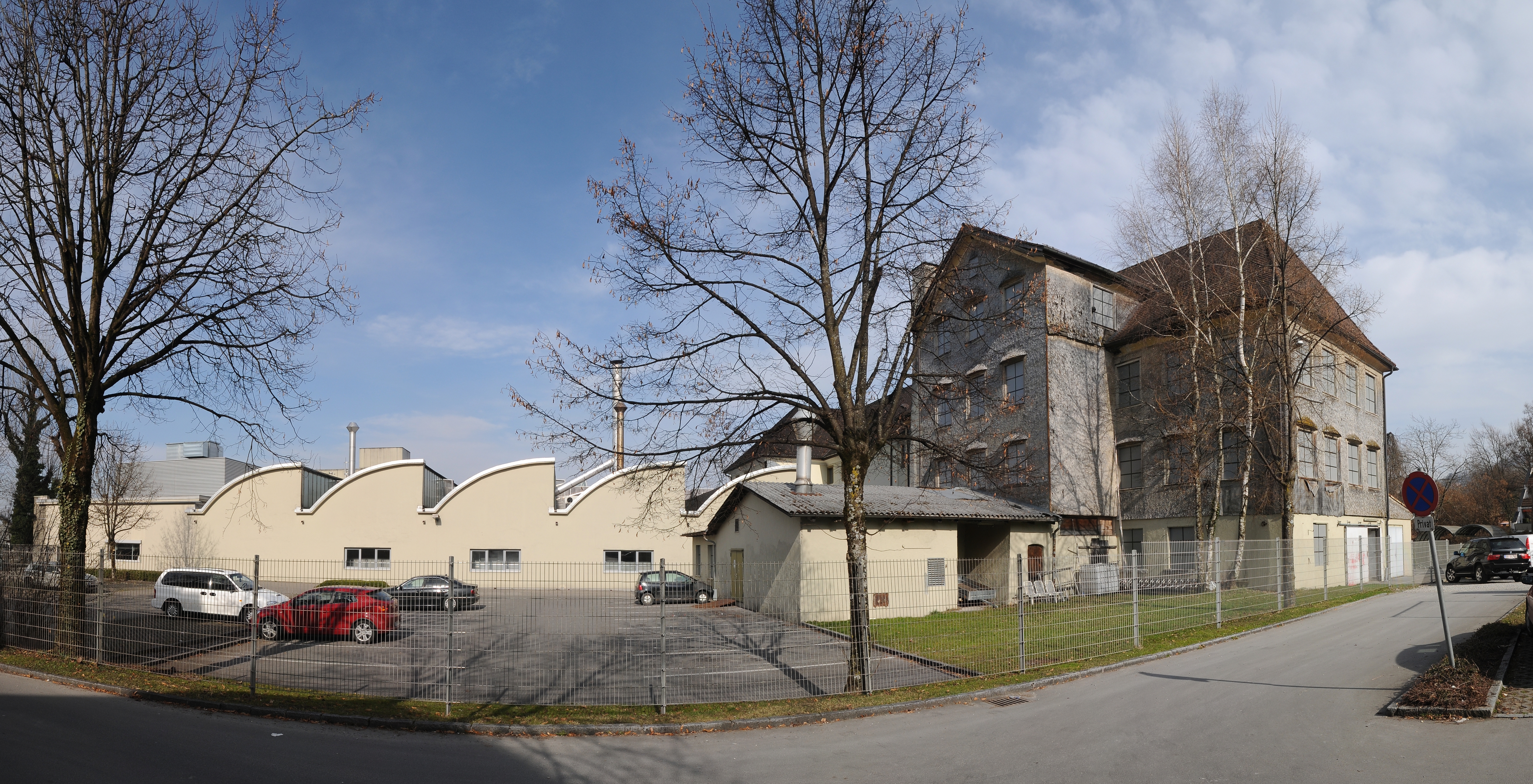
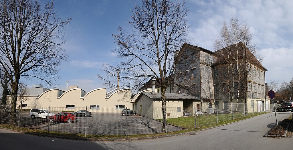
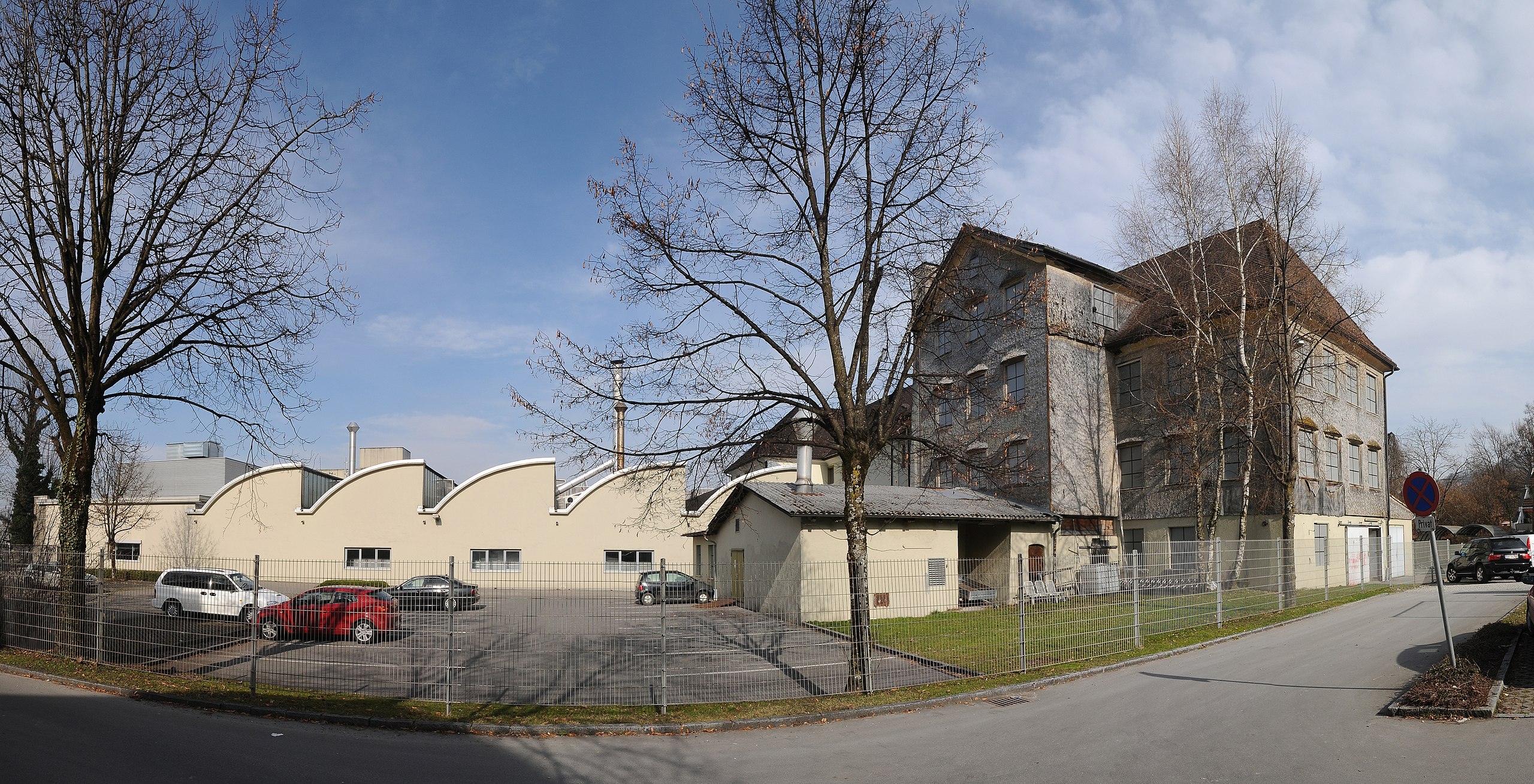
Deutsch: Rechts der, unter Denkmalschutz gestellte Bau der ehemaligen Spinnerei Juchen, der von der Firma Ölz nicht genutzt wird. Die Rudolf Ölz Meisterbäcker GmbH ist ein österreichischer Backwarenhersteller. Ihren Hauptsitz hat die Gesellschaft in Dornbirn im Bundesland Vorarlberg, wo sie der zweitgrößte Arbeitgeber der Stadt ist. Nach eigenen Angaben ist Ölz Marktführer bei Backwaren in Österreich. Besonders bekannt wurde das Unternehmen im Jahr 1953 mit der Erfindung der Backerbsen sowie deren erstmaligem Verkauf.*** Hier das Werk Juchen an der Achstrasse in Dornbirn.
|
| Date | |
| Source | Own work |
| Author | böhringer friedrich |
| Permission (Reusing this file) |
I, the copyright holder of this work, hereby publish it under the following license: This file is licensed under the Creative Commons Attribution-Share Alike 2.5 Generic license.
|
This Photo was taken by Böhringer Friedrich.
|
Feel free to use my photos, but please mention me as the author and if you want send me a message. or (rufre@lenz-nenning.at) |
| Object location | | View this and other nearby images on: OpenStreetMap |
|---|
| Camera location | | View this and other nearby images on: OpenStreetMap |
|---|
File history
Click on a date/time to view the file as it appeared at that time.
| Date/Time | Thumbnail | Dimensions | User | Comment | |
|---|---|---|---|---|---|
| current | 20:27, 12 March 2011 | | 4,967 × 2,540 (10.32 MB) | Böhringer (talk | contribs) | {{Information |Description= {{de| Rechts der, unter Denkmalschutz gestellte Bau der ehemaligen '''Spinnerei Juchen''', der von der Firma Ölz nicht genutzt wird. Die Rudolf Ölz Meisterbäcker GmbH ist ein österreichisc |
You cannot overwrite this file.
File usage on Commons
There are no pages that use this file.
File usage on other wikis
The following other wikis use this file:
- Usage on de.wikipedia.org
- Usage on www.wikidata.org