File:South Indian territories-fr.svg
Jump to navigation
Jump to search

Size of this PNG preview of this SVG file: 540 × 599 pixels. Other resolutions: 216 × 240 pixels | 432 × 480 pixels | 692 × 768 pixels | 922 × 1,024 pixels | 1,845 × 2,048 pixels | 672 × 746 pixels.
Original file (SVG file, nominally 672 × 746 pixels, file size: 267 KB)
Captions
Captions
Add a one-line explanation of what this file represents
Summary[edit]
| Description |
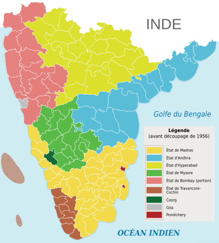
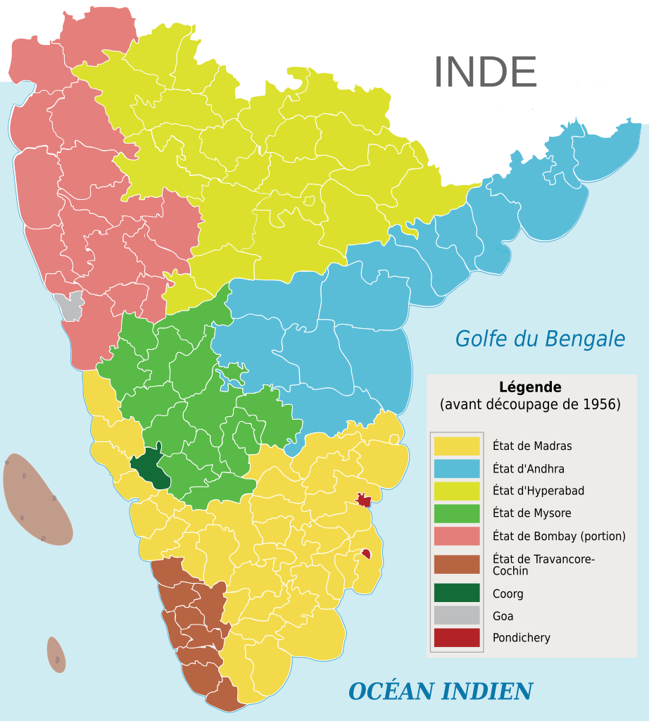
Français : Carte du découpage administratif de l'Inde avant 1956. |
| Date | |
| Source | South Indian territories.svg by AreJay |
| Author | Original work : AreJay ; translation : Flappiefh |
| Other versions |
|

Licensing[edit]
This file is licensed under the Creative Commons Attribution 3.0 Unported license.
- You are free:
- to share – to copy, distribute and transmit the work
- to remix – to adapt the work
- Under the following conditions:
- attribution – You must give appropriate credit, provide a link to the license, and indicate if changes were made. You may do so in any reasonable manner, but not in any way that suggests the licensor endorses you or your use.
File history
Click on a date/time to view the file as it appeared at that time.
| Date/Time | Thumbnail | Dimensions | User | Comment | |
|---|---|---|---|---|---|
| current | 18:45, 11 October 2016 | | 672 × 746 (267 KB) | Flappiefh (talk | contribs) | User created page with UploadWizard |
You cannot overwrite this file.
File usage on Commons
There are no pages that use this file.
File usage on other wikis
The following other wikis use this file:
- Usage on fr.wikipedia.org