File:SouthAsia physical.jpg
Jump to navigation
Jump to search

Size of this preview: 626 × 599 pixels. Other resolutions: 251 × 240 pixels | 501 × 480 pixels | 802 × 768 pixels | 1,070 × 1,024 pixels | 2,139 × 2,048 pixels | 2,723 × 2,607 pixels.
Original file (2,723 × 2,607 pixels, file size: 3.43 MB, MIME type: image/jpeg)
Captions
Captions
Add a one-line explanation of what this file represents
Summary[edit]
| Description |
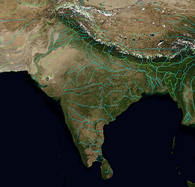
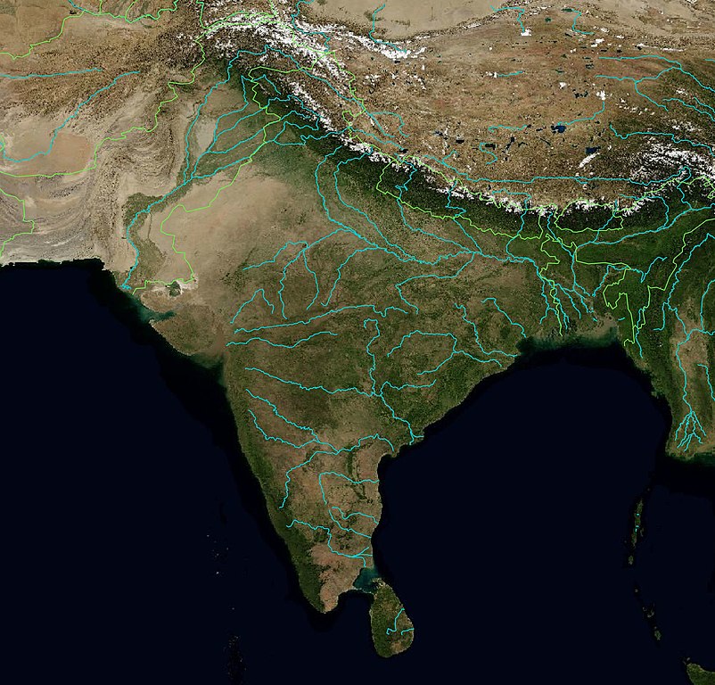
Physical map of Stouh Asia with major rivers and country boundaries |
|||||||||
| Date | ||||||||||
| Source | Base map - Blue Marble from NASA, Rivers and country border public domain shapefiles from Natural Earth | |||||||||
| Creator |
Multiple sources combined with QGIS |
|||||||||
| Permission (Reusing this file) |
|
|||||||||
| Geotemporal data | ||||||||||
| Bounding box |
|
|||||||||
| Georeferencing | ||||||||||
File history
Click on a date/time to view the file as it appeared at that time.
| Date/Time | Thumbnail | Dimensions | User | Comment | |
|---|---|---|---|---|---|
| current | 07:47, 13 August 2018 | | 2,723 × 2,607 (3.43 MB) | Shyamal (talk | contribs) | {{Information |Description=Physical map of Stouh Asia with rivers |Source=Base map - Blue Marble from NASA, Rivers and country border public domain shapefiles from Natural Earth |Date=2018 |Author=Multiple sources combined with QGIS |Permission={{cc-0}} |other_versions= }} Category:Maps of India |
You cannot overwrite this file.
File usage on Commons
There are no pages that use this file.