File:Sluizen 14.jpg
Jump to navigation
Jump to search

Size of this preview: 800 × 600 pixels. Other resolutions: 320 × 240 pixels | 640 × 480 pixels | 1,024 × 768 pixels | 1,280 × 960 pixels | 2,560 × 1,920 pixels | 4,463 × 3,347 pixels.
Original file (4,463 × 3,347 pixels, file size: 2.36 MB, MIME type: image/jpeg)
Captions
Captions
Add a one-line explanation of what this file represents
Summary[edit]
| Description |
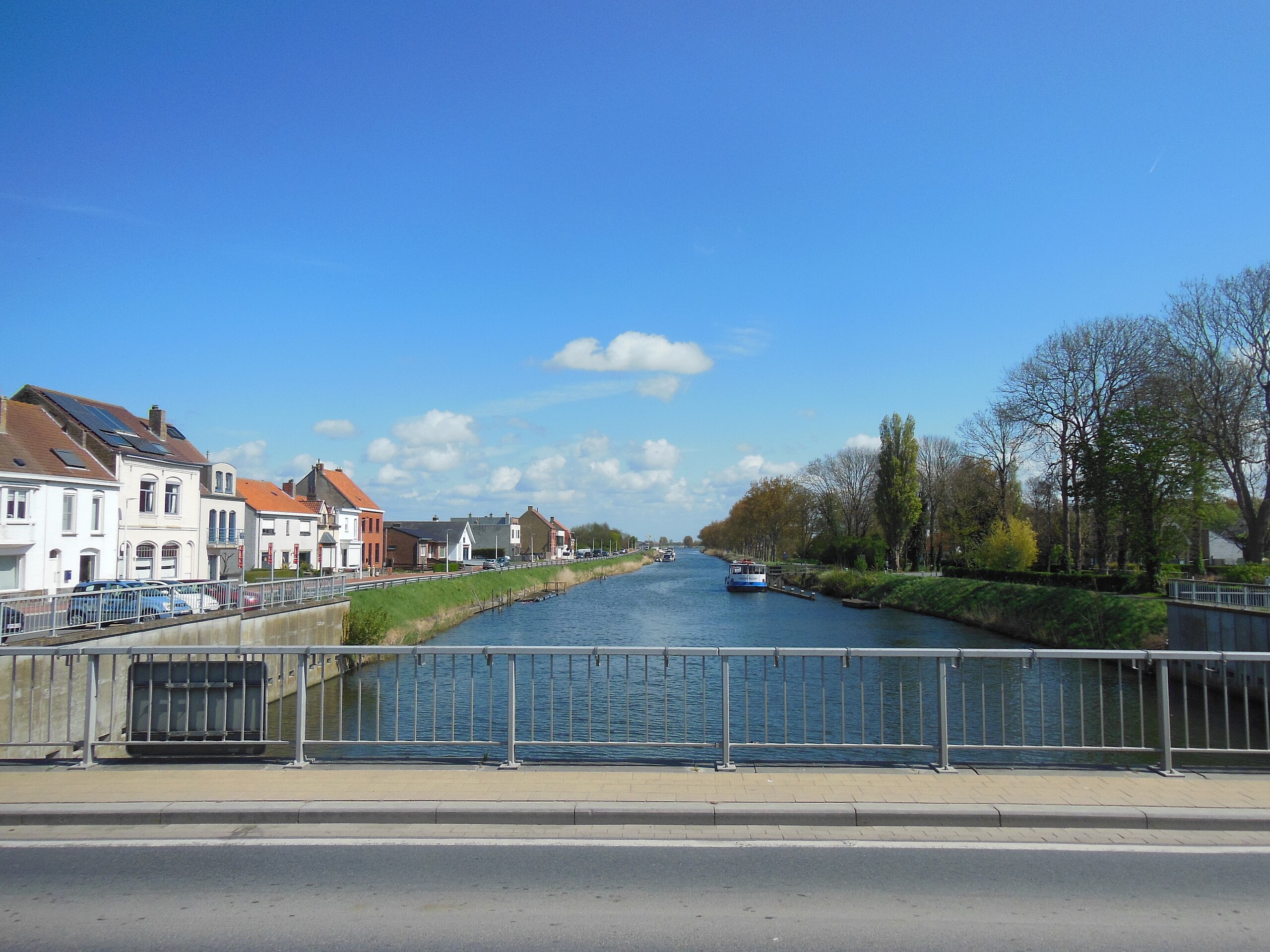
Nederlands: De IJzer, landinwaarts, rechtlijnig tot aan de Uniebrug |
| Date | |
| Source | Own work |
| Author | Frans90245 |
| Camera location | | View this and other nearby images on: OpenStreetMap |
|---|
De bochtige benedenloop van de IJzer werd ten behoeve van de scheepvaart in de 17de eeuw afgesneden door een rechtlijnig kanaal van Nieuwpoort tot de Uniebrug.Van Nieuwpoort tot Diksmuide zijn op de oevers van de rivier dijken gebouwd. Het waterpeil wordt op een constant niveau gehouden voor de scheepvaart. Dat deel van de rivier wordt ook IJzerkanaal genoemd.
Licensing[edit]
I, the copyright holder of this work, hereby publish it under the following license:
This file is licensed under the Creative Commons Attribution-Share Alike 4.0 International license.
- You are free:
- to share – to copy, distribute and transmit the work
- to remix – to adapt the work
- Under the following conditions:
- attribution – You must give appropriate credit, provide a link to the license, and indicate if changes were made. You may do so in any reasonable manner, but not in any way that suggests the licensor endorses you or your use.
- share alike – If you remix, transform, or build upon the material, you must distribute your contributions under the same or compatible license as the original.
File history
Click on a date/time to view the file as it appeared at that time.
| Date/Time | Thumbnail | Dimensions | User | Comment | |
|---|---|---|---|---|---|
| current | 15:10, 22 May 2017 | | 4,463 × 3,347 (2.36 MB) | Frans90245 (talk | contribs) | User created page with UploadWizard |
You cannot overwrite this file.
File usage on Commons
There are no pages that use this file.