File:Singapore.svg
Jump to navigation
Jump to search

Size of this PNG preview of this SVG file: 631 × 599 pixels. Other resolutions: 253 × 240 pixels | 505 × 480 pixels | 809 × 768 pixels | 1,078 × 1,024 pixels | 2,156 × 2,048 pixels | 2,129 × 2,022 pixels.
Original file (SVG file, nominally 2,129 × 2,022 pixels, file size: 2.53 MB)
Captions
Captions
Add a one-line explanation of what this file represents

|
This file was moved to Wikimedia Commons from wts.oldwikivoyage using a bot script. All source information is still present. It requires review. Additionally, there may be errors in any or all of the information fields; information on this file should not be considered reliable and the file should not be used until it has been reviewed and any needed corrections have been made. Once the review has been completed, this template should be removed. For details about this file, see below. Check now! |
Summary[edit]
| Description |
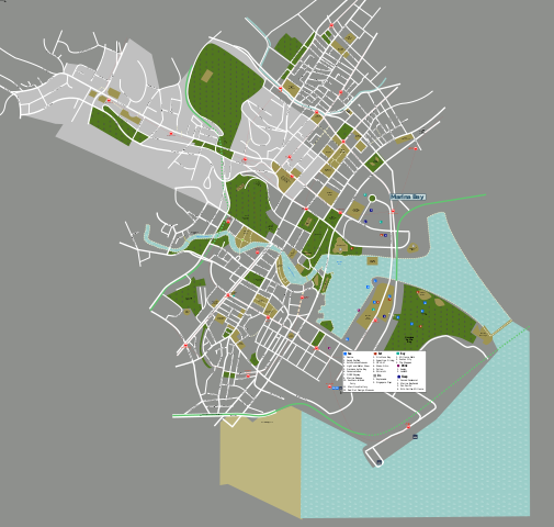
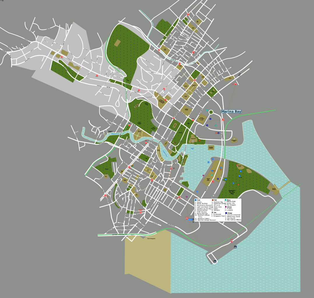
Vector source file used to generated Singapore maps. By jpatokal, using standard Wikivoyage map template. PNG versions exported from this svg file.
|
| Date | 15 September 2007 (original upload date) |
| Source | OSM + Own work |
| Author | User: (WT-shared) Jpatokal at wts wikivoyage |
| Location | Singapore |
Licensing[edit]
This file is licensed under the Creative Commons Attribution-Share Alike 1.0 Generic license.
- You are free:
- to share – to copy, distribute and transmit the work
- to remix – to adapt the work
- Under the following conditions:
- attribution – You must give appropriate credit, provide a link to the license, and indicate if changes were made. You may do so in any reasonable manner, but not in any way that suggests the licensor endorses you or your use.
- share alike – If you alter, transform, or build upon this work, you must distribute the resulting work under the same license as the original.
Original upload log[edit]
| This file was imported from Wikivoyage WTS. |
The original description page was here. All following user names refer to wts.wikivoyage-old.
- 2007-09-15 14:05 (WT-shared) Jpatokal archive copy at the Wayback Machine 744×1052 (1325857 bytes) Vector source file used to generated Singapore maps. By jpatokal, using standard Wikitravel map template. {{location|Singapore}} (Import from wikitravel.org/shared)
- 2007-09-20 10:14 (WT-shared) Jpatokal archive copy at the Wayback Machine 744×1052 (1519654 bytes) Sep 2007 update complete (Import from wikitravel.org/shared)
- 2009-03-30 14:40 (WT-shared) Jpatokal archive copy at the Wayback Machine 744×1052 (1548109 bytes) (Import from wikitravel.org/shared)
- 2009-10-03 08:53 (WT-shared) Jpatokal archive copy at the Wayback Machine 744×1052 (1574076 bytes) Updated (Import from wikitravel.org/shared)
- 2012-09-13 11:42 ImportBot[dead link] 744×1052 (1419675 bytes) rm WT-logo
File history
Click on a date/time to view the file as it appeared at that time.
| Date/Time | Thumbnail | Dimensions | User | Comment | |
|---|---|---|---|---|---|
| current | 12:58, 30 January 2018 | | 2,129 × 2,022 (2.53 MB) | Drat70 (talk | contribs) | Updated Marina Bay area |
| 12:13, 20 November 2017 |  | 2,129 × 2,022 (2.53 MB) | Drat70 (talk | contribs) | Updated Orchard area | |
| 12:59, 15 November 2017 |  | 2,129 × 2,022 (2.5 MB) | Drat70 (talk | contribs) | Updated Brash Basah area | |
| 13:36, 23 October 2017 |  | 2,129 × 2,022 (2.47 MB) | Drat70 (talk | contribs) | Updated listings/map for Riverside | |
| 14:09, 20 October 2017 |  | 2,129 × 2,022 (2.47 MB) | Drat70 (talk | contribs) | Updated Clarke Quay area | |
| 12:26, 16 October 2017 |  | 2,129 × 2,022 (2.47 MB) | Drat70 (talk | contribs) | Updated Chinatown | |
| 12:08, 9 October 2017 |  | 2,129 × 2,022 (2.46 MB) | Drat70 (talk | contribs) | Updated places and roads in Little India area | |
| 12:35, 2 October 2017 |  | 2,129 × 2,022 (2.43 MB) | Drat70 (talk | contribs) | Extended map into Marina Bay area added layer for Marina Bay area added remaining stations for Downtown line | |
| 06:21, 21 September 2017 |  | 744 × 1,052 (1.36 MB) | Drat70 (talk | contribs) | General update, mostly in the Bugis area: * removed/added buildings and roads which are not up to date * added Downtown line stations * updated Bugis layer to correspond to the Bugis wikivoyage article | |
| 13:22, 22 December 2012 |  | 744 × 1,052 (1.35 MB) | OgreBot (talk | contribs) | (BOT): Reverting to most recent version before archival |
You cannot overwrite this file.
File usage on Commons
The following 6 pages use this file:
- User:Chumwa/OgreBot/Travel and communication maps/2017 November 11-20
- User:Chumwa/OgreBot/Travel and communication maps/2017 October 1-10
- User:Chumwa/OgreBot/Travel and communication maps/2017 October 11-20
- User:Chumwa/OgreBot/Travel and communication maps/2017 October 21-31
- User:Chumwa/OgreBot/Travel and communication maps/2017 September 21-30
- User:Chumwa/OgreBot/Travel and communication maps/2018 January 21-31
File usage on other wikis
The following other wikis use this file:
- Usage on vi.wikipedia.org