File:Sgurr Dubh Beag via the Dubh Slabs - geograph.org.uk - 1635595.jpg
Jump to navigation
Jump to search
No higher resolution available.
Sgurr_Dubh_Beag_via_the_Dubh_Slabs_-_geograph.org.uk_-_1635595.jpg (640 × 480 pixels, file size: 50 KB, MIME type: image/jpeg)
Captions
Captions
Add a one-line explanation of what this file represents
Summary[edit]
| Description |
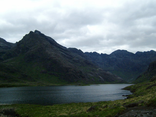
English: Sgurr Dubh Beag via the Dubh Slabs Taken from near the shore of Loch Coruisk, where the stream joins it from Loch a' Choire Riabhach. The Dubh Ridge slabs run more or less unbroken from the loch shore, just above sea-level, to the summit at 733m....one day! |
| Date | |
| Source | From geograph.org.uk |
| Author | Martyn Ayre |
| Attribution (required by the license) | Martyn Ayre / Sgurr Dubh Beag via the Dubh Slabs / |
| Camera location | | View this and other nearby images on: OpenStreetMap |
|---|
| Object location | | View this and other nearby images on: OpenStreetMap |
|---|
Licensing[edit]

|
This image was taken from the Geograph project collection. See this photograph's page on the Geograph website for the photographer's contact details. The copyright on this image is owned by Martyn Ayre and is licensed for reuse under the Creative Commons Attribution-ShareAlike 2.0 license.
|
This file is licensed under the Creative Commons Attribution-Share Alike 2.0 Generic license.
Attribution: Martyn Ayre
- You are free:
- to share – to copy, distribute and transmit the work
- to remix – to adapt the work
- Under the following conditions:
- attribution – You must give appropriate credit, provide a link to the license, and indicate if changes were made. You may do so in any reasonable manner, but not in any way that suggests the licensor endorses you or your use.
- share alike – If you remix, transform, or build upon the material, you must distribute your contributions under the same or compatible license as the original.

_heading:270.00&language=en)
_heading:270.00&language=en)
File history
Click on a date/time to view the file as it appeared at that time.
| Date/Time | Thumbnail | Dimensions | User | Comment | |
|---|---|---|---|---|---|
| current | 17:34, 4 March 2011 | | 640 × 480 (50 KB) | GeographBot (talk | contribs) | == {{int:filedesc}} == {{Information |description={{en|1=Sgurr Dubh Beag via the Dubh Slabs Taken from near the shore of Loch Coruisk, where the stream joins it from Loch a' Choire Riabhach. The Dubh Ridge slabs run more or less unbroken from the loch sho |
You cannot overwrite this file.
File usage on Commons
There are no pages that use this file.