File:Senegal railways.svg
Jump to navigation
Jump to search

Size of this PNG preview of this SVG file: 796 × 600 pixels. Other resolutions: 319 × 240 pixels | 637 × 480 pixels | 1,019 × 768 pixels | 1,280 × 965 pixels | 2,560 × 1,929 pixels | 1,266 × 954 pixels.
Original file (SVG file, nominally 1,266 × 954 pixels, file size: 411 KB)
Captions
Captions
Add a one-line explanation of what this file represents
| Description |
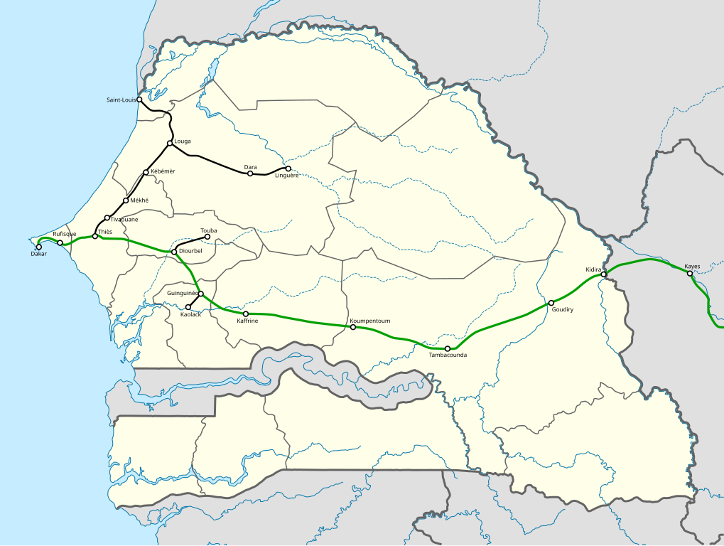
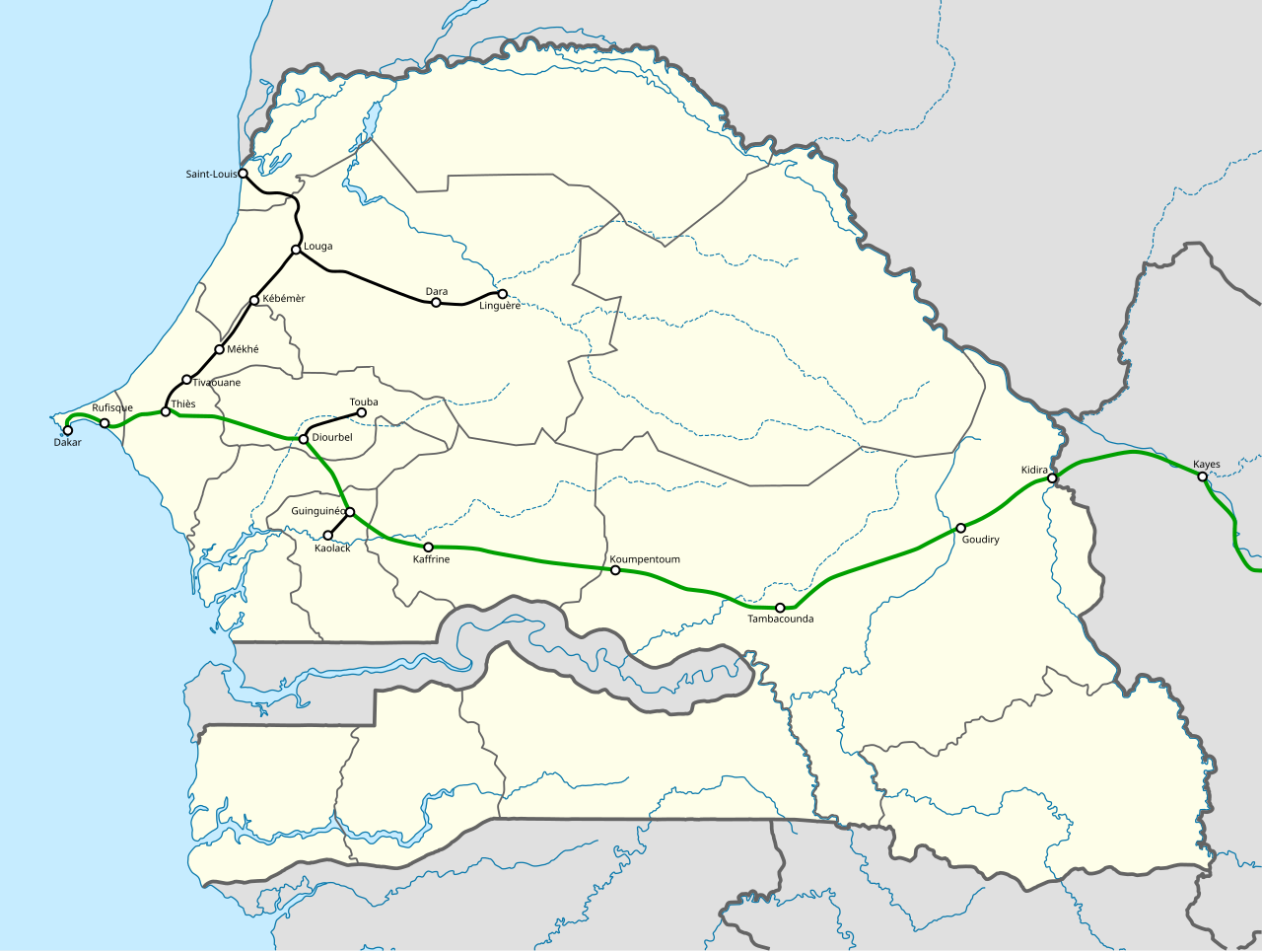
English: The senegalese railway network. Shown in green is the Dakar-Niger railway.
Suomi: Senegalin rautatieverkko.
Français : Les chemins de fer du Sénégal. |
| Date | (UTC) |
| Source |
|
| Author |
|
| This is a retouched picture, which means that it has been digitally altered from its original version. Modifications: Added the cities and the railways. The original can be viewed here: Senegal location map.svg:
|
This file is licensed under the Creative Commons Attribution-Share Alike 3.0 Unported license.
- You are free:
- to share – to copy, distribute and transmit the work
- to remix – to adapt the work
- Under the following conditions:
- attribution – You must give appropriate credit, provide a link to the license, and indicate if changes were made. You may do so in any reasonable manner, but not in any way that suggests the licensor endorses you or your use.
- share alike – If you remix, transform, or build upon the material, you must distribute your contributions under the same or compatible license as the original.
Original upload log[edit]
This image is a derivative work of the following images:
- File:Senegal_location_map.svg licensed with Cc-by-sa-3.0
- 2009-09-15T20:56:02Z NordNordWest 1266x954 (477807 Bytes)
- 2009-09-15T15:34:57Z NordNordWest 1266x954 (479064 Bytes) =={{int:filedesc}}== {{Information |Description= {{de|Positionskarte von [[:de:Senegal|Senegal]]}} Quadratische Plattkarte, N-S-Streckung 103 %. Geographische Begrenzung der Karte: * N: 16.9° N * S: 12.0° N * W: 17.8° W *
- File:Senegal_rel89.jpg licensed with PD-USGov-CIA
- 2008-01-05T23:23:37Z Botev 1104x1292 (269354 Bytes) Shaded Relief Map of [[:en:Senegal|Senegal]] Source: [http://www.lib.utexas.edu/maps/africa/senegal_rel_1989.jpg] from the [http://www.lib.utexas.edu/maps/africa.html Perry-Castañeda Library Map Collection]. Date: 1989 {{P
Uploaded with derivativeFX
File history
Click on a date/time to view the file as it appeared at that time.
| Date/Time | Thumbnail | Dimensions | User | Comment | |
|---|---|---|---|---|---|
| current | 19:08, 6 February 2011 | | 1,266 × 954 (411 KB) | Yaamboo (talk | contribs) | Reupload. |
| 12:10, 6 February 2011 |  | 1,266 × 954 (412 KB) | Yaamboo (talk | contribs) | {{Information |Description={{en|The senegalese railway network.}} {{fi|Senegalin rautatieverkko.}} {{fr|Les chemins de fer du Sénégal.}} |Source=*File:Senegal_location_map.svg *File:Senegal_rel89.jpg * Les Atlas Jeune Afrique: Sénégal. Les |
You cannot overwrite this file.
File usage on Commons
The following page uses this file:
File usage on other wikis
The following other wikis use this file:
- Usage on en.wikipedia.org
- Usage on fr.wikivoyage.org
- Usage on hu.wikipedia.org
- Usage on ja.wikipedia.org