File:Selter Berlin 1809.jpg
Jump to navigation
Jump to search
Size of this preview: 736 × 600 pixels. Other resolutions: 295 × 240 pixels | 589 × 480 pixels | 943 × 768 pixels | 1,257 × 1,024 pixels | 2,513 × 2,048 pixels | 7,029 × 5,728 pixels.
Original file (7,029 × 5,728 pixels, file size: 7.14 MB, MIME type: image/jpeg)
Captions
Captions
Add a one-line explanation of what this file represents
Summary[edit]
| Title |
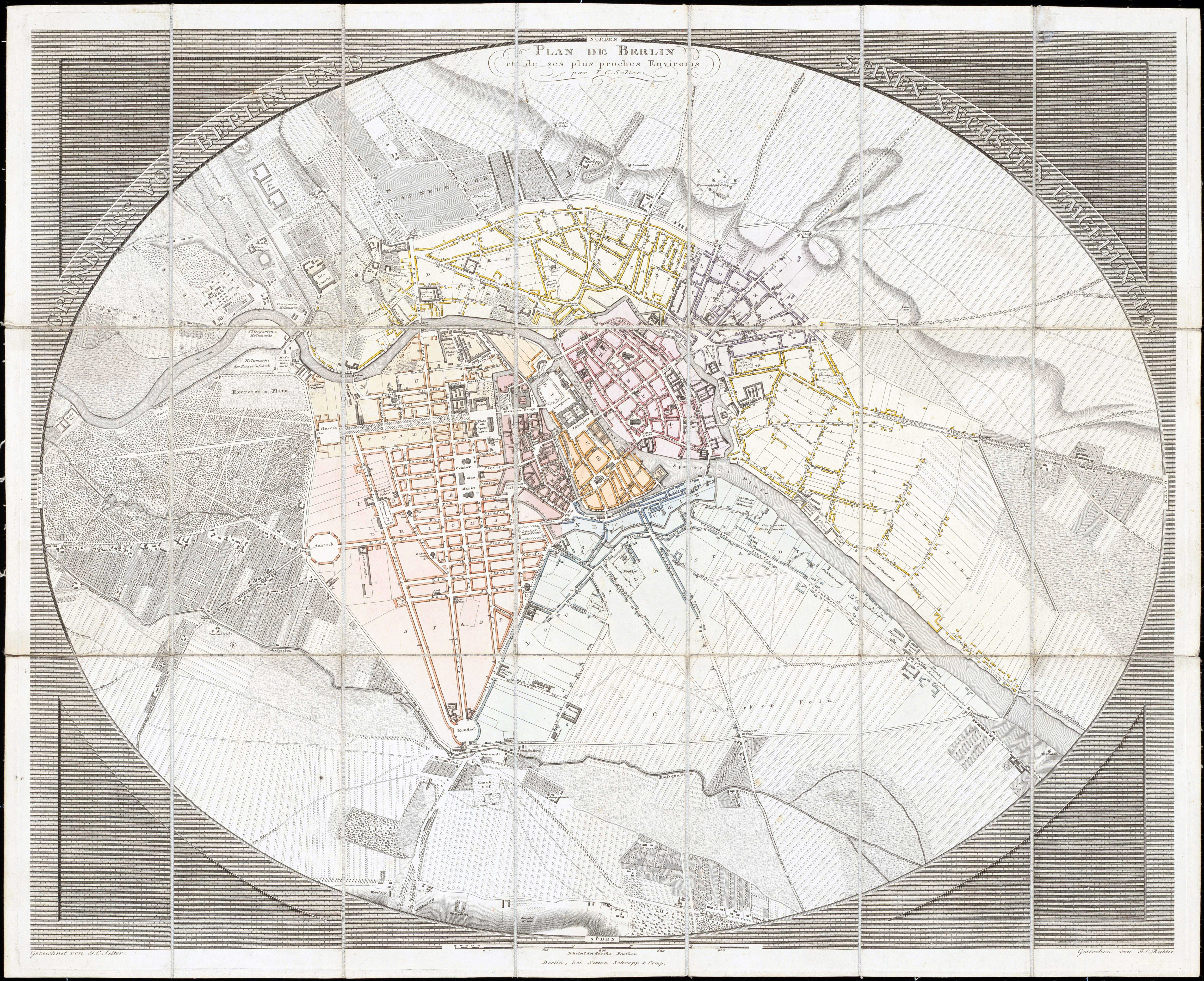
Grundriss von Berlin und seinen naechsten Umgebungen. Plan de Berlin et de ses plus proches Environs par I.C. Selter |
| Description |
Deutsch: Der Plan ist in einer Ellipse mit umgebender ziegelförmiger Gravur eingefasst. Der Titel steht oben in der ovalen Umrandung (oben in der Mitte, dreizeilig der franz. Titel). Unter dem Plan steht: "Berlin, bei Simon Schropp & Comp" und in der rechten unteren Ecke: "Gezeichnet von J.C. Richter". Am unteren Rand eine Maßstabsleiste über "500 Rheinländische Ruthen". In der Umrandung sind die vier Himmelsrichtungen angegeben. |
| Date | |
| Source | Zentral- und Landesbibliothek Berlin (urn:nbn:de:kobv:109-opus-104340) |
| Creator |
Jean Chrétien Selter |
| Geotemporal data | |
| Map location | Berlin |
| Scale | 1:13,300 |
| Heading |
 |
| Georeferencing | |
| Bibliographic data | |
| Language | German |
| Publisher |
Simon Schropp |
| Archival data | |
| Collection | Zentral- und Landesbibliothek Berlin |
| Accession number |
B 54/1809/1 |
| Dimensions | height: 46 cm (18.1 in); width: 55.5 cm (21.8 in) (height: 43.8 cm (17.2 in); width: 54.2 cm (21.3 in) map size) |
| Medium | colored copper engraving print |
| Notes |
Literatur
|
Licensing[edit]
|
This is a faithful photographic reproduction of a two-dimensional, public domain work of art. The work of art itself is in the public domain for the following reason:
The official position taken by the Wikimedia Foundation is that "faithful reproductions of two-dimensional public domain works of art are public domain".
This photographic reproduction is therefore also considered to be in the public domain in the United States. In other jurisdictions, re-use of this content may be restricted; see Reuse of PD-Art photographs for details. | ||||
File history
Click on a date/time to view the file as it appeared at that time.
| Date/Time | Thumbnail | Dimensions | User | Comment | |
|---|---|---|---|---|---|
| current | 15:37, 12 December 2010 | | 7,029 × 5,728 (7.14 MB) | Alexrk2 (talk | contribs) | {{LargeImage}} {{Information |Description='''Grundriss von Berlin und seinen naechsten Umgebungen.''' ''Plan de Berlin et de ses plus proches Environs par I.C. Selter'' * Format: 54,2 x 43,8 cm (nur der Plan, Ellipse) * Maßstab: 1:13.300 * Kupferstich, k |
You cannot overwrite this file.
File usage on Commons
The following page uses this file: