File:Schnellverbindungen Wien geographisch.png
Jump to navigation
Jump to search

Size of this preview: 800 × 593 pixels. Other resolutions: 320 × 237 pixels | 640 × 474 pixels | 1,024 × 759 pixels | 1,280 × 949 pixels | 2,560 × 1,897 pixels | 3,062 × 2,269 pixels.
Original file (3,062 × 2,269 pixels, file size: 436 KB, MIME type: image/png)
Captions
Captions
Add a one-line explanation of what this file represents
Summary[edit]
| Description |
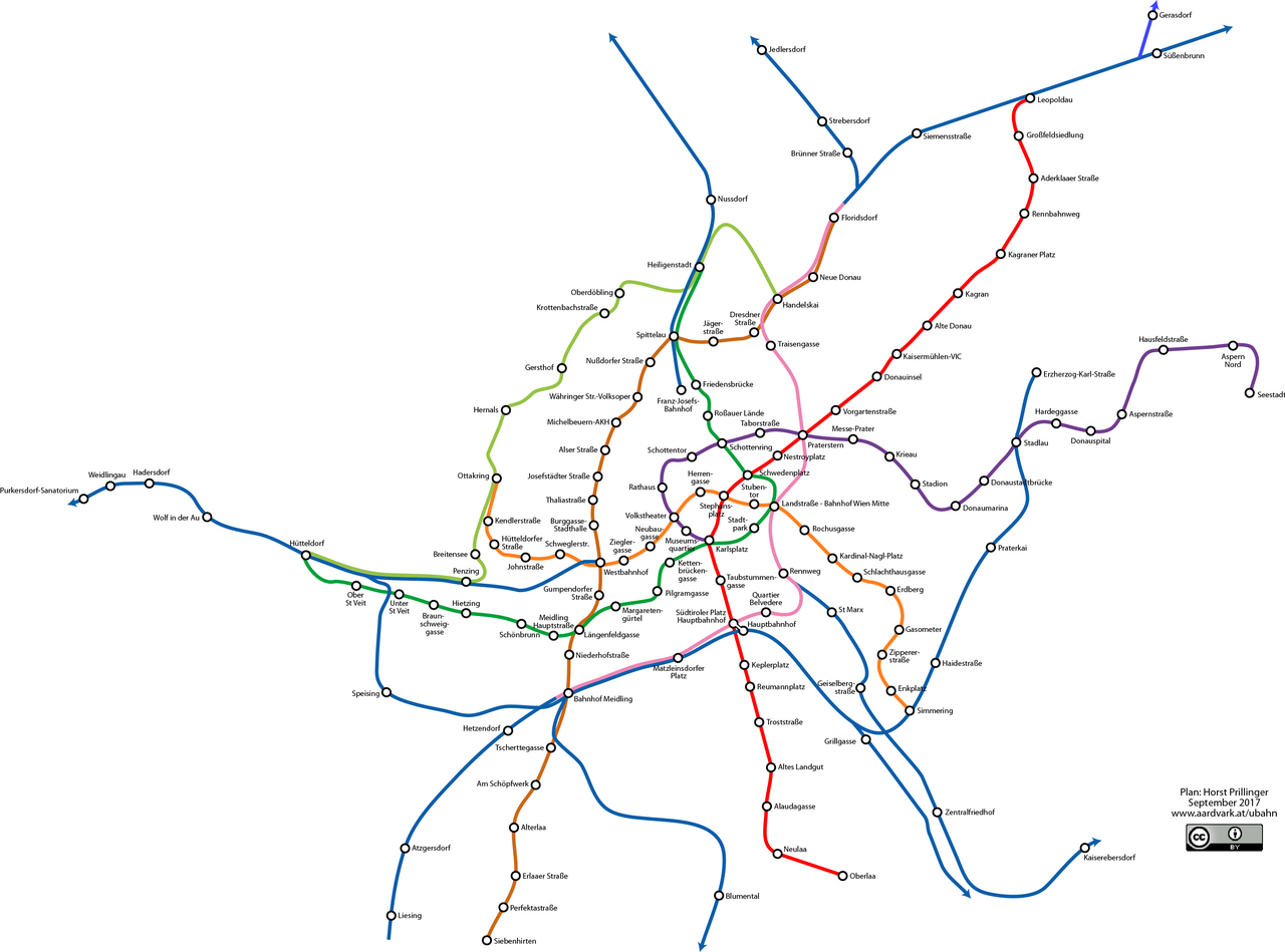
Deutsch: Netzplan der Schnellverbindungen in Wien (Stand September 2017) |
| Date | |
| Source | http://homepage.univie.ac.at/horst.prillinger/ubahn/deutsch/geographischer_plan_s-bahn_u-bahn.html |
| Author | Horst Prillinger |
Licensing[edit]
This file is licensed under the Creative Commons Attribution 4.0 International license.
- You are free:
- to share – to copy, distribute and transmit the work
- to remix – to adapt the work
- Under the following conditions:
- attribution – You must give appropriate credit, provide a link to the license, and indicate if changes were made. You may do so in any reasonable manner, but not in any way that suggests the licensor endorses you or your use.
File history
Click on a date/time to view the file as it appeared at that time.
| Date/Time | Thumbnail | Dimensions | User | Comment | |
|---|---|---|---|---|---|
| current | 18:51, 5 August 2017 | | 3,062 × 2,269 (436 KB) | Chondrocladia (talk | contribs) | neue farbgebung |
| 19:02, 19 July 2017 |  | 3,062 × 2,269 (423 KB) | Chondrocladia (talk | contribs) | User created page with UploadWizard |
You cannot overwrite this file.
File usage on Commons
The following 8 pages use this file:
- User:Chumwa/OgreBot/Potential transport maps/2017 August 1-10
- User:Chumwa/OgreBot/Potential transport maps/2017 July 11-20
- User:Chumwa/OgreBot/Public transport information/2017 August 1-10
- User:Chumwa/OgreBot/Public transport information/2017 July 11-20
- User:Chumwa/OgreBot/Transport Maps/2017 August 1-10
- User:Chumwa/OgreBot/Transport Maps/2017 July 11-20
- User:Chumwa/OgreBot/Travel and communication maps/2017 August 1-10
- User:Chumwa/OgreBot/Travel and communication maps/2017 July 11-20